South to Nebraska
Day 7, June 14, 2015
(Brookings, SD to Bellevue, NE: 256 miles)
Backtracking in the Story–Crossing the Mississippi in Minnesota: Before I continue my narrative about this part of the journey, I will backtrack just a bit to recall a moment in Minnesota that caught my attention. My earlier blog post about traveling in Minnesota mentioned a rest stop in Floodwood, MN (alleged Catfish Capital of the U.S.). Just beyond Floodwood, off Rte. 2, is the westward turn off for Rte. 200 which I followed to reach Remer and all its charms. But about 10 miles along Rte. 200 west, I crossed the Mississippi River. The Mississippi River?
The small bridge and marker came and went before it sunk in—I had crossed the Mississippi River. This small stream was The Mississippi? In Minnesota? Yup. Later, after consulting a more detailed map, I realized that Lake Itasca, the headwaters of the Mississippi, was about 40 northwest of where I had planned to stay, but couldn’t get accommodations, in Walker, MN.
The map below shows the route of the Great River Road in Minnesota:
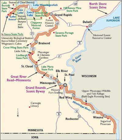
This smallish lake (about 2 miles in surface area) is birthplace of the Mighty Mississippi River. Wow. It totally got past me at the time. Duh. What a great photo op missed. I wouldn’t cross the Mississippi again until I reached St. Louis.
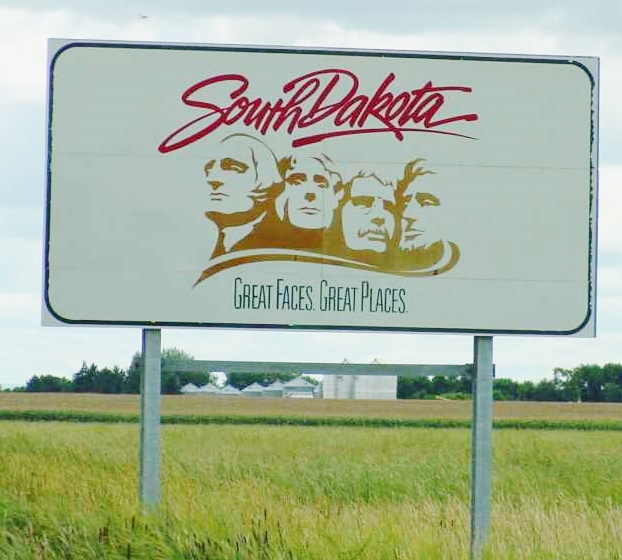
But now it was the long grueling interstate trek down I-29 through North Dakota and South Dakota where I spent the night in Brookings, the fourth largest city in South Dakota, with a population of just 23,000. Then I-29 would take me into Iowa and eventually I would cross the Missouri to reach my destination to the west on Sunday—Bellevue, Nebraska to visit my Aunt Anne. I saw nothing of Brookings, home to South Dakota State University, except the exit ramp to get to the next right turn for the Staurolite Inn. The Staurolite is a strange, stony fortress-like accommodation with a restaurant, lounge, and conference center. The rooms were arranged on two levels in an arc surrounding a large indoor pool area.
The inn probably was hip when it opened in 1973 but the dark, cavernous interior hallways were lifeless and a bit scary. There was a noisy wedding reception in progress on the main floor and after the reception ended the drunken guests poured into the “Fireside Lounge” where nearby I huddled in my booth in the tacky restaurant munching on what was purported to be a Caesar salad all the while trying to tune out the hyperactive revelers.
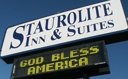
I was eager to leave early the next morning as I stepped over empty beer cans, plastic drink cups and cigarette butts (seems almost everyone in South Dakota smokes) discarded near the front entrance by the young party-goers the night before. But the truly happy part of this experience was that the room cost a mere $44.00, had Wi-Fi, and was comfortable enough for one night. As those famous British philosophers, the Rolling Stones, wisely counseled: “You don’t always get what you want, but sometimes you get what you need.”
I can report that the trip down I-29 through the eastern slice of North and South Dakota taxes the soul. It’s mostly flat with a farm here and there. One small random sighting broke the dull spell: somewhere along the way I passed a large sign plunked in a field near the interstate avowing: “Dakotans reject animal activists!” Next to that sign was another: “Eat Beef!” Huh? OK, if that’s how you feel.
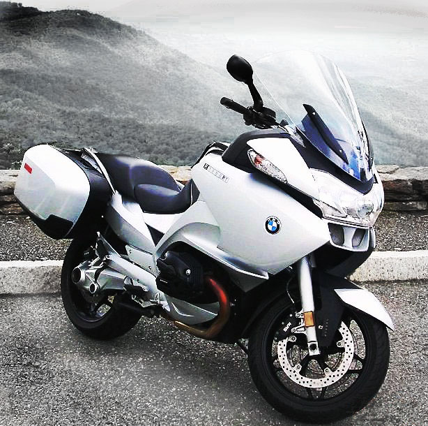
The landscape is not so much featureless as it is plain and repetitive. It was the first time so far that I longed to have my iPod plugged in to provide distraction and entertainment. On the plus side, the speed limit was 80 mph. You can chew up pavement quickly at that speed—true, except there was a brutal headwind pushing me backward. Undeterred, I kept the Silver Streak at 80 and just let the wind beat the hell out me. I was going south as fast as I could; if I ended up a tattered rag at the end, so be it.
On to Iowa, the Sgt. Floyd Monument, Lewis and Clark State Park and Bellevue, Nebraska:
The big surprise for me was western Iowa. Like eastern Nebraska it’s not at all like the flat farmlands associated with these states. The Missouri River Valley is hilly, forested here and there, and almost lush.
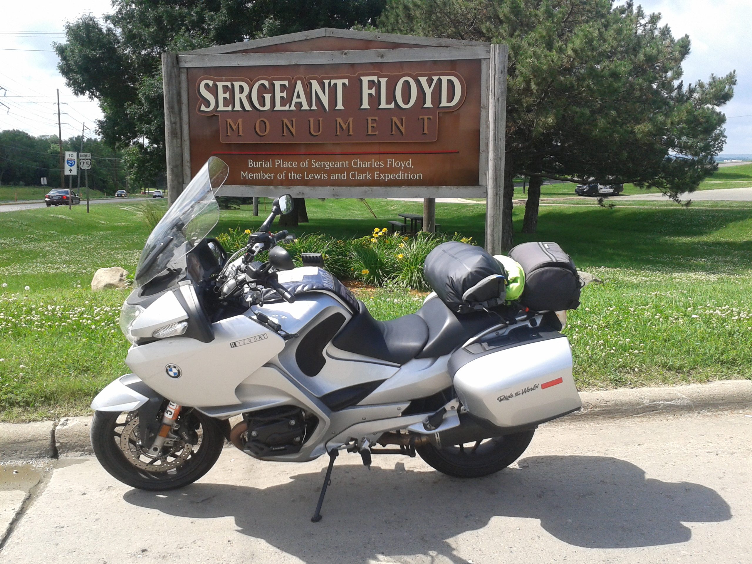
At Sioux City, I relentlessly sought out the Sgt. Charles Floyd monument. The directional signs were needlessly confusing but I was determined to find this landmark, having seen it from the interstate last year during the homeward bound portion of the “Westward Ho” trip with Frank “Paco” Bartlett. I eventually located the monument and was richly rewarded for my trouble.
I will be the first to admit that as history nut, I am fascinated by the Lewis and Clark Corps of Discovery expedition. After reading Stephen Ambrose’s popular history of the expedition I was hooked.
Sgt. Floyd, a Kentuckian and one of the first to volunteer with the Corps, was the only member of the Corps of Discovery to die; presumably from appendicitis. It was remarkable that a journey that took two years and four months up the Missouri River from St. Louis into the wilderness of the plains, the Rockies, to the west coast and back with just the one fatality among the 33 members. And this loss was from a condition readily treated today but at the time even the best doctors couldn’t have helped poor Sgt. Floyd. He was only 22 years-old when he died on August 20, 1804. He was buried on a high bluff above the Missouri River near present day Sioux City.
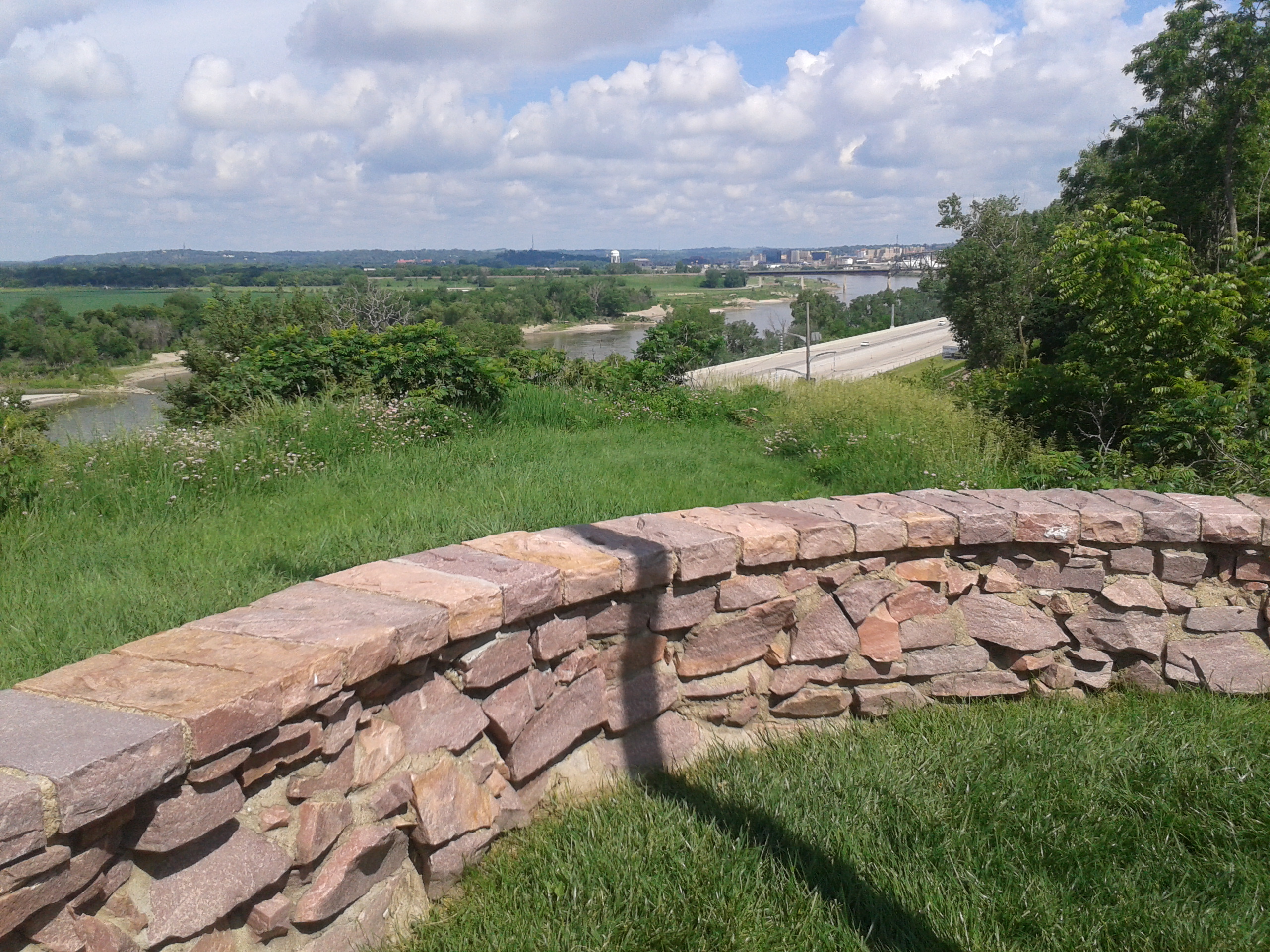
An impressive 100 ft. high white sandstone obelisk constructed in 1901 rises above the bluff and marks his gravesite. It’s a quiet, meditative location with a majestic view of the Missouri River. The river is now in a different location relative to where the bluff was in 1804. In fact, Sgt. Floyd had to be reinterred to the current spot because, as the river shifted it eroded the contours of the bluff and pulled Sgt. Floyd’s remains down to the river bank.
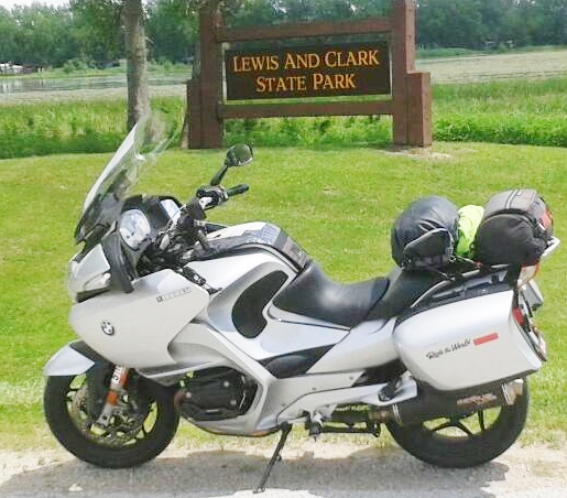
I returned to I-29 south and in less than 30 miles, spied a sign for Lewis and Clark State Park at the exit for Onawa, Iowa. I hesitated. Should I check this out or keep riding? I knew rain and thundershowers were predicted for the Omaha area. Hmmm. Well, another Lewis and Clark opportunity. So what if I got a caught in a terrifying storm. I surely wouldn’t melt and I might learn one more fact about the Corps of Discovery.
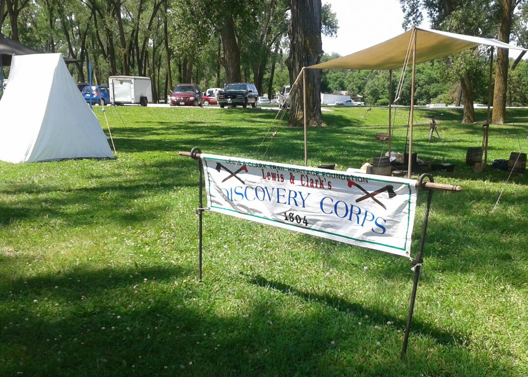
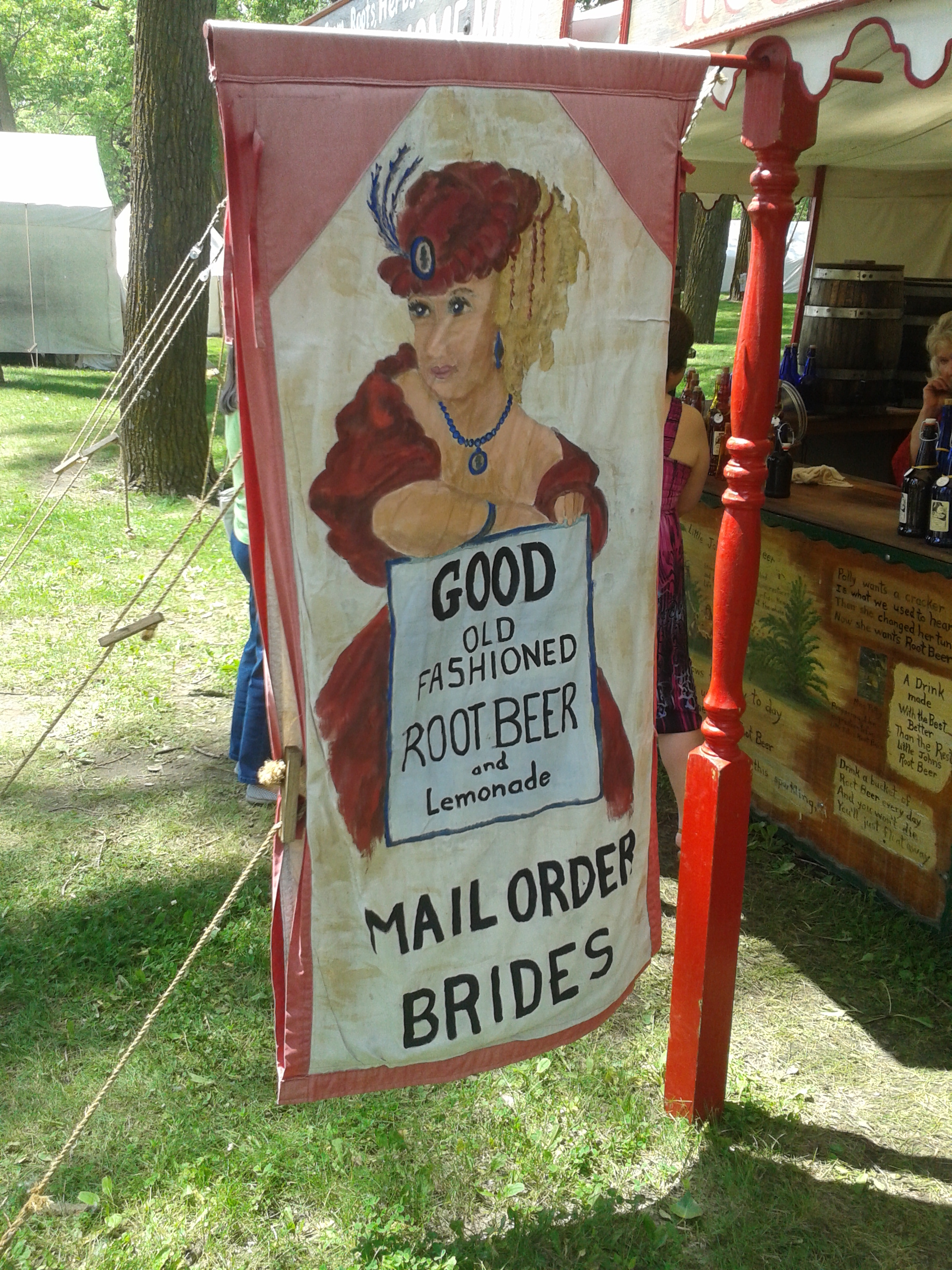
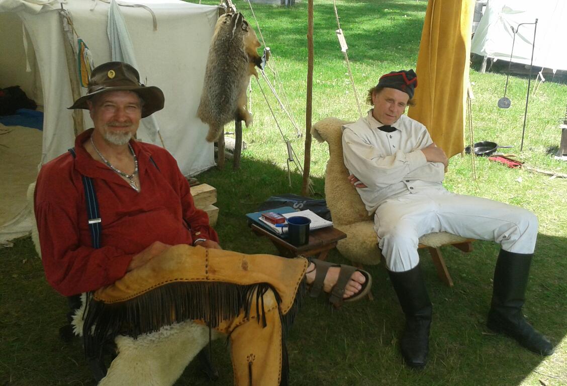
I swung off the interstate and leaned The Silver Streak west. The park sits on horseshoe-shaped Blue Lake and on this Sunday it was filled with campers and day trippers—it was the last day of the Lewis and Clark Festival, with re-enactors, replica expedition encampments, old timey vendors and craftspeople. Jackpot!
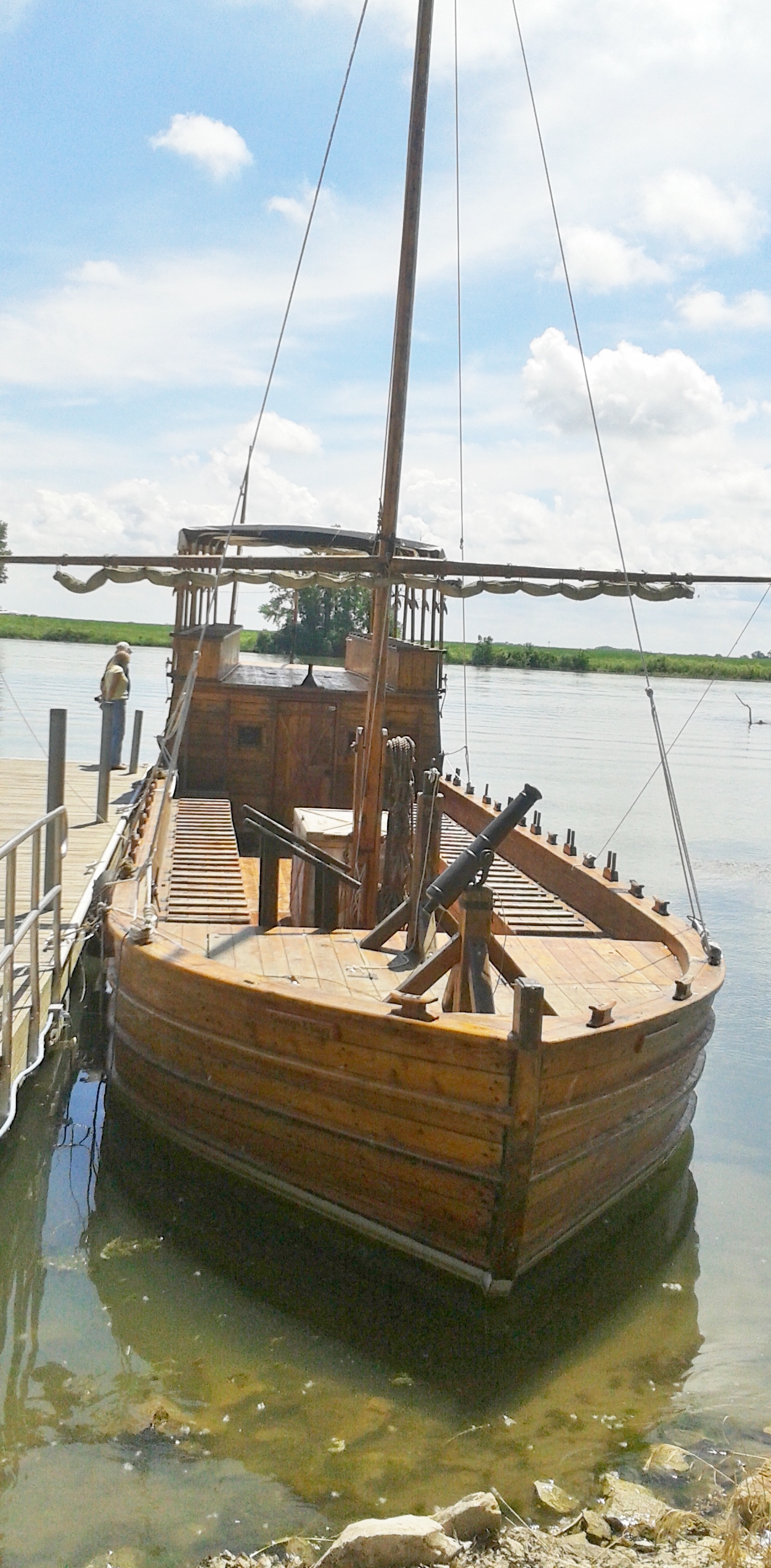
In addition to all this, a replica keel boat was moored on the lake next to the visitor’s center and inside the center—one of the actual keelboats from the expedition, lovingly preserved. I never would have expected to see the real thing here in Iowa. Double jackpot!

While strolling among the encampment I met several knowledgeable and engaging members of the Sgt. Floyd Tri-State Chapter of the Lewis and Clark Trail Heritage Foundation. These folks know their history including arcane details such what kind of lightweight woolen material was used for the explorers’ clothing in those days. For more about the Foundation: http://lewisandclark.org.
I had another 75 miles to go, so I left the park to get one last photo at the entrance sign. Off to the west across the Missouri were the Winnebago and Omaha tribal lands but I had no time explore them. I jumped on I-29 once again to get to Aunt Anne’s.
Interstate 29 and I were becoming like family. I’d spent many hours riding south on it but really, it was time for us to part. As I approached Omaha, the predicted rain hit me. I was paying the price for my obsession with Lewis and Clark. I had no choice but to pull over and tug on my rain suit. So, there I was on the shoulder of busy I-29 with semis whizzing past me trying to get jacket and pants on. Finally encased in my protective but toasty Frogg Toggs cocoon (Frogg Toggs are made of Tyvek—the material used to wrap houses in) I edged back into the flow of traffic. Predictably, I rode but a few miles and the showers inexplicably stopped. Sigh. What can you do? Well, ya just keep riding and sweating.
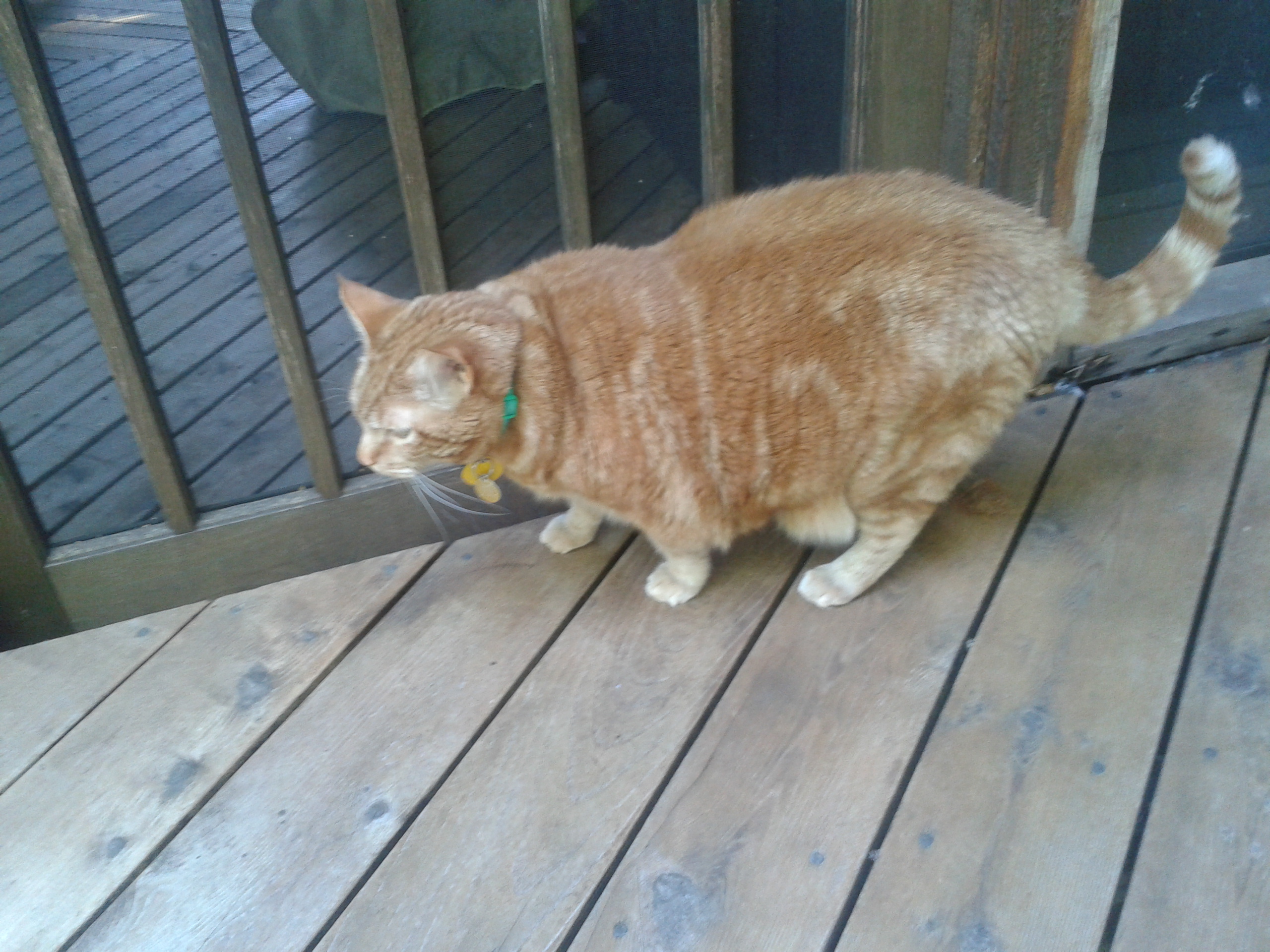
At last I turned west, went over the bridge, crossed the Missouri once again, and was welcomed to Nebraska. I followed Aunt Anne’s perfectly scripted directions and pulled into the driveway of her exquisite home around 2:00 p.m. Aunt Anne greeted me and right away introduced me to her gentleman friend—Tabby, a puppy-like ginger cat, who is quite content to hang out wherever his human companions happen to be. Sometimes he’s quietly underfoot. Have to be careful where your feet end up under a table because Tabby might be there listening in on the conversation. Tabby and I bonded quickly because, as the first one up, I made sure his bowl was filled with fresh food.

We ate, had our 5:00 p.m. cocktails, and talked into the night. It was a memorable visit, especially the hilarious moment Monday night when I got locked in the garage. I’d been cleaning the bug splattered windshield of the bike which was safely tucked in the two-car garage and Aunt Anne came to the doorway between the garage and the back of the kitchen to see how I was doing. “I thought you’d finished that some time ago,” she said. I told her I had been putting it off to work on the blog, but was almost done.
Aunt Anne went back inside and I took a few more minutes completing the clean-up.
I went to the door to get into the house—LOCKED. What? Oh right, Aunt Anne was careful about re-locking that passage door from the garage. OK. I thumped the door soundly. Nothing. Uh oh. Had she gone upstairs to bed? And if so, she would never hear me since she would have removed her hearing aids.
I pounded again. Nothing. This might mean a night in the garage in the back seat of her car. I tried one more thing: I opened the garage door and started for the front to ring the doorbell in hopes that she was still downstairs and would hear it. Just then she popped out of the door from the kitchen as I stood in stocking feet at the entrance of the garage—“I thought I heard a noise. That was you knocking wasn’t it? Oh no, I locked you out. Force of habit. Sorry.”
“You’re never going to live this down, you know,” I joked. “It’s going in the blog.” Unfazed by that threat, she laughed and we grabbed our drinks and settled in for a long talk in the cozy family room with Tabby keeping us company.
On to Missouri through Kansas
Day 8, June 16, 2015
(Bellevue, NE to Columbia, MO: 313 miles)
I kissed Aunt Anne goodbye at the Bellevue post office where I shipped a 10 lb. box of clothing and assorted gear back home. A 10 lb. box! Despite my judicious packing, I still had 10 lb. of stuff I didn’t need. It was a shameful moment for me, “Mr.-I-Travel-Light,” as I paid the clerk and left to gas up.
It was bittersweet departure—my Aunt is a resilient woman who has coped with a number of health limitations that she handles with dignity and grace. She insisted on preparing meals for me, showed me around town, and before I left, she made sure I had water and a container of magnesium powder to stave off leg cramps.
Aunt Anne was about 14-years-old when I was born. I fondly recall her babysitting my sister, Sheila, and me—she was lively and funny and we loved having her take care of us. One Halloween she showed up with an outrageous red devil mask which should have been terribly scary except I knew it was our Aunt Anne and so I couldn’t possibly be afraid. I also was the consummate worry-wart and one day while riding in her car it conked out not far from the family home. I was quite distressed by this. How would we get to Grandma’s house? Aunt Anne reassured me that it would be all right. We would just walk there. She held my hand as we went down the country road and all was well. My trust in her was absolute after that.
A beautiful dark-haired young woman with a pixie haircut, she went on, among other accomplishments, to become an expert skier first in Vermont and then Colorado. I think she may have been one of the first “ski bums” of the late 1950s and her adventurous life enthralled me.
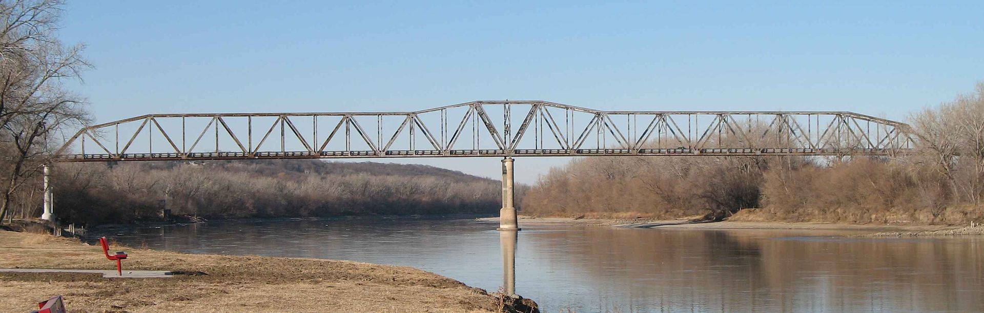
I left Bellevue and crossed the old truss bridge for the bargain price of 50 cents (cars, $1.00) and connected up with I-29. So, there I was slugging out the miles down I-29 once more, though it was slightly more interesting as I approached the outskirts of Kansas City.
Rolling countryside and some foothills in the distance provided a bit of variety. I decided to peel off slightly westward to officially ride through Kansas and see the skyline of Kansas City, Kansas. Then it was straight ahead on I-70 past Kansas City, Missouri, Independence, and to Columbia, MO, my destination for an overnight. At last I said goodbye to I-29 and was now working my eastward—toward home!
The rain started as I got close to Columbia. I found my cheap motel, got the cover on the bike, and hunkered down for the evening.
Eastbound through St. Louis and on to Indiana
Day 9, June 17, 2015
(Columbia, MO to Dale, IN: 309 miles)
The next morning the rain intensified. Small rivers were running down the inclined driveway in front of the motel. I packed up, had the Host Budget Inn’s meager version of a continental breakfast, returned to my room and tried to wait out the worst of it while working on the blog. My plan was a bust. By 10 a.m. it was still at it—pick your cliché about a robust and vigorous rainfall and that’s what was going on. Weather radar indicated that the rain was conveniently distributing its soggy bounty east to west right down the I-70 corridor. There was no escape.
I reluctantly checked out and experienced the most intensely terrifying part of the entire trip—heavy rain and almost no visibility. Inexplicably, some motorists did not have their lights on. Did they forget? Were they just stupid? I cursed them roundly for this folly. I slowly followed the wake of a semi, whose lights were just dim pinpoints in the foggy mist.
I rode on with white knuckle intensity, hunched up shoulders (you know what that led to later, right?), and pleas to the Almighty on my lips. I really don’t know how long it took but eventually the visibility improved and I could almost manage the speed limit. It’s about 125 miles to St. Louis from Columbia, a couple of hours at 65mph. Again, I have no recollection of how long it took. I was just relieved that the rain abated when I had to work my way through St. Louis with its assorted construction zones and on/off ramps for different city exits to eventually connect with I-64 east.
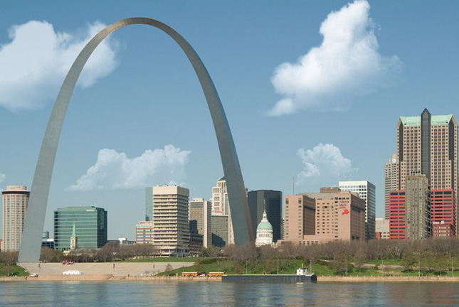
I crossed the Missouri and shortly the Gateway Arch appeared ahead of me. I chugged along carefully threading my way through traffic and crossed the Mississippi and I was now in Illinois on I-64. The real eastward leg was underway!
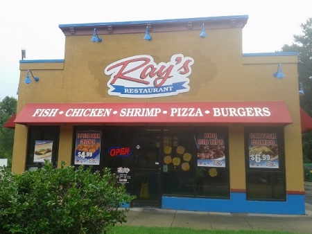
With the rain just about over, I jumped off 64 to get lunch at Ray’s in Washington Park, Illinois, which is really at the edge of East St. Louis. And if you are thinking that I stumbled into an all-black enclave, you would be right. Housing segregation at its worst.
Everything at Ray’s was fried. Not a healthy choice on the menu but I was there, I was hungry, and I tried to limit the damage with some butterfly shrimp and coleslaw all of which were very good. Everyone in Ray’s was pleasant and one fellow, decked out in a complete rapper outfit including gold capped teeth called me, “Sir.” That was an unexpected honorific in a chicken joint in East St. Louis.
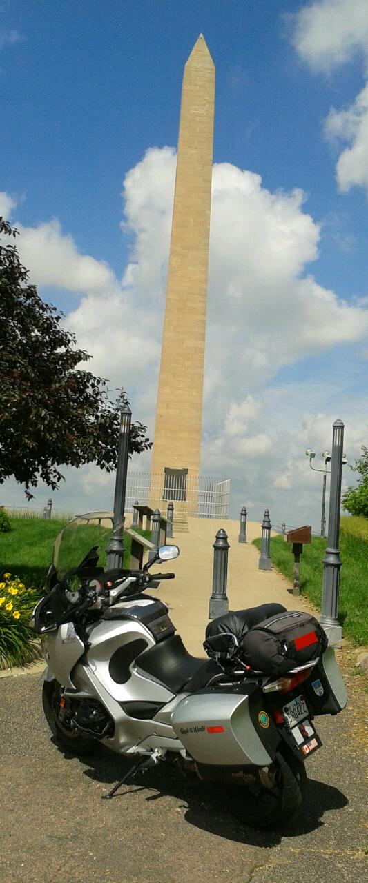
About half-way through southern Illinois, with it sprinkling on and off, I stopped for gas in Mt. Vernon. By the exit ramp stood a tacky Washington Monument replica. Now, I realize the good people of Mt. Vernon, Illinois, were trying to make a connection with George Washington but I think they missed the point. The Washington Monument is in Washington, D.C. and certainly not at Washington’s home at Mt. Vernon in Alexandria, VA. This bit of self-promotion, without a doubt, was a first class “one-off” and a total misfire.
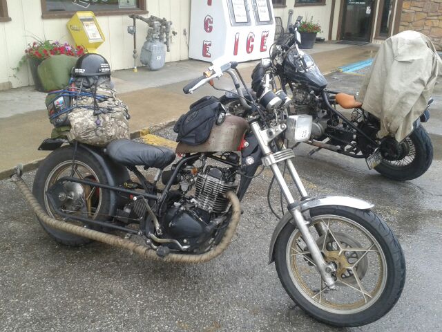
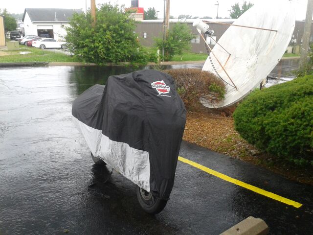
Gassing up at the Shell station, I heard a hearty backfire and looked up to see two guys ride in on authentic “rat bikes.” One bike was a one cylinder thumper cobbled together from assorted parts from different motorcycles—a real “Frankenbike.” The other was a modified Yamaha 750.
The pair had no rain gear other than what looked like a long western-style trail coat that the older of the two had draped over his bike. And, as you can see from the photo above, the seats were really primitive, too. Ouch. They had come from somewhere on the east coast, had ventured to the west coast and were returning east to North Carolina for a rally.
No question, they were the real deal. Must be tough as boots to be riding on those machines in bad weather. Next to them I felt like a real wuss wearing my Frogg Toggs with my bike equipped with ABS brakes, cruise control, hard cases, adjustable suspension, and adjustable windscreen. I got their OK for the pics and then, embarrassed to be in the company of real bad-ass bikers, I hastily motored out in the direction of Indiana.

I had hoped to make to Ferdinand, IN and I got close but the rain started up again in earnest and I had enough. I bailed out of I-64 at Dale, a few miles from Ferdinand, and found a Motel 6. Bad choice. Very expensive compared to various accommodations I found so far, most of which didn’t exceed $65. With no coffee maker in the room, this place didn’t even offer the parsimonious fare of the Budget Inn in Columbia—it offered nothing. Well, there was the “free” coffee in the morning. Wow, generous. Oh, and there was no Kleenex either.
Showering the next morning I discovered a long black hair stuck to the wall. Yuck. Nice cleaning job, folks. This was most money I’d spent so far and had gotten the least. I wasn’t pleased. However, to put things in perspective, there was a gas station right next door with a good-sized convenience store, strangely named “Chuckles,” that had a decent selection of food and drink items.
Down the road in Dale, with one traffic light and a population of 1,600 (they must have been hiding somewhere in the corn fields, I hardly saw anyone) was a well-stocked “Package Store.” The owner was a biker and we had a friendly chat about road trips. He was not a weekend cruiser type but had done some serious long distance rides. Our shared experiences took my mind off the penitential conditions at the motel.
I discovered later that Florence Henderson (AKA Carol Brady of the Brady Bunch) is from Dale. It seems odd that Dale didn’t make a point of advertising this fact with a sign or a marker or something. Maybe sell some Brady Bunch junk? At least this was a genuine connection to the town not like the Washington Monument knock-off was to Mt. Vernon, IL.
Of course it rained overnight but the day seemed to be clearing. I was happy to be on the road and away from my “hosts.” If this lodging is anything like other Motel 6s, I’d recommend another brand.
The Big Push: Indiana to West Virginia
Day 10, June 18, 2015
(Dale, IN to Beckley, WV: 375 miles)
Making my way through southern Indiana, the scenery was classic Midwestern: corn fields, soy fields, wheat fields, farms and small towns.

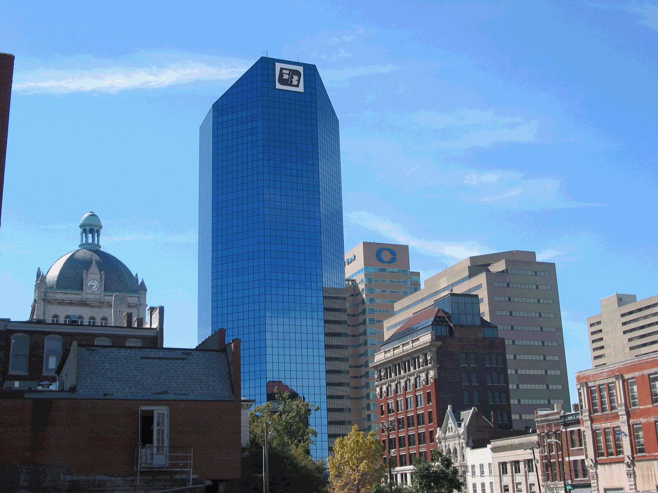
Before long it was “Welcome to Kentucky.” I had forgotten that the skyline of Louisville, KY was such an appealing sight. There are a few commercial structures with interesting architectural touches and then there are the numerous church steeples poking above the tree line.

(internet image by Fine Art America)
I chalked up the additional 79 miles to Lexington and passed familiar exit signs for the University of Kentucky (Go Wildcats) and local routes from my grad school days there.
(internet image by Conjunction Marketing)
Just about halfway between Louisville and Lexington is the state capital, Frankfort, and about 20 miles south of Frankfort is Woodford County—where the upscale Bourbon of the same name is distilled. Another mystery solved: I had wondered why the name Woodford was chosen for that brand. It was all very simple: that’s where it’s made. Of course, a quick Google search would have enlightened me ages ago, but why do it the easy way?
By lunchtime I had reached Mt. Sterling and tried a Cracker Barrel assuming I could get a salad of some kind, which turned out to be true. No complaints: CB is what you expect. No surprises. Bland, all-American fare to keep you fueled so you can continue traveling. The place was busy with families and geezers like me. Next to me, a mother and her young daughter were having lunch with the grandmother, all the while yakking away. Southern accents can sometimes be charming and cute but to my ear that afternoon the twangy sing-song Kentucky accent was annoying and grating. During the two years I lived in Kentucky, I guess I adjusted to the sound. In the four-and-a-half decades since I left the Bluegrass State, it seems I’d lost any tolerance for it. Of course, I was planning on making it to West Virginia that day. No improvement in the accent department there.

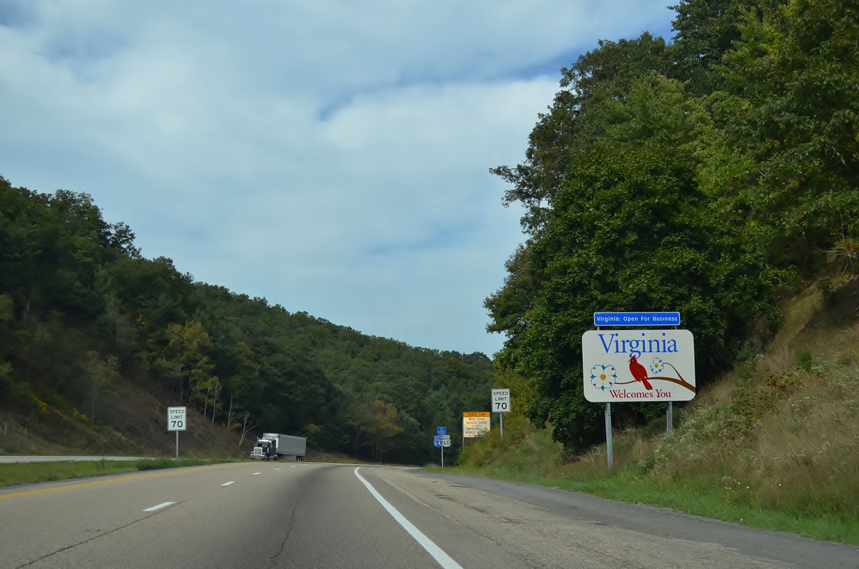
Off and on rain greeted me as I crossed into West Virginia. I sincerely believe that one of the ugliest sections of interstate highway is between the Kentucky border and Charleston, WV. I guess Charleston can be pretty under the best of conditions but today was gloomy and dreary and even the golden dome of the capitol seem lose its glitter.

Probably the section of interstate highway/toll road with the most demanding and challenging series of curves is between Charleston and Beckley, WV. But mix in some rain and it’s no bag of chips. A rider is no longer excited about handling the switchbacks but simply trying to get through it alive. With much effort and concentration I got to Beckley as the rain ebbed away.
Beckley has plenty of accommodations and I unwisely picked a Microtel since it seemed the least crowded when I arrived around 6:00 p.m.
Silly me, I was seeking a kind of formal balance to my travels: I started the trip staying in a Microtel in Ohio and since it was OK and affordable, I thought I’d end the trip in one.
Now, let’s do a playback from Indiana: Bad choice. Very expensive. This was the most expensive motel yet, over $90.00. They did offer a cold breakfast but there was no fridge, no microwave, and no coffee maker.
There was a pool and spa but earlier a bus had disgorged a group of kids and they overwhelmed the facilities. I wasn’t about to try to wedge my way in among a pod of squirming porcine brats. I retreated to my room after scrounging up an edible salad at a Burger King, watched some TV and hoped the people in the next room would turn off their set before midnight.
Homeward Bound to Virginia via I-64 to I-81 to I-66
Day 11, June 19, 2015
(Beckley, WV to Reston, VA: 295 miles)
I had just packed the cover to the bike to get the day started and it began to rain again. I muttered a futile curse at the skies and went inside to finish organizing my gear, load up, and get on the road for home. There was no point in complaining. Weather-wise I had been enormously lucky throughout the most interesting parts of the trip. Yes, now, I was being plagued by rain in just about every state as I traveled east.
But the fact was that I hadn’t planned doing any sightseeing in these states anyway, especially Indiana and Kentucky. I pretty much had seen what I wanted to see in those states from previous travels. So, aside from the tension of riding in wet conditions there was nothing to feel bad about. And, really, my new Michelin Pilot tires were performing flawlessly in the rain—that in itself was greatly reassuring.
I took off from the Microtel and perhaps the cursing worked because once underway, the rain stopped. Though the day was overcast and threatening, the road was dry for all 176 miles from Beckley to Harrisonburg, VA. That was 60 percent of the trip home completed. My luck was holding up. In fact, it was holding up nicely because the rain, though steady, was not blinding and The Streak sailed along effortlessly. The worst part of the ride was the effect that the dopes that refuse to pass and get to the right on I-81 have on traffic flow. I was sitting behind a semi going faster than the car to my left because someone several miles ahead in the passing lane wasn’t passing but squatting there holding up a parade of other vehicles. The zenith of thoughtlessness.
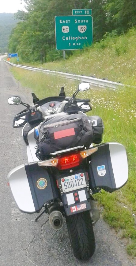
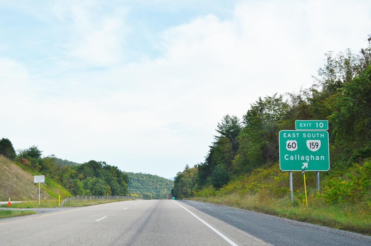
Without any rain to interrupt me on I-64, I was even able to get my signature photo of my motorcycle next to the exit sign for Callaghan, VA. The last time I had a chance to take a shot like this was when I owned Big Blue and visited the area in 2008, staying the night in Hot Springs, VA.
One of the fascinating attractions in the tiny town of Callaghan is the Humpbacked Covered Bridge, a wooden structure spanning Dunlop Creek. It’s one of the last of its kind in the U.S. (See photo below)
Special thanks to Brendan Reals of Falls Church for granting permission to use this photo. He’s a first rate photographer and has a stunning collection of prints of Washington, DC and scenes of Virginia at: http://fineartamerica.com/profiles/brendan-reals.html
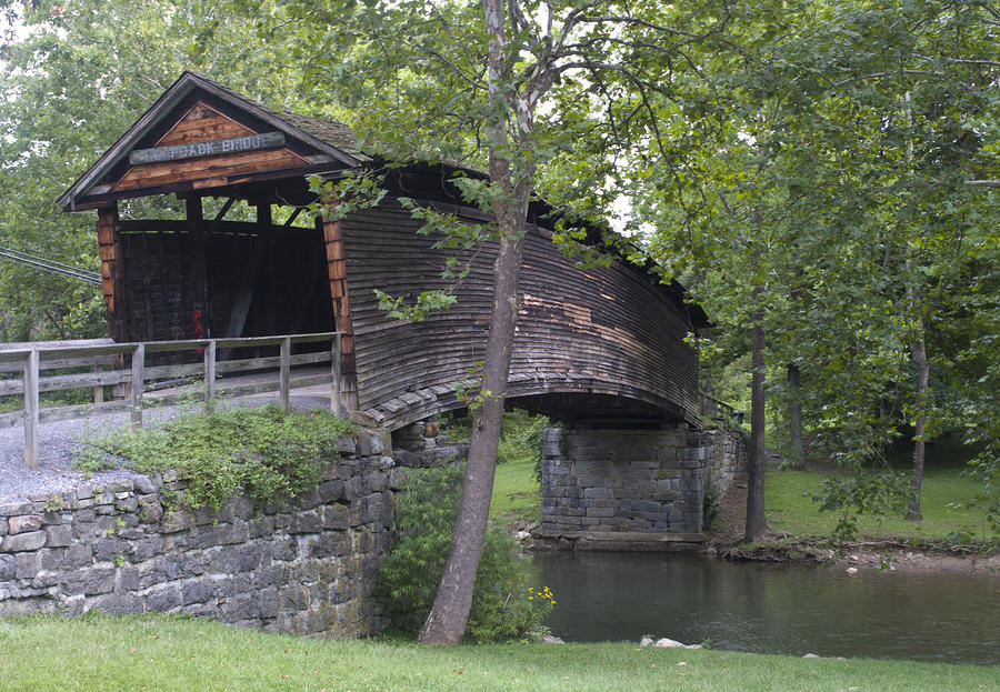
(2009 photo courtesy of photographer, Brendan Reals
http://fineartamerica.com/profiles/brendan-reals.html)
The trip up I-81 has become so routine for me that I don’t fear the trucks or the 70+ mph speeds anymore. There was a time that the idea of riding the I-81 corridor through the valley filled me with dread. Now, I’m no longer a puddle fearfulness. I guess there’s no substitute for the direct experience of motorcycling and doing it over and over until you get to know your limits, hone your skills, and learning by doing.
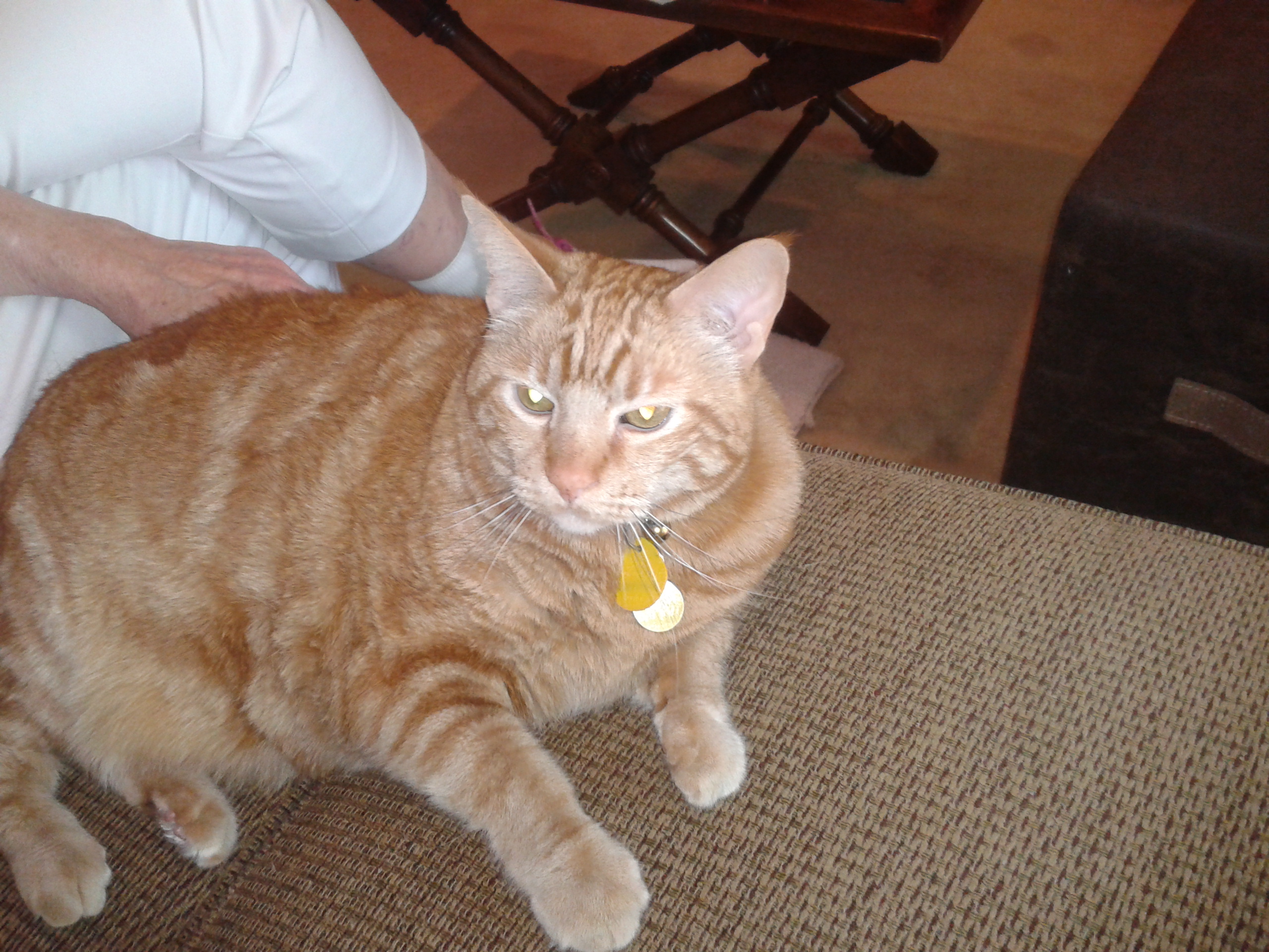
And so, by 12:40 p.m. I was coasting down our driveway. I checked the mileage: in 10 days of riding I chalked up 3,326 miles for the round trip and got home safely. And our two cats were waiting for me. Ah, so good to be home!
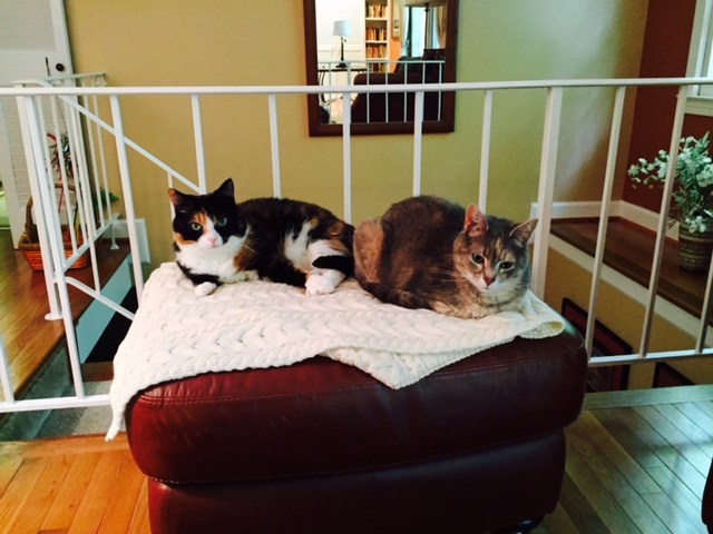
Kimmy and Dusty
Yes, that’s a smile on my face.
Thanks for reading!
Welcome back home, in one piece no less.
Of the 3,326 miles you logged, the trip heading home sounded like it was full of sound and fury and signifying, instead of nothing, your determination, equanimity and desire for fun and exploration. That was really the tone of the whole trip.
It was very enjoyable to follow your adventures through your blog. At some point, you must turn the blog into a book. Maybe call it “Beemer Biker Zens Out.”
I had to laugh about your parking the Beemer behind the biker bar and going in with the swagger of the “aw shucks” guy from Virginia, with your all-gear-all-the-time halo. Nice contrast!
Also, I liked your story about the “Rat Bikes,” and you with your full-body armor and urban-chic ride. That could have turned into a monumental standoff but sounds like you handled it with the diplomacy that is natural to the Irish……….Say what?
And the ten pounds shipped home. Just curious……did you weigh what you started with? I suppose there’s an optimal weight on a machine like that.
Hearing about your Aunt Anne was interesting. I can picture your getting locked out, but at least it was in a safe place instead of a flop house in East St. Louis. Is she the last of your older family generation?
That whole story about the Lewis and Clark expedition made me want to read more about it. I hadn’t before seen a picture of the keel boat and was trying to imagine how they managed to survive on that thing for so long with 33 members packed in.
I had enquired in an email whether you were done with your 2,000+ mile trips and you replied that “No, don’t think I’m done with long trips. I still have my goal of riding in all of the contiguous 48 states. With this last one, I have reached 42. I need OK, TX, NV, CA, OR, & WA to hit the magic number. Next year, I hope.” I was wondering if you will manage that before TX secedes from the Union? Suppose they’ll require a passport?
Well, I could go on but there were so many juicy tid bits scattered along the way that it’ll suffice to say thanks for the work you put into writing an entertaining story, to say nothing of the work it took to make it all happen.
Good luck next year.
Thanks for hanging in there and finally getting your comments posted (once I figured out how to get it to work). Should Texas secede, I will just have to take them off the list as no longer part of the U.S. They stole Texas from Mexico so it could be a slave state, so maybe they should have never been allowed to join in the first place.
Despite the sometimes challenging conditions, you seemed to have done quite well on this trip! I enjoyed reading all the entries, even though the ability to leave comments was delayed.
Your #1 fan!
XXXOOO!