Yellowstone National Park—Part 2: Mammoth Hot Springs, Alpine Pastures, and a Snowy Mountain Pass

May 30, 2014

Yellowstone National Park Entrance Sign

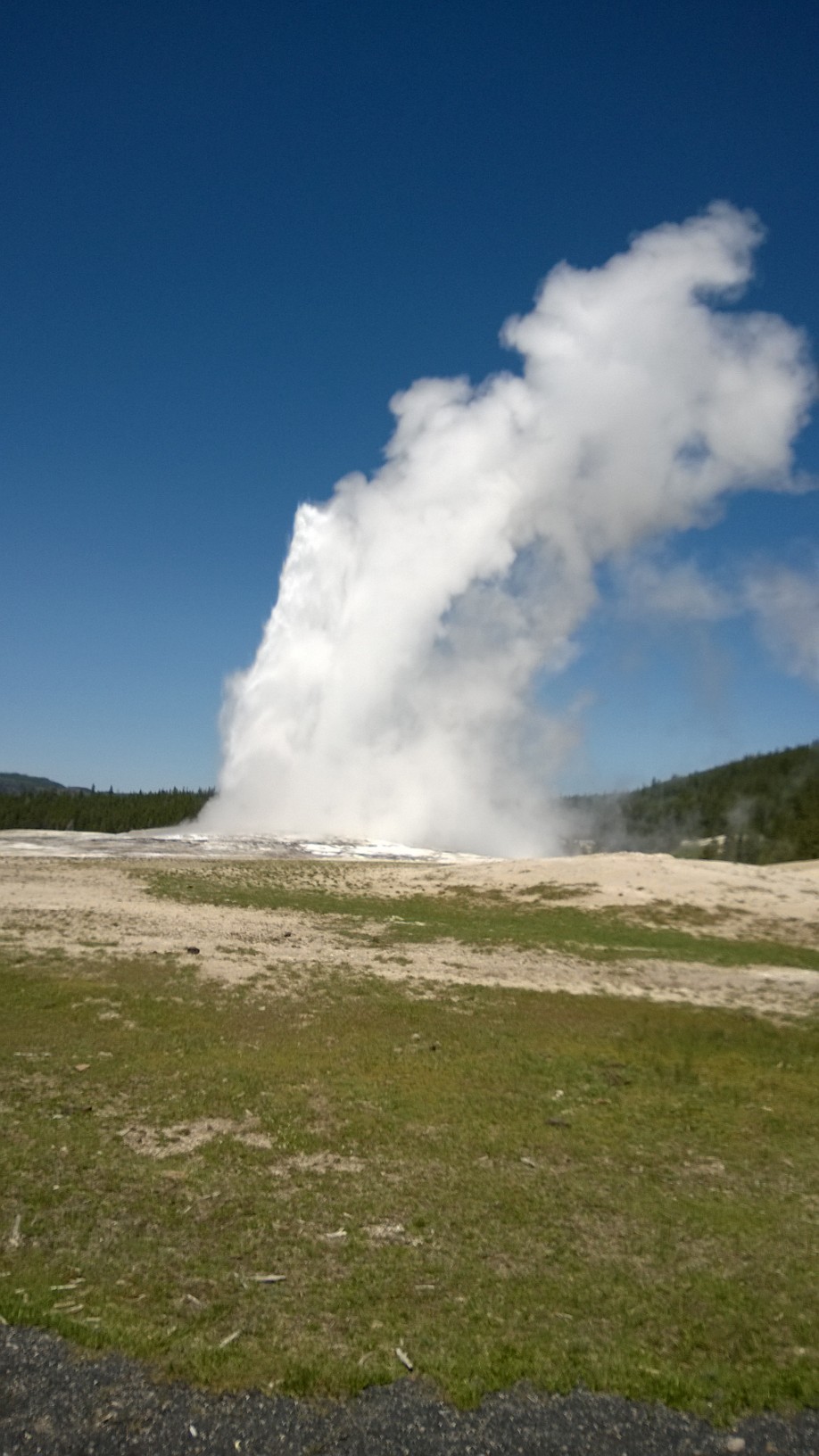
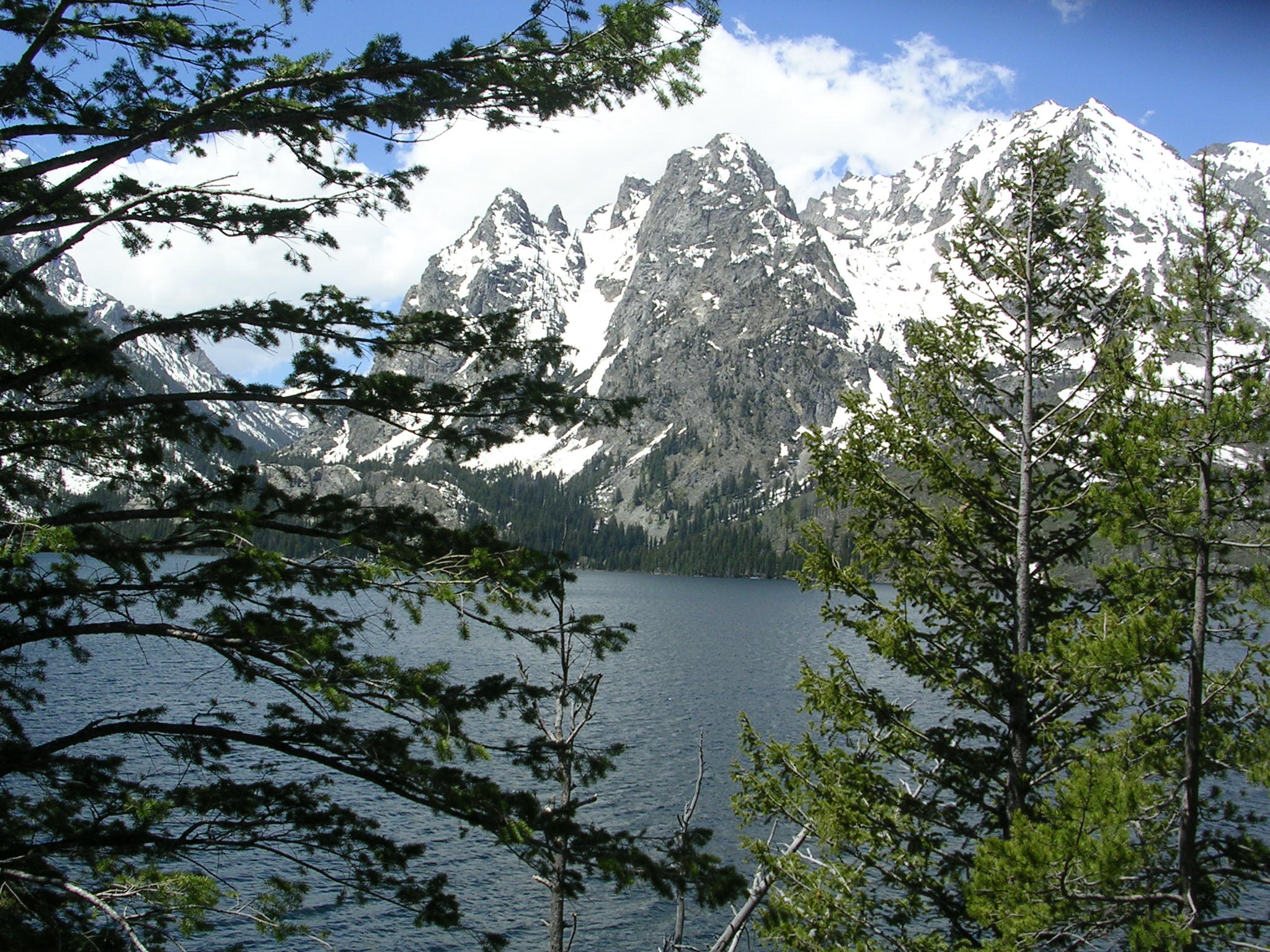
I think I’ve exhausted my portfolio of adjectives. Yellowstone National Park does that to you. You can get away with it the first time, but the second time you are stricken with a galloping case of redundancy. Reflecting on our 122 mi. circuit in the northern part of YNP, I realized that the same descriptive elements came to mind even though this area was significantly different from the southern portion. So, if I repeat myself, please be forgiving.

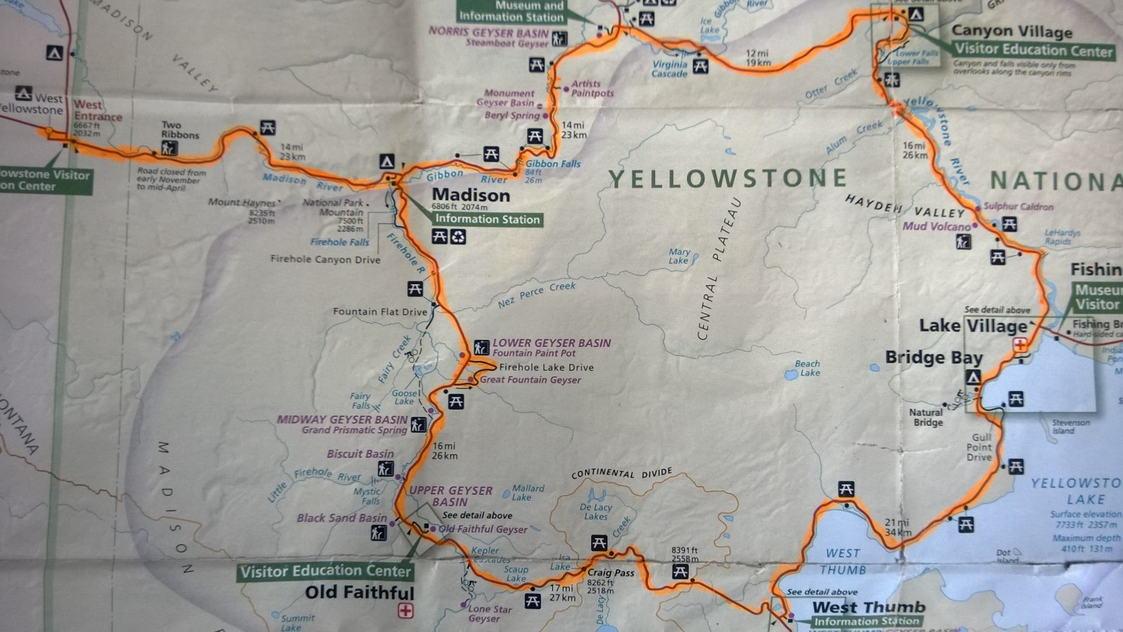
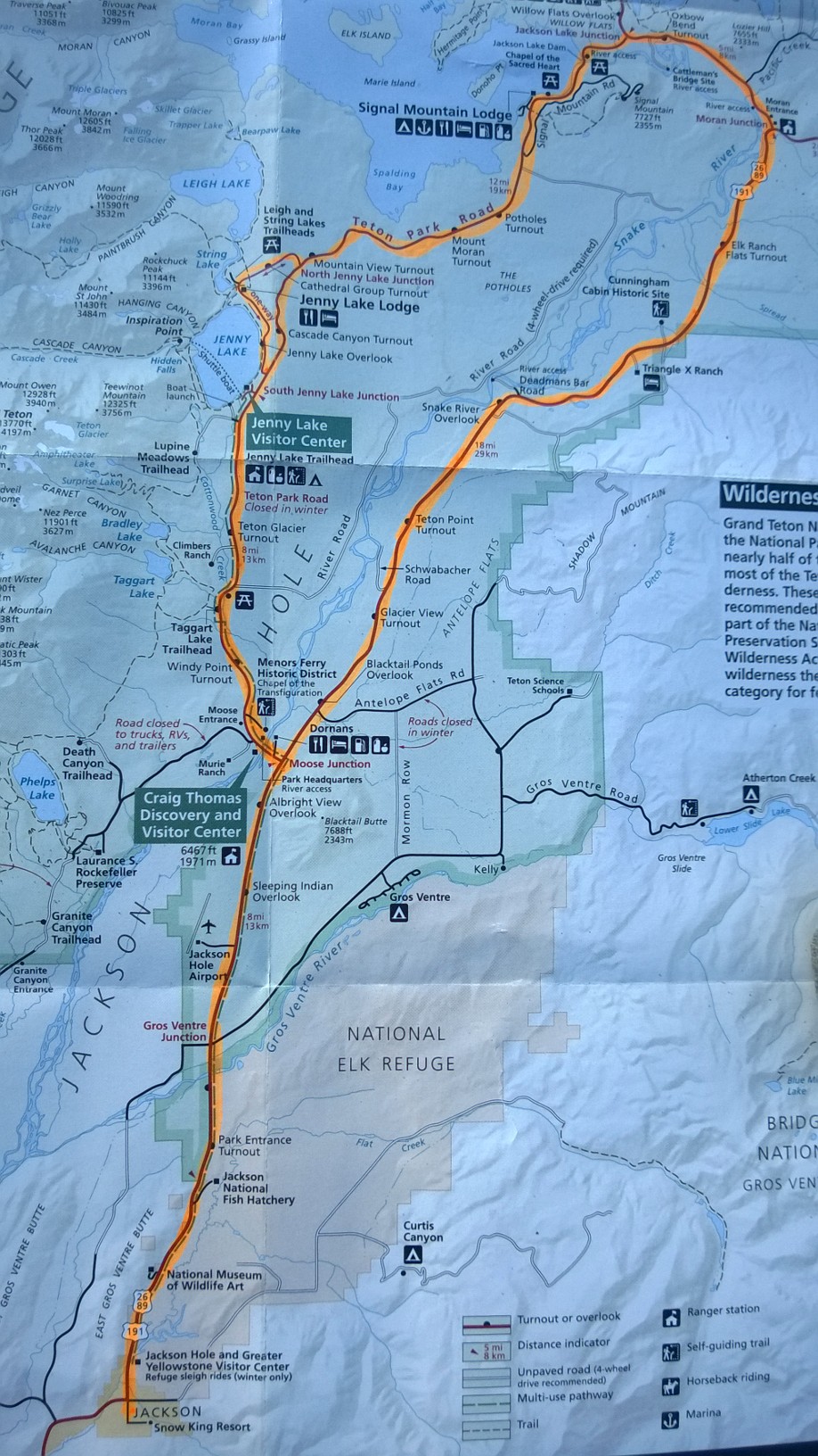
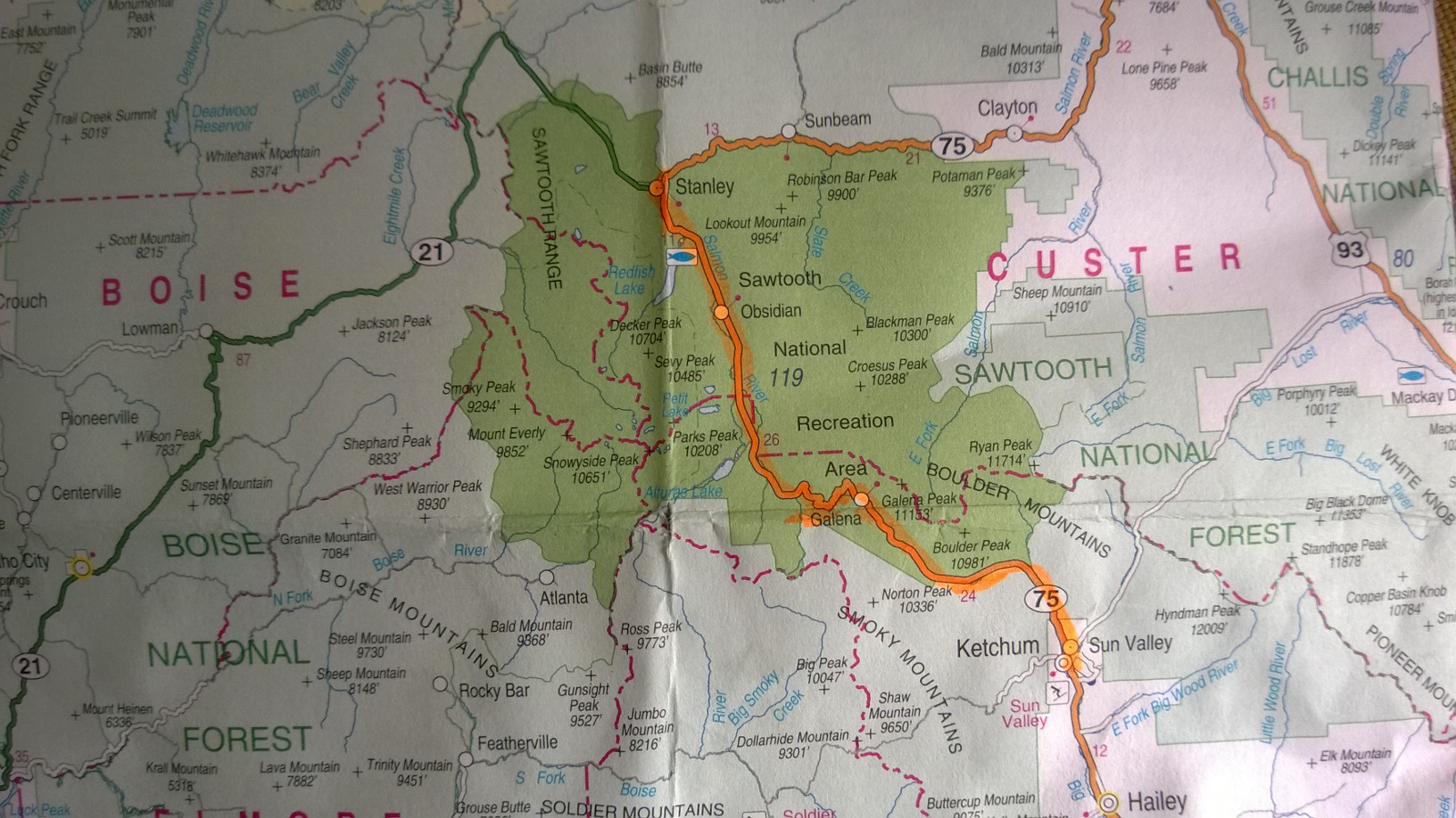
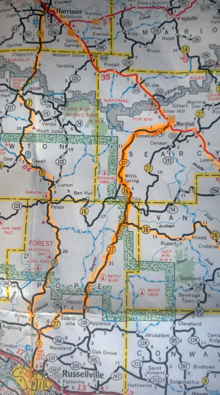
This is a map of our ride today:

Route Map: Ride #2, Yellowstone NP

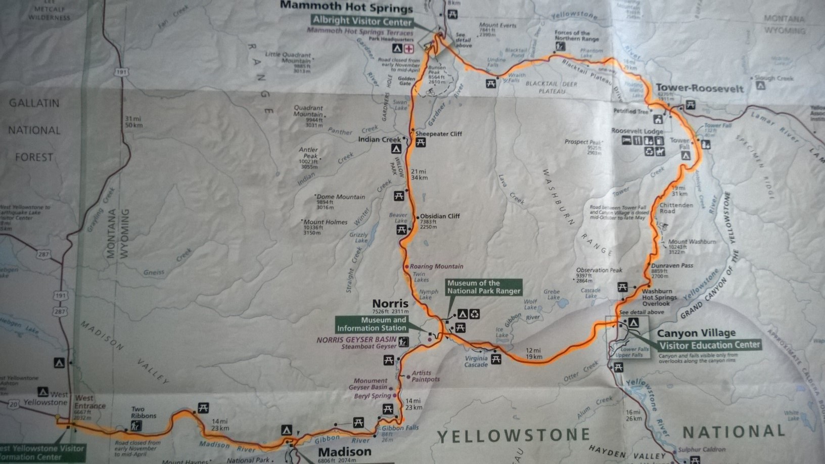
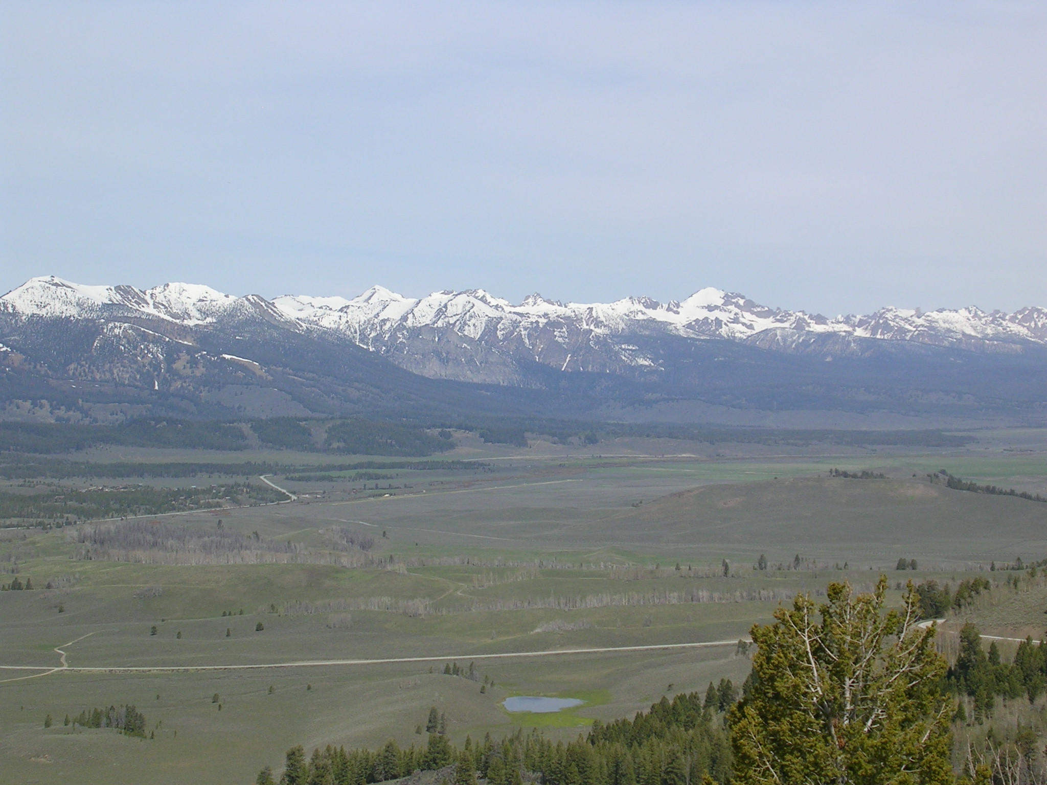
We began by retracing our route east from yesterday but went north at the Norris Junction. Road work was under way and we had a 15 min. delay. We rode British style on the left as the traffic alternated one way north and south. It was a rough trip—the road was in bad shape and the bikes hopped all over the uneven surface as the contact patch of the tires was often lost. Deep but camouflaged potholes had to be sidestepped quickly. As the road climbed higher we could see Bunsen Peak (8,464 ft. elev.) and the Blacktail Deer Plateau in the distance.

Blacktail Deer Plateau

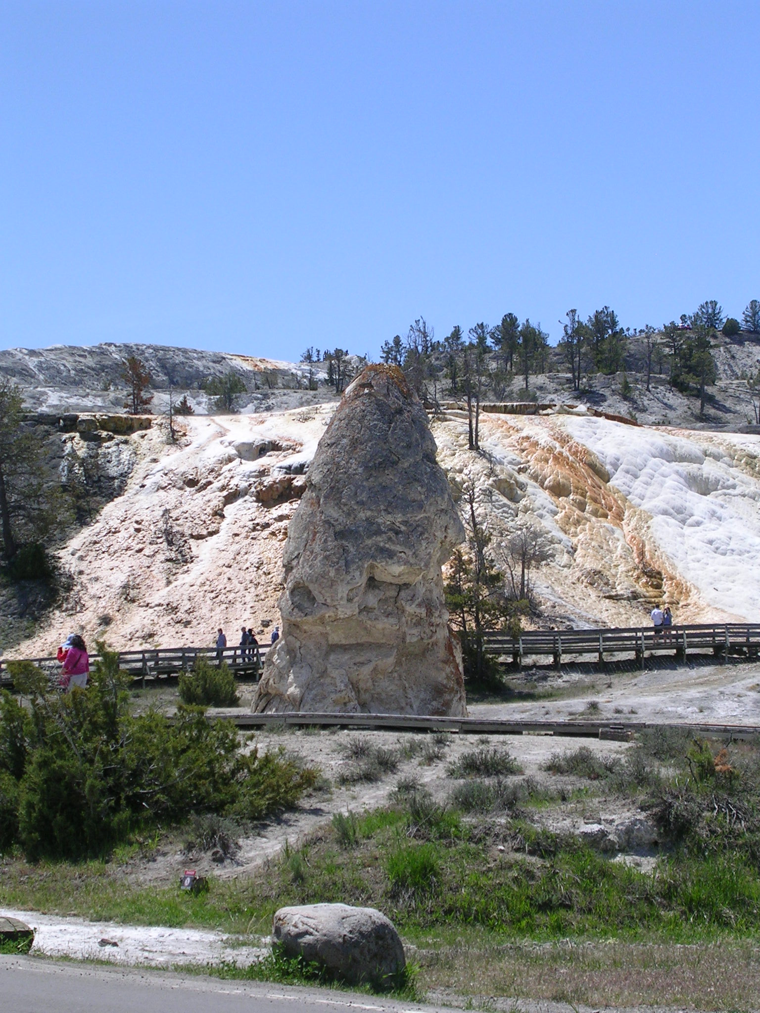
Then we bounced down through two hairpin switchbacks into the valley where Mammoth Springs percolates. And, yes, it is mammoth. With an interesting hoodoo in the foreground, the springs sit on huge mound of sulfuric looking deposits.

Mammoth Springs Hoodoo


Mammoth Hot Springs
Mammoth Hot Springs

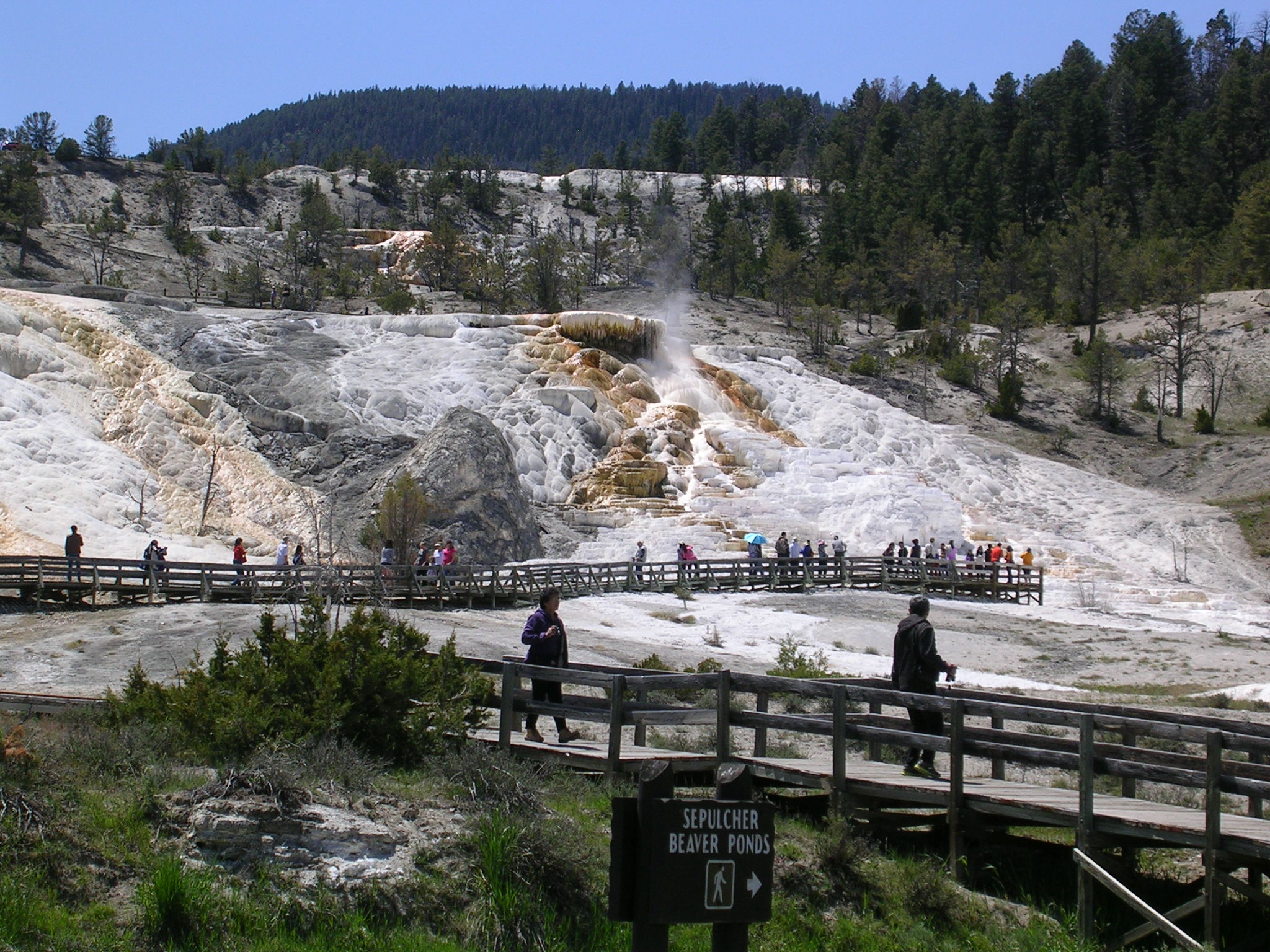
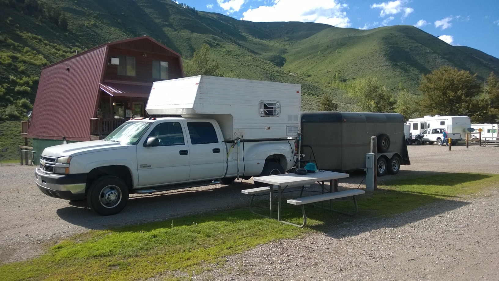
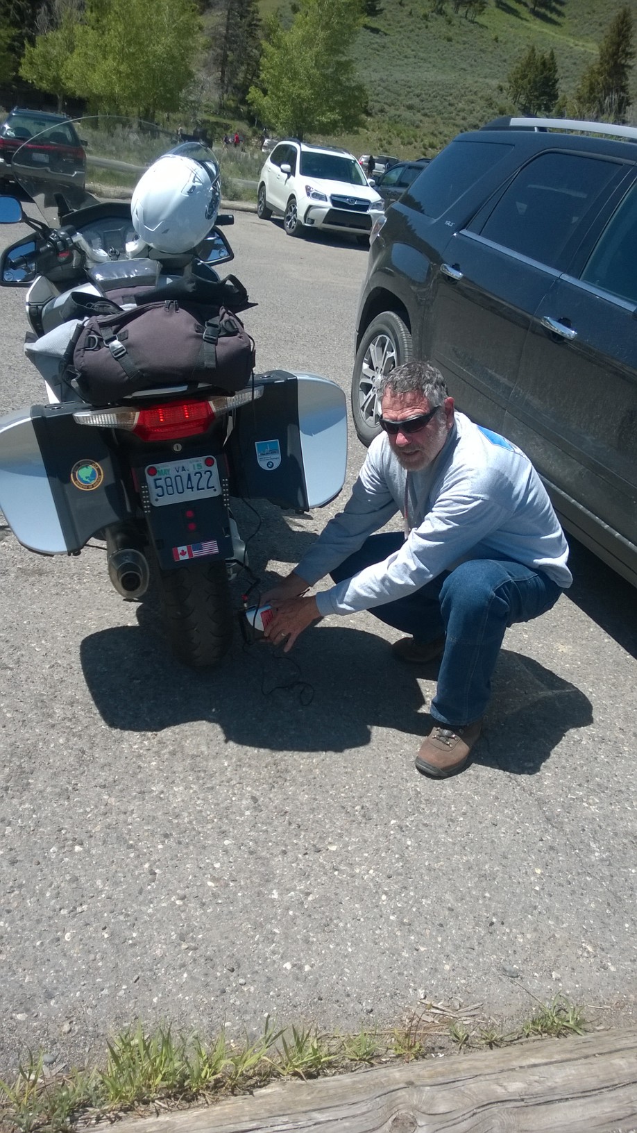
Across from the springs, we had a picnic lunch, I re-inflated my rear tire that had lost pressure in the cold air overnight, and then we saddled up to ride east along the base of the Blacktail Deer Plateau.

Re-inflating that pesky rear tire

The motorcycling here was exquisite. We passed tranquil alpine pastures, streams and stands of fir trees covering the hillsides. The tarmac here was fresh and smooth and our tires gripped perfectly through the twisties and sweepers that demanded attention but didn’t overwhelm.
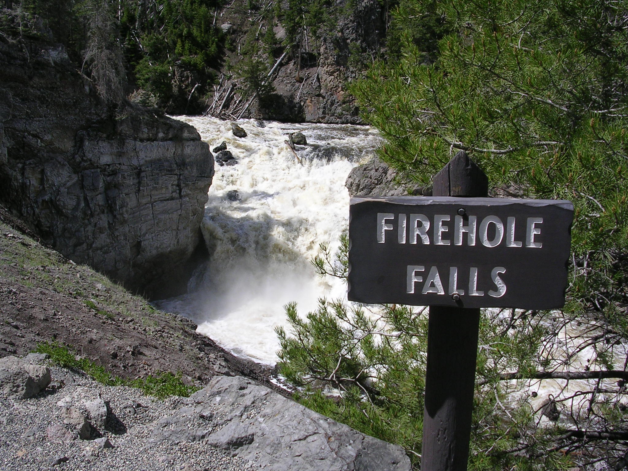
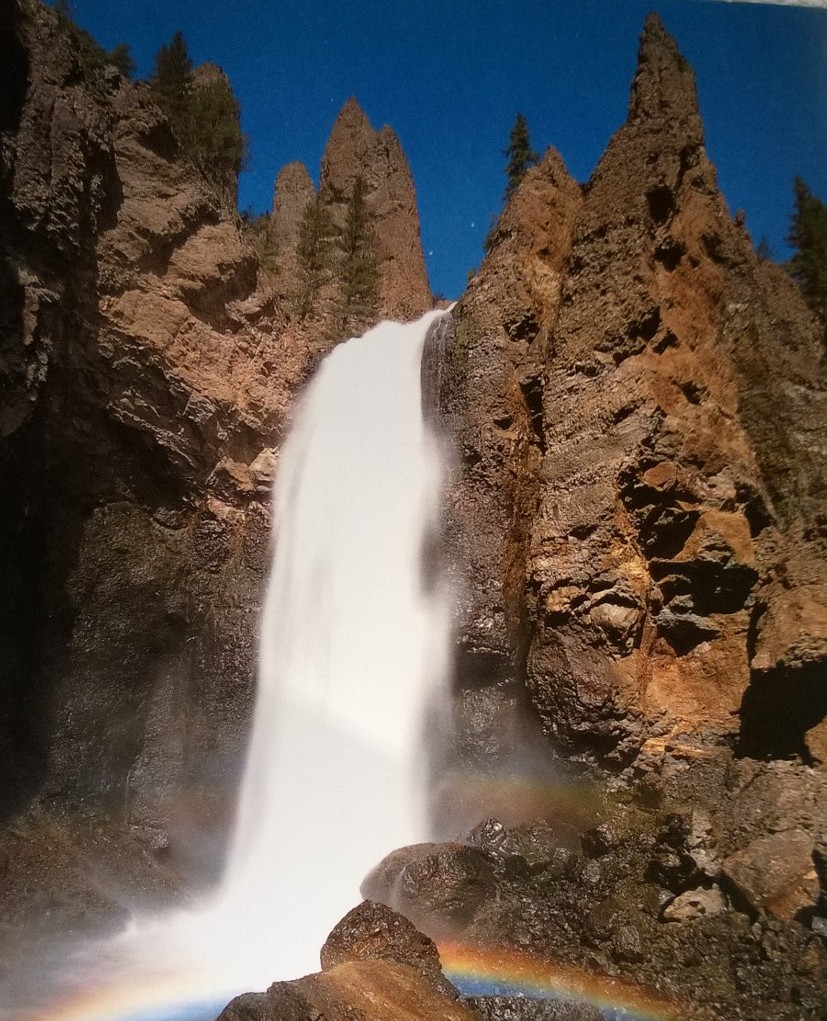
As we swung our bikes south, we stopped at the Tower Falls for quick photos and then the fun began.

Tower Falls
Tower Falls

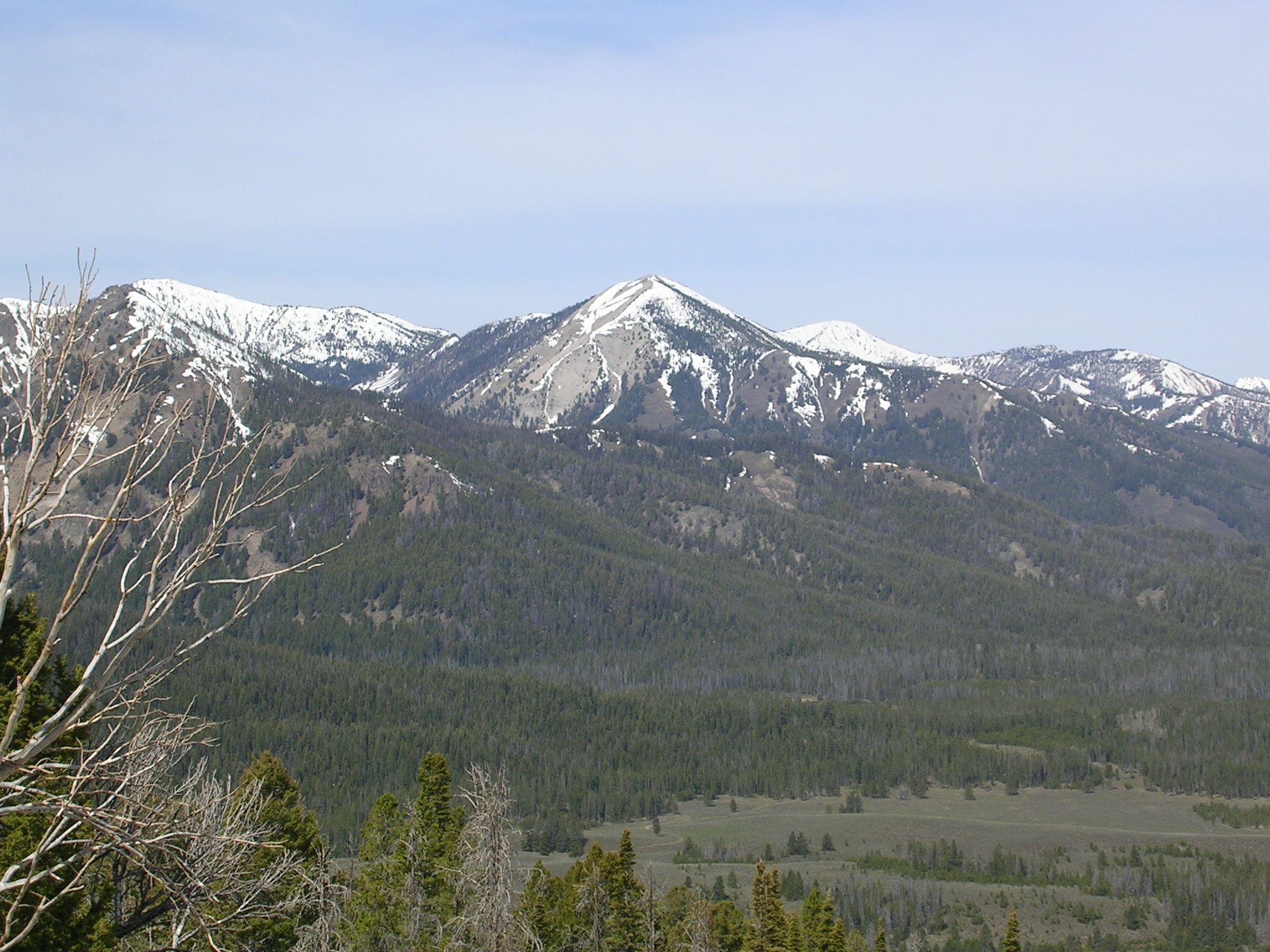
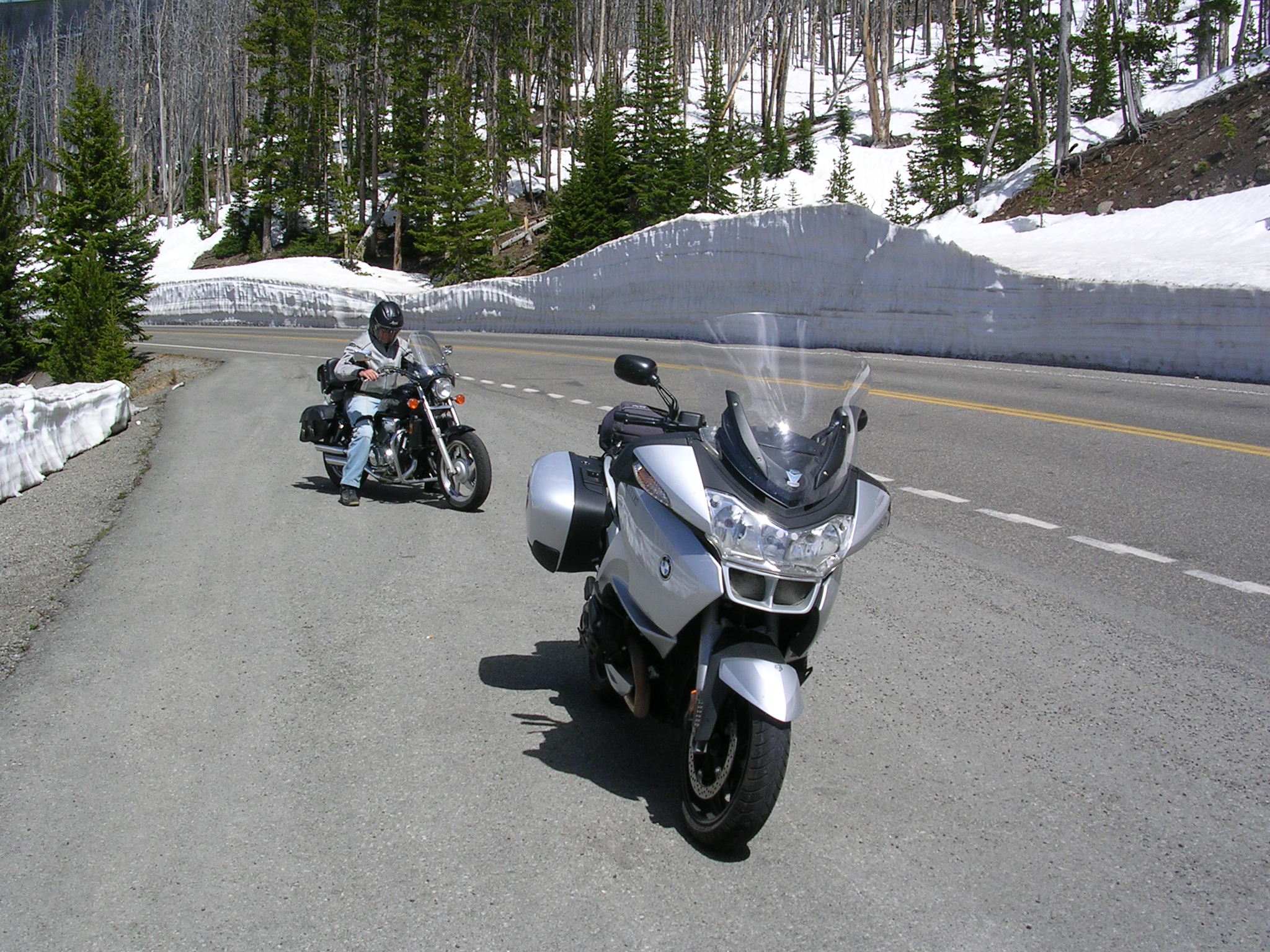
The route started its ascent near Mt. Washburn, a big boy with an elevation of 10,243 ft. The temperature dropped more than 10 degrees as we squirmed our way toward the Dunraven Pass (8,859 ft. elev.).

Banks of snow, some towering over 12 ft. , lined the east side of the road. The posted speed limit for the numerous curves never got over 25 mph. We were on the outside of the mountain; there were no guardrails and the drop off was unnerving.

Some cars and trucks like to blast their way up to the summit and get disturbing close to bikers like us who have every reason to play it safe by sticking religiously to the designated speed limit. I think it’s called survival of the smartest. We just pulled over for these hot shots and assumed that the Darwin effect would justify our cautious approach.

Dunraven Pass
Dunraven Pass


Snow Bank--Rufus in Background
Big Snow–Rufus in background dwarfed by the snow drift

Cruising down from the pass we got to the Canyon Village Junction, gassed up and started our return trip along, by now, a very familiar route west since this was the fourth time we’d followed the 28 mi. stretch along the Gibbon and Madison Rivers. We knew the road well and our bikes seemed to know the way, too, happily sailing along at 45-50 mph in a sweet spot of motorcycling bliss.
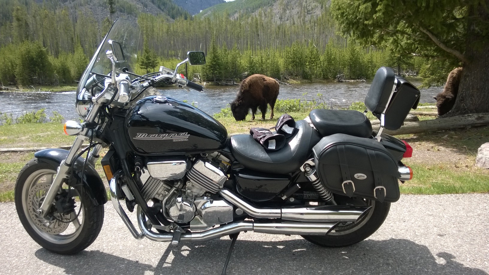
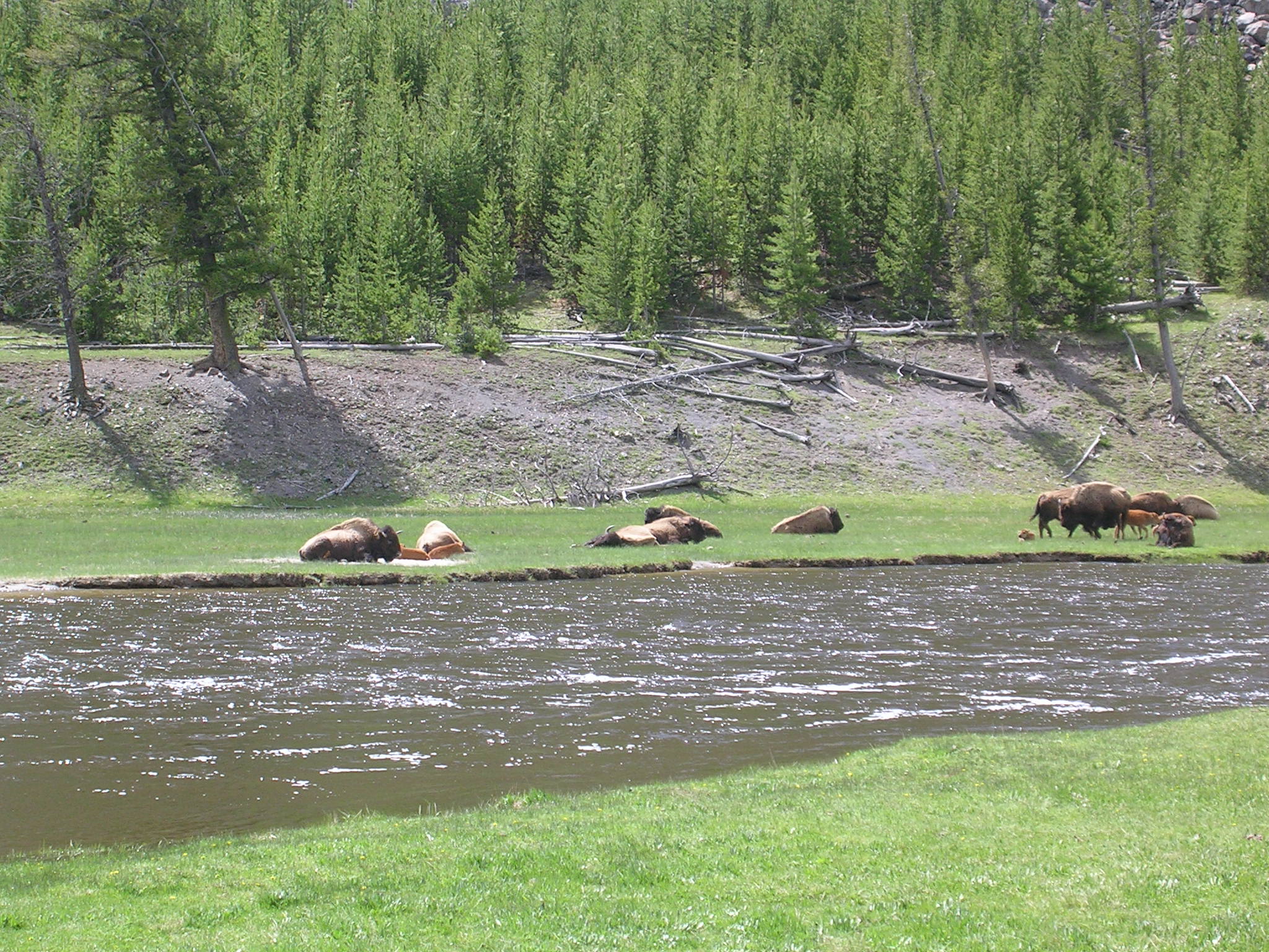
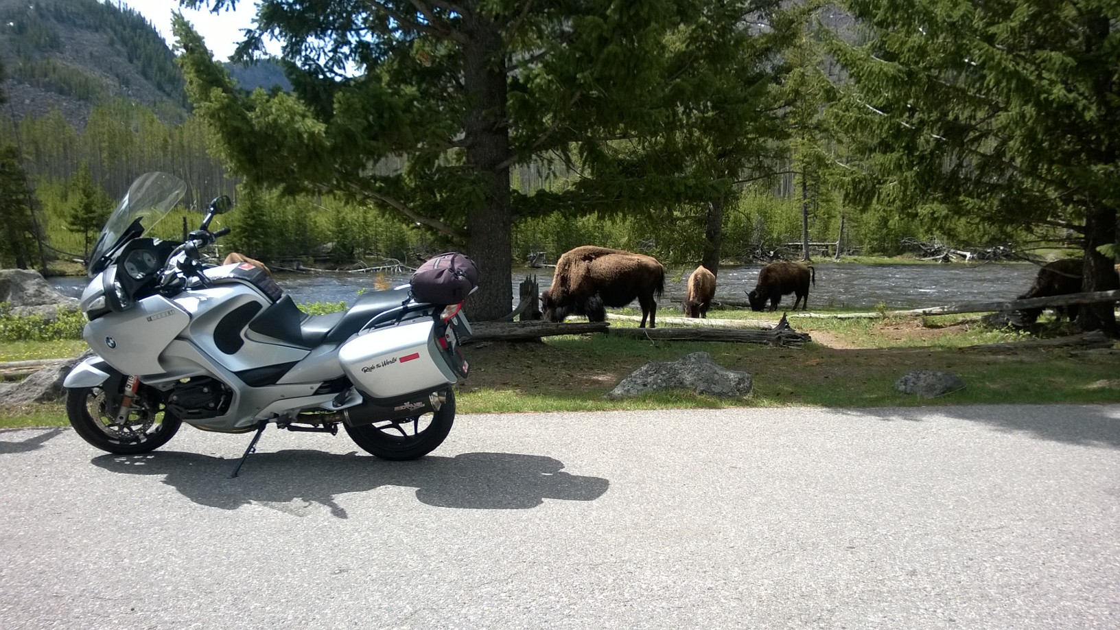
The road passed through what I had begun to think of as “Bison Valley” and the scene brought to mind passages of the 23rd Psalm—phrases like green pastures, still waters, and restoration of health seemed so congruent with what we saw.
I felt incredible happiness seeing bands of noble bison plodding along, grazing and resting and caring for their young. They seemed so dignified and in complete harmony with the land and water. It’s no surprise that Native Americans honored their spirit. These shaggy but perfect animals provided food, shelter and clothing to native people and they, in turn, were grateful for the abundance these incredible creatures provided them. It would advance our culture immeasurably if we could see animals as beings more like us than different and part of the web of creation we share.
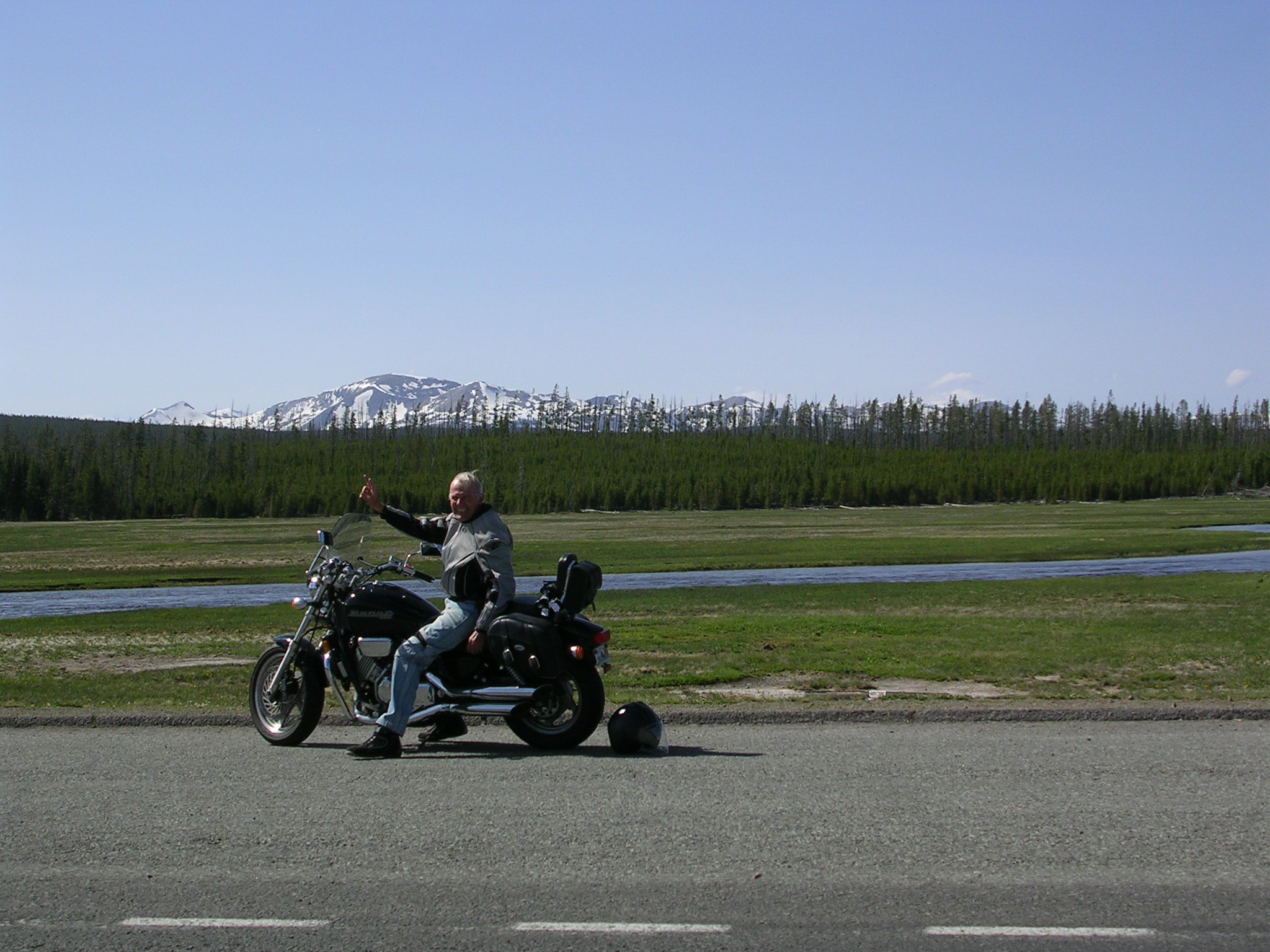
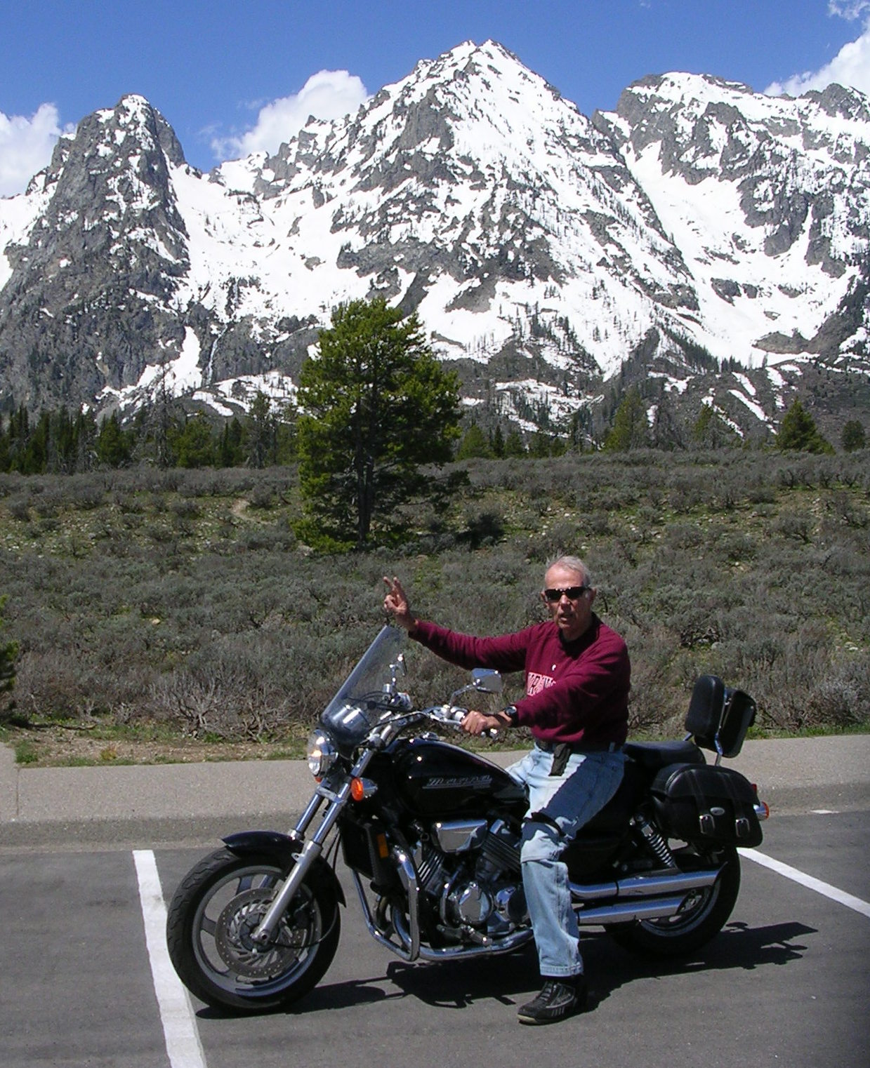
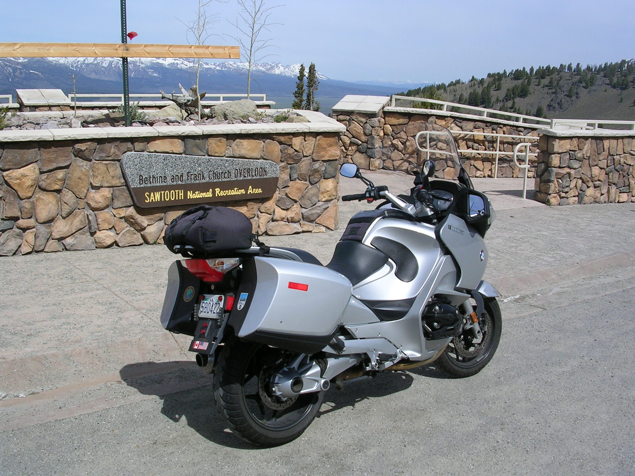
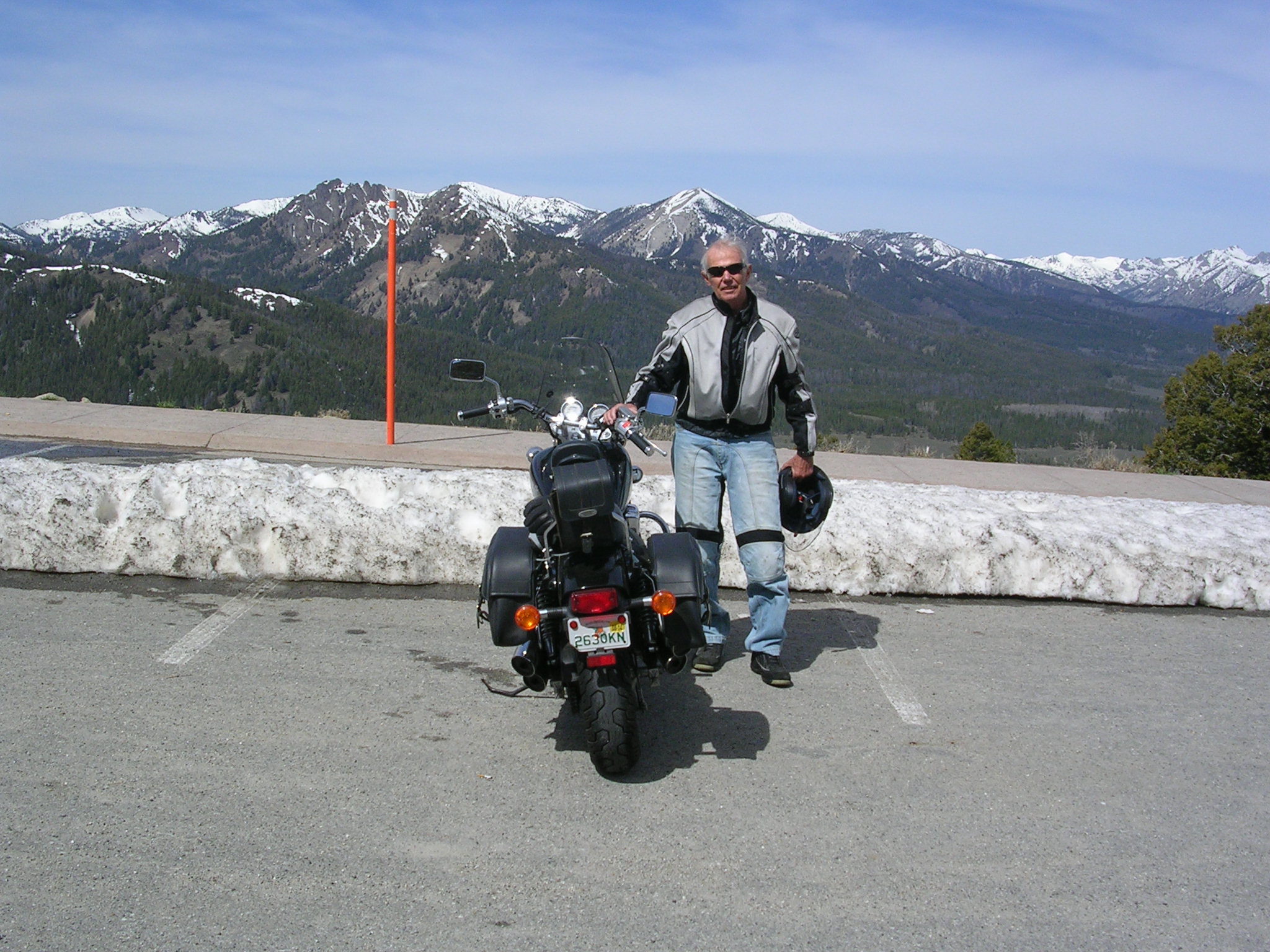
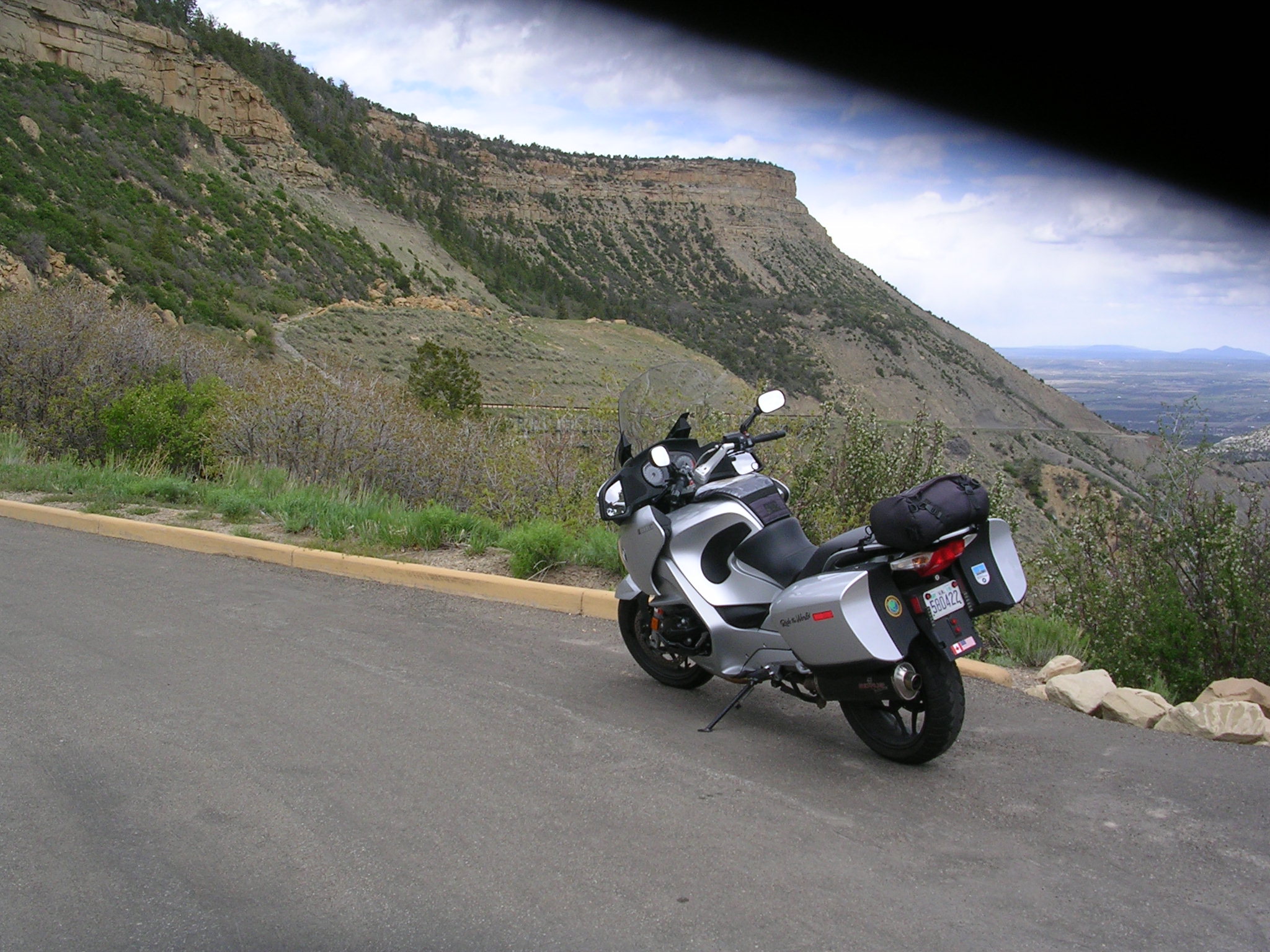
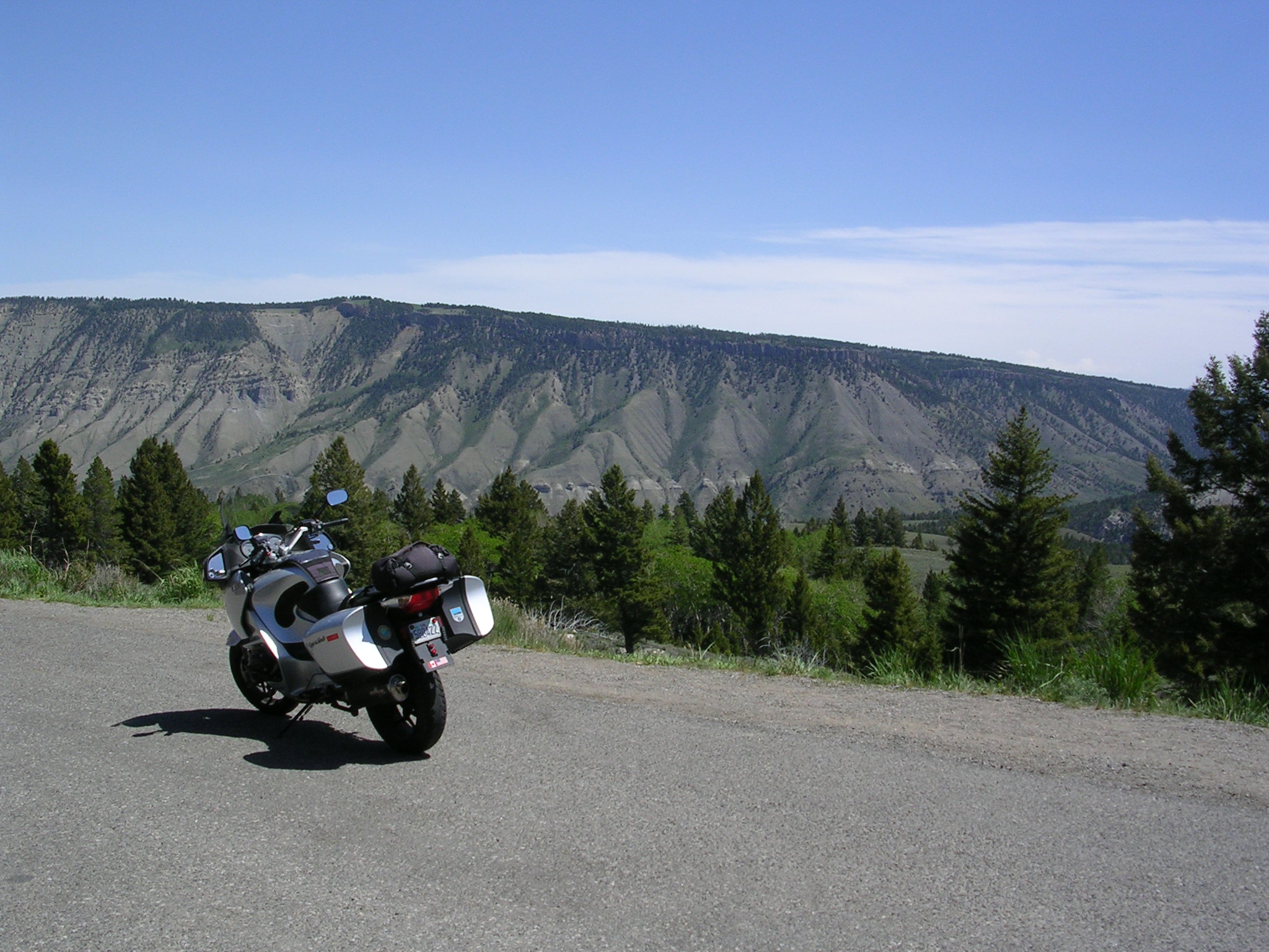
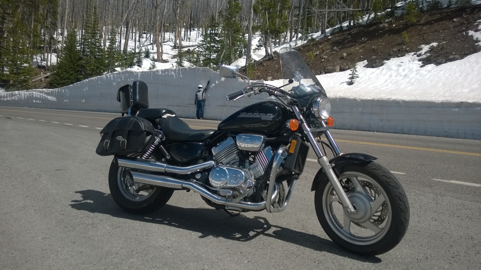
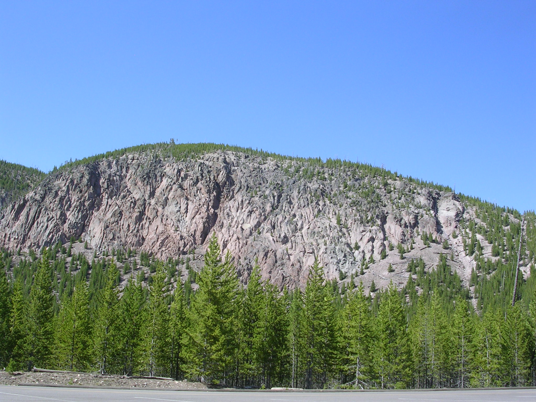
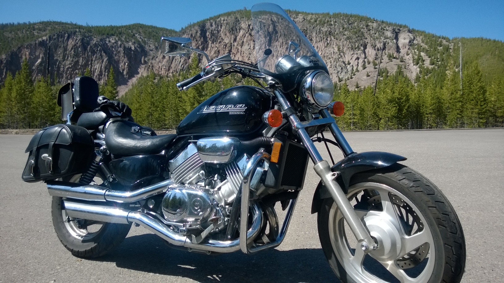
After that, we made one stop at the “rim of the caldera” where the ancient volcano collapsed after eruption and left high walls in place. There Frank took a photo of his motorcycle,”Sheba.” It was a lovely shot that Honda could use for advertising purposes.

Rim of the Caldera
Rim of the Caldera
"Sheba" at the Caldera
“Sheba” at the Caldera

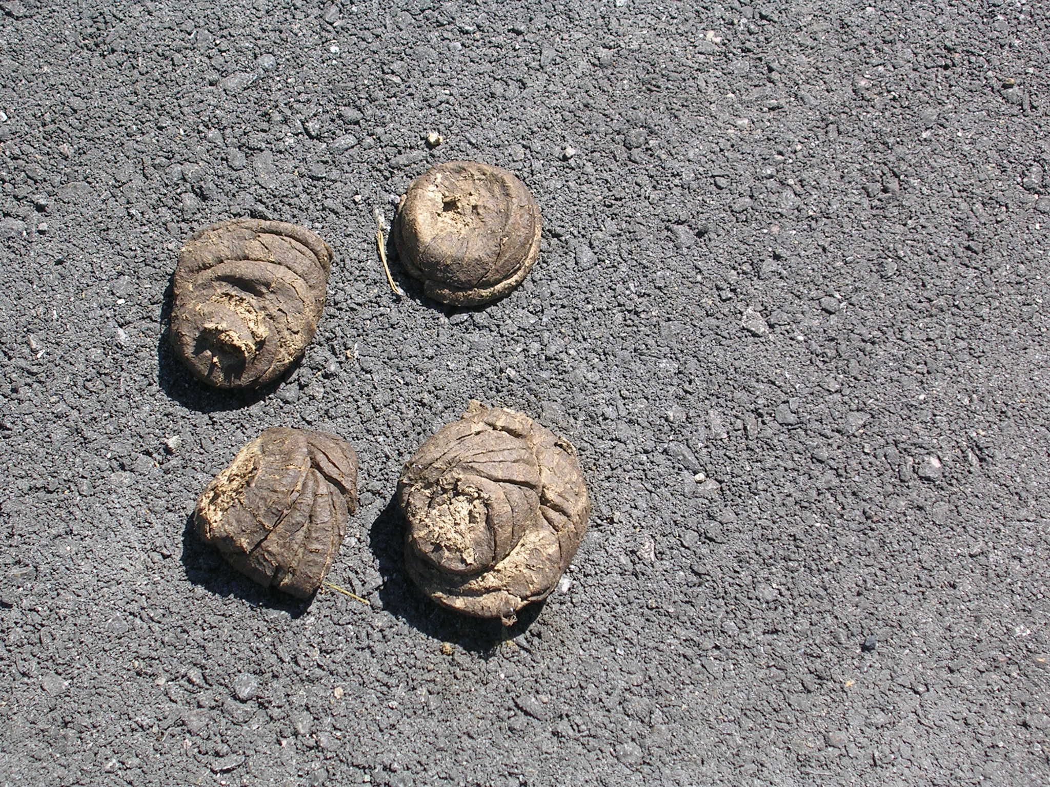
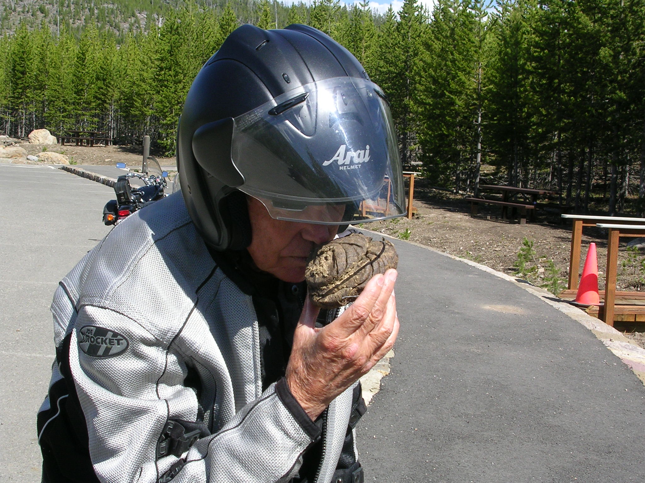
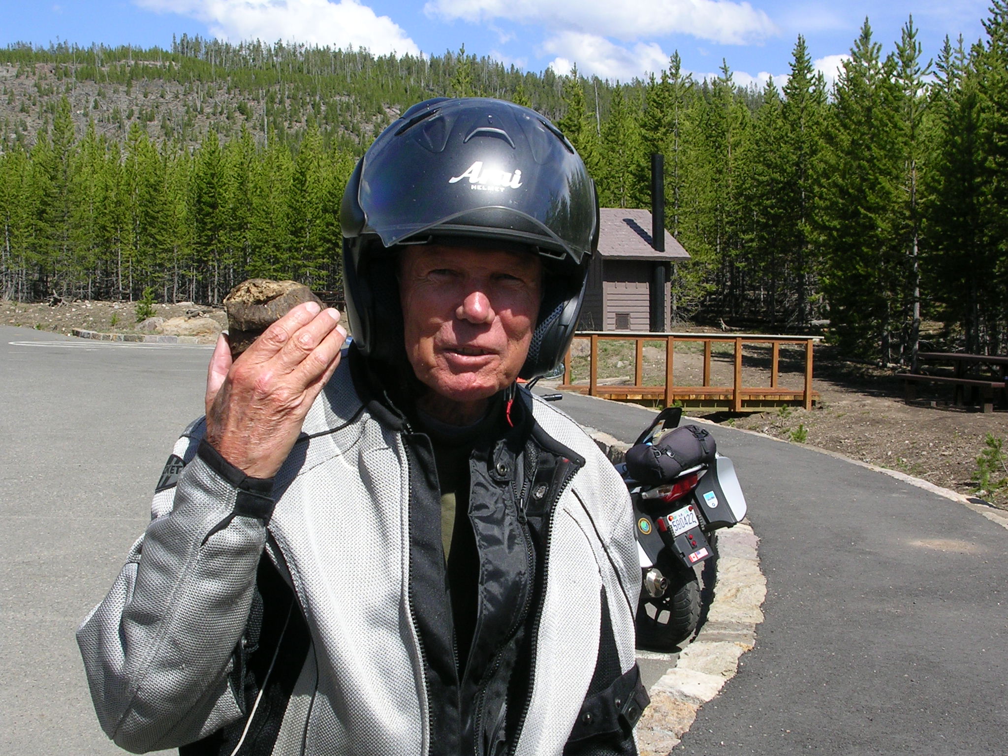
During our caldera stop, we spied what I believed was bison poop. Frank (Paco) wasn’t sure. He scientifically inspected one of the “pies,” gave it a good sniff and pronounced it as authentically bison poop.

Is This Bison Poop?
Is this Bison Poop?
The Sniff Test
The Sniff Test
Yes, It's Bison Poop!
Yes, it’s Bison Poop!

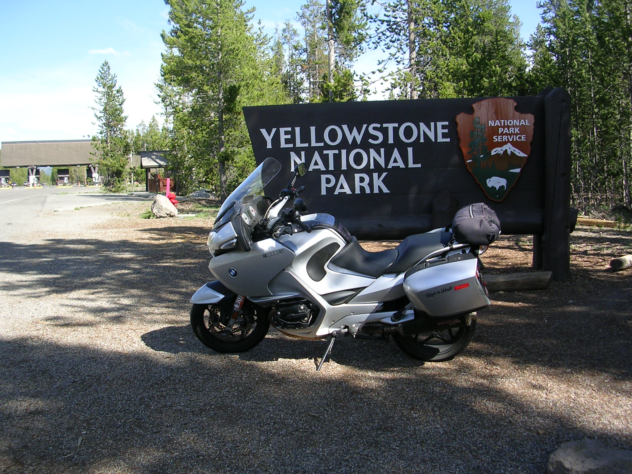
And so we departed Yellowstone National Park. I may never return here again, but my heart is full forever with memories of its haunting beauty.
Footnote: Thanks go to Frank “Paco” Bartlett not only for his steadfast camaraderie during all these outings but also for supplying several photos, acting as the chief science officer for bison poop, and serving as key researcher for facts and figures used in this narrative.

Yellowstone—Part 1: Bison, Geysers, Canyons, Lakes, and More

May 29, 2024, West Yellowstone, WY

Old Faithful Geyser, Photo by Frank Bartlett

Yellowstone was the United States’ first national park. The wisdom and foresight of those who helped create this sanctuary, including Teddy Roosevelt, deserve the thanks of every generation.
The Park is a treasure chest of natural beauty with so many interesting combinations and varieties that your senses overflow with joy. Riding a motorcycle through the lower loop of the park brings you close to all these elements. You can inhale the scent of fir trees, watch the bison grazing, their new-born calves wobbling beside their mothers, see steam rising from the hot springs, feel the cold winds blowing across the ice floes of Lake Yellowstone and smell the ocean-like odors of the sulfur fields.
The riding is pleasant and affords scores of opportunities to lean into delightful sweepers. There aren’t any terrifying twisties and even hopping over the Continental Divide wasn’t a chore. However, we were dogged all day by a persistently aggressive breeze that knocked us around regardless of our direction which required keeping our attention on the road and not the unfolding spectacle of scenery before us.

Yellowstone Ride #1,Route Map
Route Map: Rite #1, Yellowstone, NP

Our day began with a 10 minute wait to get into the west entrance to park but we were soon rewarded with the chance to go into a turn-out where bison grazed at the edge of the parking area.  Across a gentle river more bison rested in the grass with their young.

Bike and Bison
Bike and Bison
Grazing Bison
Grazing Bison
Beemer and Bison
Beemer and Bison

From that point on, we followed the path of many tourists before us. The tourists in their cars, vans, campers, and mammoth RVs, not the wild animals, were the real danger to us. They abruptly pulled out on to the roadway or lurched suddenly into a turn-out to click away at the bison or the landscapes. To make matters worse for me, the horn on my bike inexplicably conked out just when I needed to warn more than one driver to pay attention.
We took a death-defying three mile to loop on a rough one-way road with loose gravel, no shoulders or guard rails to Firehole Falls which seems to rush out of nowhere and plunge down, its waters churning furiously.

Firehole Falls
Firehole Falls

Then it was on through the hot springs and geyser basin until we came to Old Faithful. Luckily, we only had to wait about 45 minutes before we witnessed the glorious three-minute eruption with its rooster tail of steam spewing into the clear Wyoming air. Yellowstone Park is reputed to sit on one of the hottest hot spots on earth.

Paco at the Geyser
Paco at the Geyser
Rufus at the Geyser
Rufus at the Geyser

From there, it was over the Continental Divide—the road actually crosses it twice, once at about 8,300 ft. and then a few miles later at 8,400 ft. After dropping down another 1,000 ft. in elevation, we encountered massive Yellowstone Lake, with 141 mi. of shoreline, still covered in spots with slabs of ice. The lake sits at an elevation of 7,733 ft. and has a maximum depth of 410 ft. It’s the largest high mountain lake in North America and is believed to be the crater formed by enormous volcanic activity. An impressive sight.

Yellowstone Lake
Yellowstone Lake
Ice Floes on Yellowstone Lake

After passing the Mud Volcano and the Sulfur Caldron, which you smell long before you see it, our next stop was the Grand Canyon of the Yellowstone, a narrow canyon that goes straight down for 800 ft. to 1,200 ft. without any interruption to the Yellowstone River.
From there we continued northward a few miles and finally turned westward back toward the west entrance enjoying the afternoon sunlight on the rivers and running the straightaways, a bit over the posted limit, and leaning into more of those sweet sweepers until we left the park and returned to West Yellowstone.

Paco by the River
Paco by the River

Before we turned down the street to the Bear Crossing RV Park where the Badger Den awaited us, we saw the Westward Ho Motel. Hey, they named their place after our trip. How cool is that?

Westward Ho Motel, West Yellowstone, WY

The total for an all day trip: 126 delightful miles, not our longest ride but one with a surprise at every bend in the road.

The Grand Tetons and Jenny Lake Ride: May 27, 2014

The Grand Tetons
The Grand Tetons

Before I dive into our latest adventure, warm thanks to everyone for your comments. Funny or serious they are appreciated as are  all the good wishes you’ve sent. Sorry I haven’t been able to reply individually.  My computer set- up is so inconvenient in a very small camper that simply keeping up with blog entries is a challenge. But keep your comments coming. We read all of them and enjoy the banter. And I promise I will avoid using the term “girl” ever again, except in regards to cowgirls, as cow-women seems degrading to our comrade sisters.

This will be a rather short entry. Although we put in 149 miles from Hoback Junction,where our RV park was located, words seem so inadequate to describe this magical part of our country.

You don’t ride into the Tetons, you ride past them. Rugged, majestic and covered in deep, deep snow. Snow lingers on in this part of Wyoming into late spring. We had hoped to ride up to Signal Mt., but the road was closed because the snow was too deep. On the route going north, the Tetons seem close enough to reach out and touch. The above photo was taken on the return route going south and the Tetons appear farther away and are viewed across a broad valley dotted with fir trees and and rolling pastures. In the winter, elk roam this valley to graze.

The map below illustrates our route past the Tetons and the loop to Jenny Lake.

Route Map: Grant Tetons Ride
Route Map: Grand Tetons Ride

Riding north through the park, with the Grand Tetons to our left, we found the one- way loop road to Jenny Lake, a 200 ft. deep body of cold clear water formed by ancient glaciers as they carved out a basin and then melted.


Jenny Lake named for the Shoshone wife of trapper and guide "Beaver Dick Leigh
Jenny Lake named for the Shoshone wife of trapper and guide “Beaver” Dick Leigh

After our visit to Jenny Lake and a granola bar lunch, we returned to the main road, rode north to Malone where we turned south on the park road for the trip back to Jackson.

With the Grand Tetons now to our right,  so many photo ops presented themselves that we had to choose just one to capture the beauty of the scene. With the massive mountains in the background, our motorcycles appeared tiny and insignificant.

Grand Teton Scenic Turn-Out
"Paco" and the Grand Tetons
“Paco” and the Grand Tetons

Although we had been warned to look for for deer, elk, and possibly bears, we encountered only camera-laden tourists from across the country and around the world. Just the same, warnings about wildlife are clearly posted on the highway.

Slow Down Wildlife on Road Sign


Reluctantly, we left Grand Teton National Park and returned to Jackson to stop in for peek at “The Million Dollar Cowboy Bar.” The bar dates to 1937 and received the first liquor license in Wyoming after Prohibition. Frank had been there on a cross-country skiing trip in 1988 and claimed it was a “must see” bar. Frank was true to his word. It’s unique. The bar stools are horse saddles, the ridiculously long bar top has silver dollars imbedded into it and the interior is made of large knobbled pine. A more Western, cowboy-themed bar does not exist.  We broke our solemn rule not to drink while out on the bikes and each had a beer with some chips. Having a drink there was almost obligatory.  Saying, “I’ll just have a sasparilly,  Maam,” to the bartender would have been criminal.

The Cowboy Bar, Jackson, WY
Ride 'em Cowboy!
Ride ’em Cowboy!

We walked around the town square for awhile which has arches of made of scores of elk antler horns at each corner entrance to the square. (No elk are harmed; they shed their antlers annually which were collected for the archways.)


Under the Antler Arch

It was time to return to the Badger Den at the Lazy J RV Park in Hoback Junction and ponder the beauty we had experienced–all of it too exquisite to try to put in to words.

Badger Den at the Lazy J RV Park


Sawtooth Mountain Range, Idaho, May 25, 2014


Sawtooth Mt. Ride Map

We left Ketchum around 10:30 a.m.–late for us to start a ride but it was in the 40s when we got up. Once the sun was a bit higher, the temps rose and we went north to the Sawtooth Range.

Galena Pass
Galena Pass

Leaving the expensive houses and ski condos of Ketchum behind, the route run straight north on Rte. 75 to the mountains. Within 20 miles, the Sawtooth Range rises up, jagged and powerful, still draped in snow.

The road then wriggles its way higher and higher with a series of twisties until the summit is reached at Galena Pass, over 8,700 ft. high. Snow banks were still hugging the road in three foot drifts and piled up near the overlook parking lot.

We stopped there for photos and to appreciate the majesty of the range before us and the peaceful valley below.

At the overlook of Galena Pass
Sawtooth Valley
Sawtooth Valley
Frank at the Snowy Galena Pass Overlook

Then it was down the down the mountain into the valley and on to Stanley for lunch. The route to Stanley is flat and devoid of trucks, or much traffic of any kind. We pushed the bikes to 65 mph without a hiccup, sometimes getting up to 70 mph, as the Salmon River flowed along side us. We passed verdant horse pastures and ranches in the brilliant late morning sun.

Papa Brunee's in Stanley, ID
Papa Brunee’s in Stanley, ID
View from Stanley, ID of the Sawtooth Range

The food at Papa Brunee’s (just about the only place open) was tasty and the people friendly. As we were about to leave, a Harley rider and his girlfriend arrived and he was astonished that our bikes sported Florida and Virginia plates. As much as we’d like to burnish our macho image of Iron Butt Bikers, we quickly explained our system of hauling the bikes to fun places to ride.

Reversing our route, we climbed the mountain, appreciating the change in views going north to south this time.

On the edge of Ketchem we swung into the small and well-cared for town cemetery to pay our respects to Ernest Hemingway who is buried there. He and his wife, Mary, rest side by side. Hemingway moved there to enjoy the outdoors he loved so much but sadly took his life in 1961. Near the grave was an empty whiskey bottle, two empty packs of cigarettes, and scores of pennies and small change. I don’t know the symbolism of any of these tokens but it seemed to me  it indicated that “Papa” was being remembered after all these years by visitors seeking out his final resting place.

Grave Site of Ernest Hemingway

We left the cemetery and returned to the Meadows RV Park and the “Badger Den.” It was a short ride by our standards, only 140 miles, but a wonderfully satisfying and memorable one.

Four Corners Ride, May 22, 2014

Four Corners Ride

Welcome to New Mexico

Our intrepid wheel man, Paco, drove the Badger Den and trailer 543 miles from Russellville, AR to Amarillo Texas for an overnight stop and then we pushed on to the Desert Rose RV Park in Bloomfield, NM, which is northwest of Albuquerque, a total distance of 453 miles from Amarillo.
Crossing the top of Oklahoma was a dispiriting trip and I was thankful we were in a heavy truck instead of braving howling winds sweeping across the featureless landscape on a motorcycle. Likewise, the panhandle of Texas held nothing that was memorable. But all of this effort brought us to New Mexico to set up our Four Corners trip on May 22nd.

Route Map: Four Corners Ride
The Silver Streak at Mesa Verde

As is painfully obvious, we’ve spent a lot of time hauling the bikes from one area of the country to another to do a one day ride. However, we were well-rewarded for these long slogs with a breathtaking circuit from northwestern New Mexico into Colorado and on to the Four Corners Monument with a short leg of the trip into Arizona, returning to New Mexico. We did clip a very tiny corner of Utah, so I’ll claim that we rode Utah.

“Rufus” at Mesa Verde
“Paco” at Mesa Verde

The change in environment from New Mexico to Colorado was striking. We went from an area of dry mesas and barren hills almost devoid of vegetation to landscape of lush forests and snow laced mountain ranges and, important to riders, better roads. The 20-plus mile ride up a twisting, serpentine road to the top of Mesa Verde offered inspiring and distracting views of the valley below us. That part of journey alone would have been more than enough for a satisfying motorcycle adventure.
We were determined, however, to find the Four Corners Monument, and so we left Mesa Verde, gassed up in Cortez and pressed on to the FCM.

“Paco” at Spruce Lodge Ruins, Mesa Verde

There the wind was ferocious. The flags of the four states and the Indian nations that have custody of the monument were flapping strenuously, ready to rip off the flagpoles. The road into the Monument was unpaved as was the area surrounding it and was an unstable surface for motorcycles.  But as can be seen from the photo below, a number of bikers—all Harley riders—were as resolute as we were to experience being in four states simultaneously. We strolled around the plaza filled with tourists from around the world, gawked at the markers and plaques, and Paco had his first taste of traditional fry bread prepared by a Ute woman.

“Paco” posing at the Four Corners Monument
Four Corners Monument Maker
Bikes Parked at the Four Corners Monument

After our visit to the Monument, we rode south into Arizona, then turned east toward Shiprock, NM to begin the final leg back to Bloomfield. Shiprock—the rock, not the town—is an imposing landmark that dominates the horizon to the south as you travel east on Route 64. It rises up from a flat plain, 7,100 ft. high, and it’s hard to not be mesmerized by the sight. This section of highway was very uneven and a brutal cross-wind continued attacking us, so I finally pulled over for a photo op to capture the scene and focus on keeping the motorcycle upright for the rest of the trip.

The Silver Streak with Shiprock in the distance

Shiprock, the town, is within the Navajo Tribal boundary and the tribe’s headquarters are there. The next town was Farmington where we made a brief visit to the local Wal-Mart for a few supplies that we could carry on the bikes. I mention this only because we were just about the only non-Native Americans in the store—we were the minorities there and it felt like we had been transported into a village of Navajos, Hopis, Utes, and other tribal populations. We were the outsiders. It was humbling experience.

Two humorous episodes deserve comment: in the store, I passed by a Native American man sporting a Dallas Cowboys t-shirt and later on the highway to Bloomfield we spied a large billboard sponsored by the local Catholic diocese that displayed a picture of Christ. The text below, “Jesus is watching you.” Directly behind the spot where the billboard stood was a commercial property—the site of an adult video store. There was only one car in the parking lot at the video store so perhaps the billboard was having the desired effect. It merited a photo but we didn’t have time. However, Paco later found the picture on the web and I’ve  included it so you can see it for yourself. Obviously, we weren’t the only ones who found humor in the juxtaposition of the two signs.

Jesus is Watching You!

We returned to the Desert Rose, toasted our 247 mile Four Corners Tour with cold Coronas and started planning our route north to Idaho as the next destination.


Ozark Ride, May 19, 2014

Russellville, Arkansas

May 20, 2014

DSCN2155
Ozark National Forest Entrance Sign


Route Map: Ozarks Ride


Paco and I rode a 200 mi. circuit starting in Russellville, AR. We began north along  Route 7–a winding scenic road that runs through the heart of the Ozark National forest.  After about 80 miles, we traveled east on 206 just north of Dogpatch, AR (yes, it’s a real place) where we picked up Route 65 and turned south. Just before Marshall, AR, we shifted west on Rte. 74 through Snowball, AR to eventually connect with Rte. 27 and back to Route 7.

DSCN2147
Ozarks Overlook

Impressions: we rode so many twisties, I Iost count.   While there were occasional 50 mph sweepers, it was a series of challenging sharp curves, with 20 and 25 mph speed limits. At the beginning of the ride, we encountered chilly temps and then very dense fog that reduced visibility to just a few feet. Later the sun broke through and it turned out to be a clear warm day so we could enjoy the overlooks of the “Grand Canyon” of Arkansas.

At the top of mountain: Ozarks Ride

The population of Arkansas is slightly less than 3 million people in 52,000 square miles. You can ride back roads for many miles and not see another car. Most people were friendly, helpful and interested in what we were doing. Not many bikers ride BMWs in this part of the U.S. so my bike was a bit of an attraction.

We stopped at the Big Piney Ranger Station for a break and information. The lady ranger was welcoming and went over our route on one of her maps. She had some photos of a big snow storm that hit the mountains a few years ago and explained that the residents of Snowball were without power for six weeks. Ouch. We returned to the “Badger Den” at the Mission RV Park in Russellville, tired but satisfied with a rewarding day’s ride.

Today was a travel day through OK and TX. Tomorrow, we plan to drive to an RV park near Farmington, NM and start the Four Corners tour the next day.

DSCN2140
Paco says, “Alleluia, we did it!”

End of our blog for today.  Cheers, “Rufus” & “Paco”


In the Ozarks

After a very long drive across Tennessee and Arkansas, we found an RV Park with nice amenities except for the train tracks nearby that cause the camper to shake as the trains roll by. Tomorrow we ride through the Ozark Mountains in a 100+mi. loop. Good weather expected. Pictures to follow soon.

Where are you going?

When I’ve mentioned I’m taking an extended motorcycle trip west with my old pal, Paco, the first question is: Where are you going? The unsatisfying answer is, we’re not sure–just yet.  Regardless, the Honey Badger Biker Blog will chronicle our motorcycle trip west and the answer will be: Here we are, wherever that may be.

As is likely obvious, this is my first blog and very rudimentary. As I learn more about how it works, I expect to make visual and content refinements.

Why the Honey Badger theme? Honey Badgers are fearless, a bit crazy, and will eat just about anything. That seemed to be the perfect mascot for two geriatric bikers.