Frank was one of my very best friends going back to 1967. Starting in 2010 we began taking motorcycle trips together going as far south as Key West and north into South Dakota’s Black Hills. Many of our travels are recorded in this blog. Frank was a kind and generous soul. He had a wealth of funny stories that always made me laugh as we traveled the USA together. He was the kind of friend who lessened my sorrows and increased my joys. I will miss him beyond any words I can offer. Until we meet again, rest in peace my good friend.
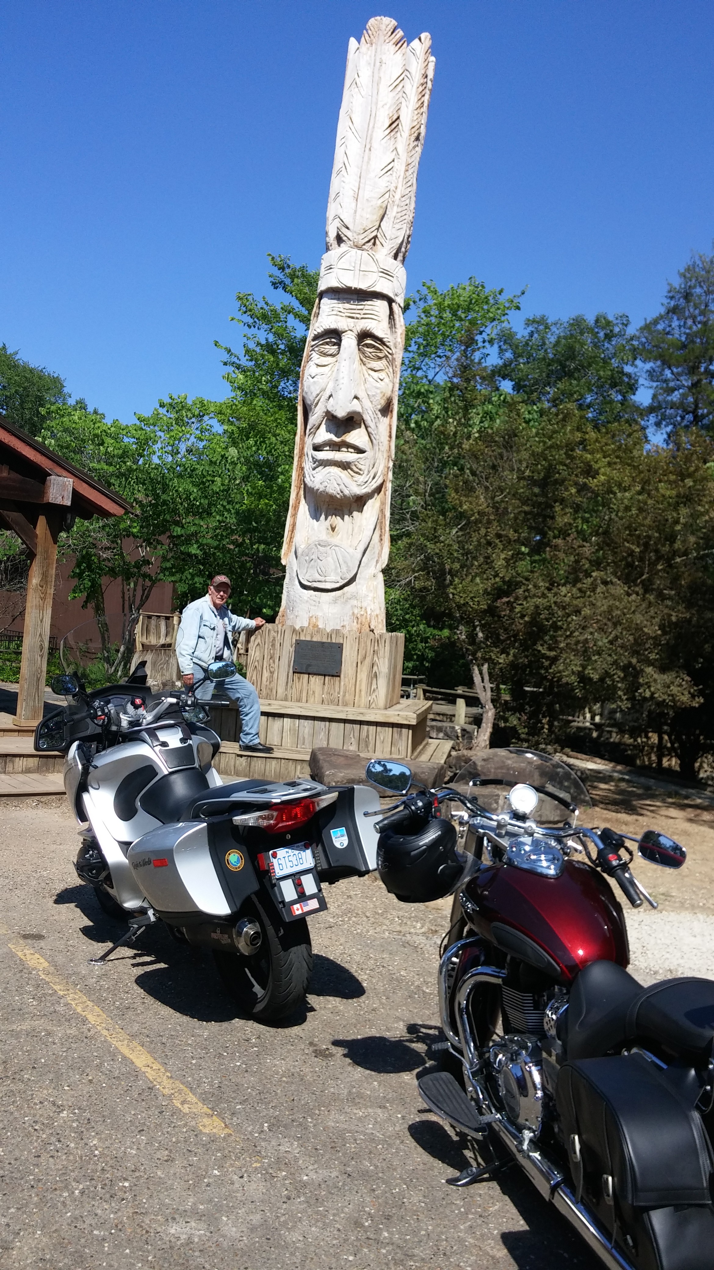
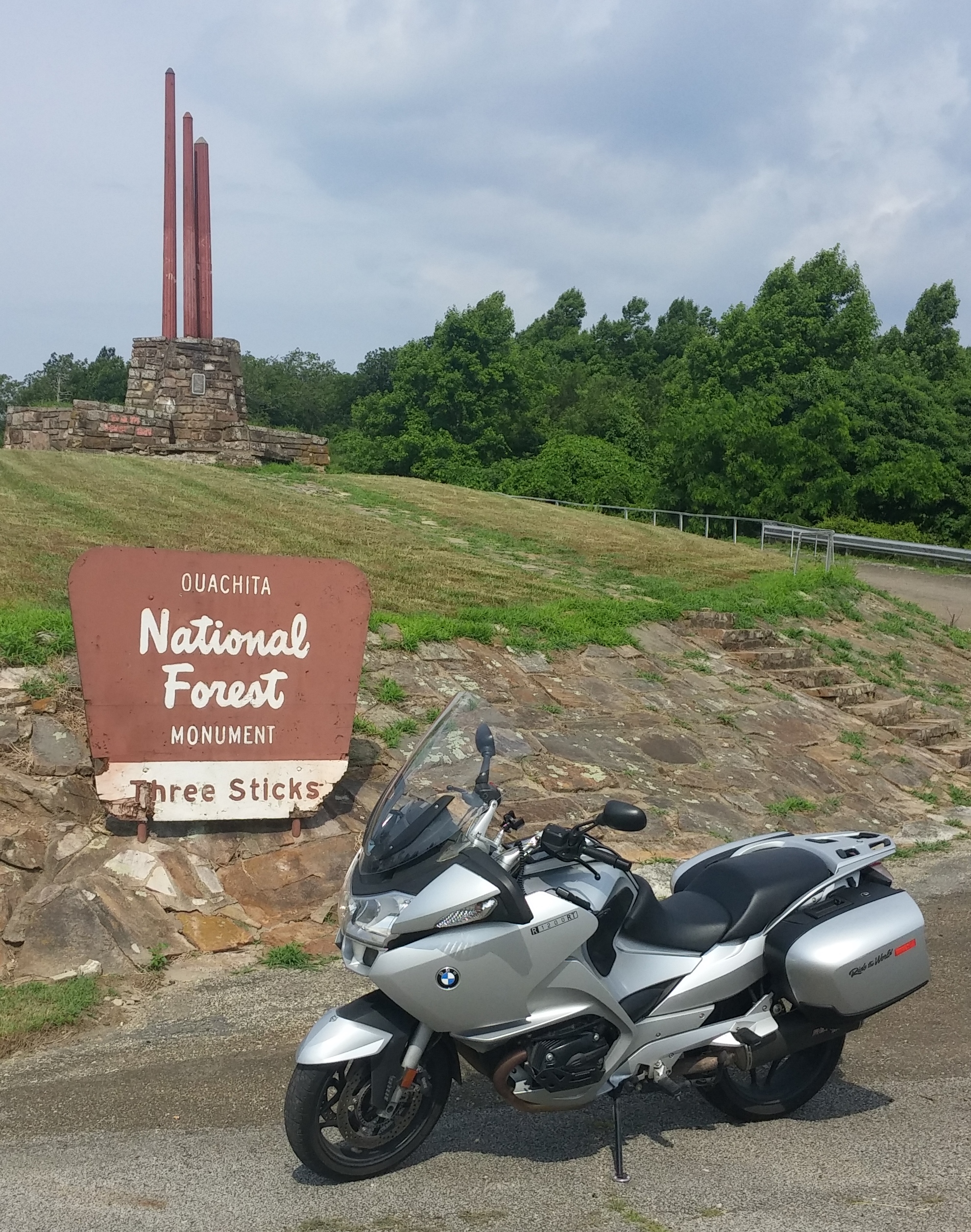
Located at a turnout on Hwy. 259 near Big Cedar, OK, we thought this monument had something to do with the history of local native people–perhaps at meeting place of some sort. It was nothing of the kind.
It was a self-congratulatory monument to state politicians for their efforts in developing “roads, water, forest and recreation.” The three sticks refer to: Land, Wood, and Water.
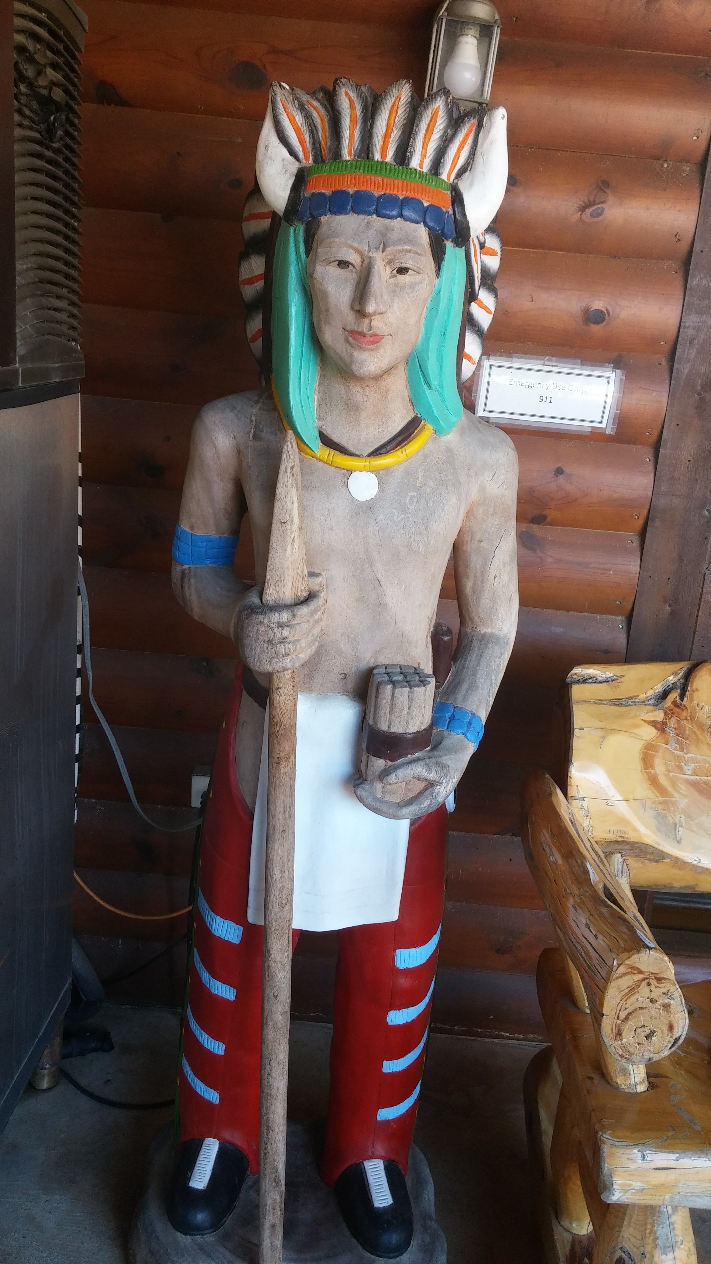
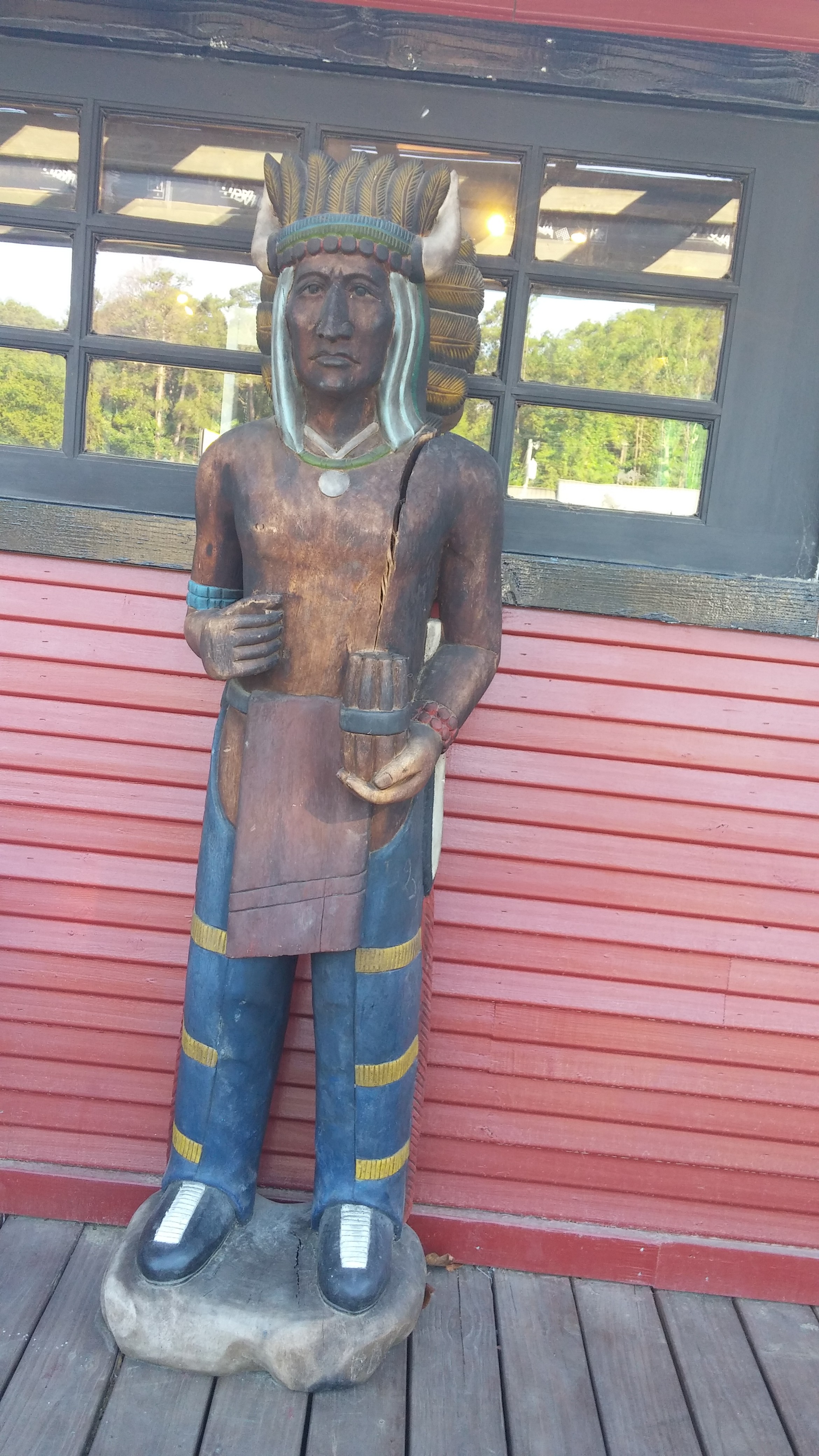
Not very PC: Cigar Store Indian statues are popular in the area. Left: Outside the breakfast room at the Hotchatown Country Lodge. Right: At the entrance to the Grateful Head Restaurant, Hotchatown, OK
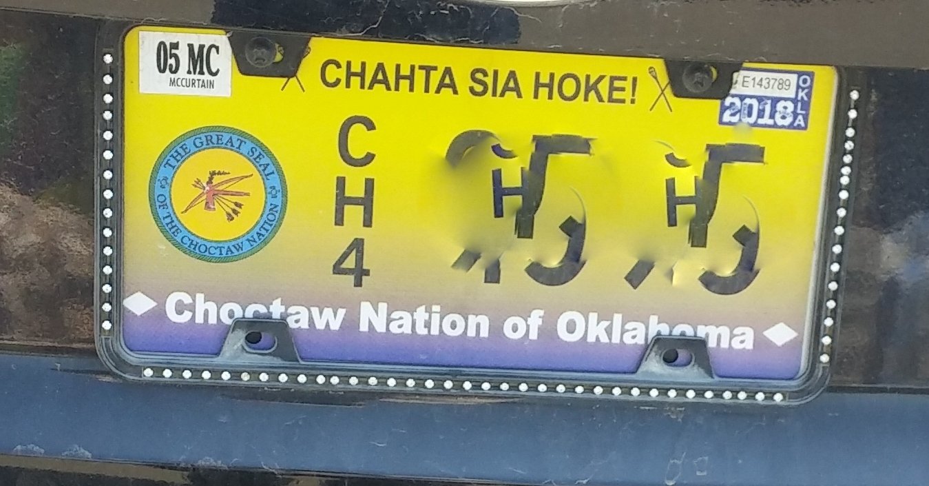
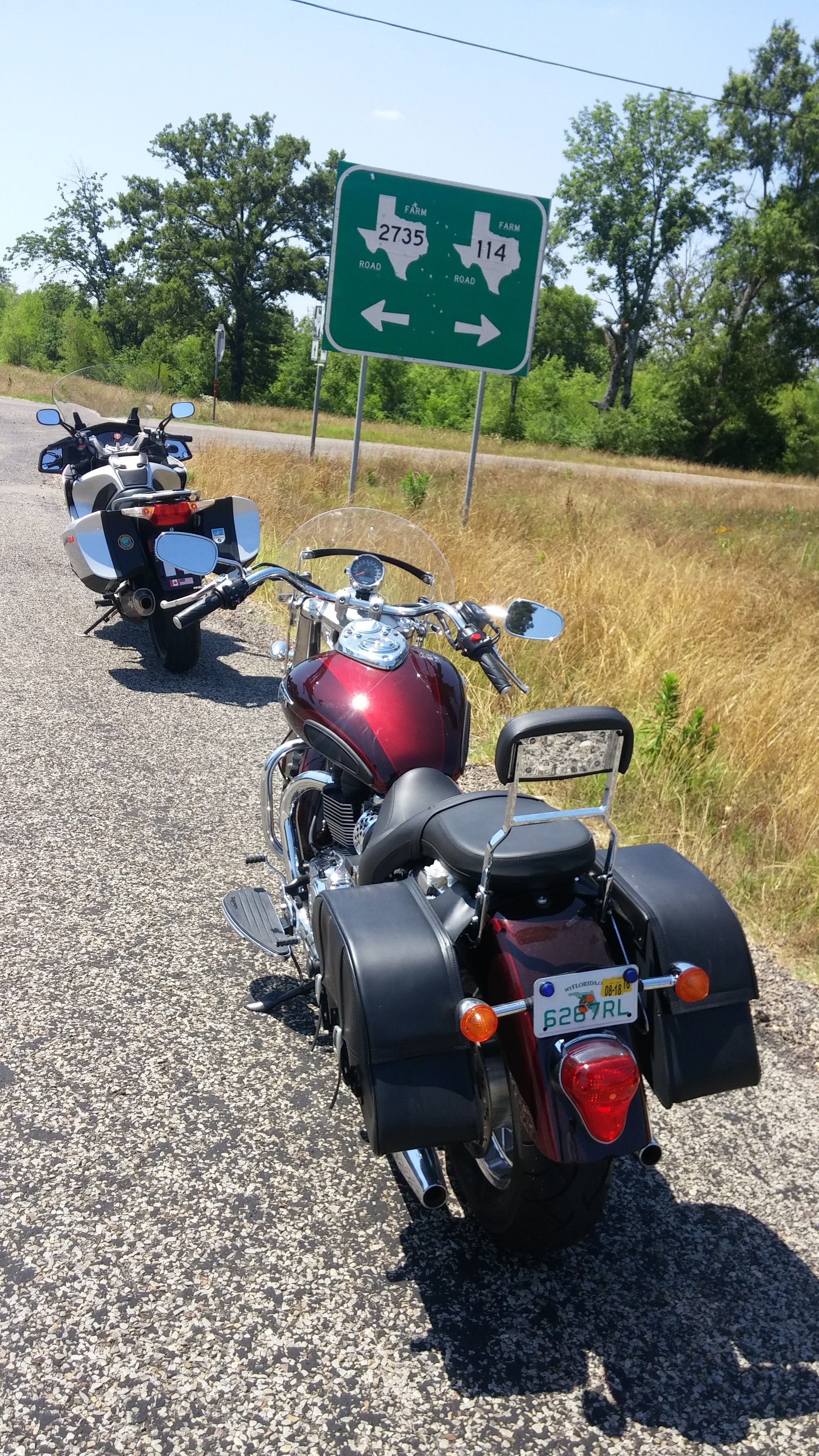
Meanwhile, we were within the boundaries of the Choctaw Nation. (Note: license plate number altered to protect owner’s privacy.)
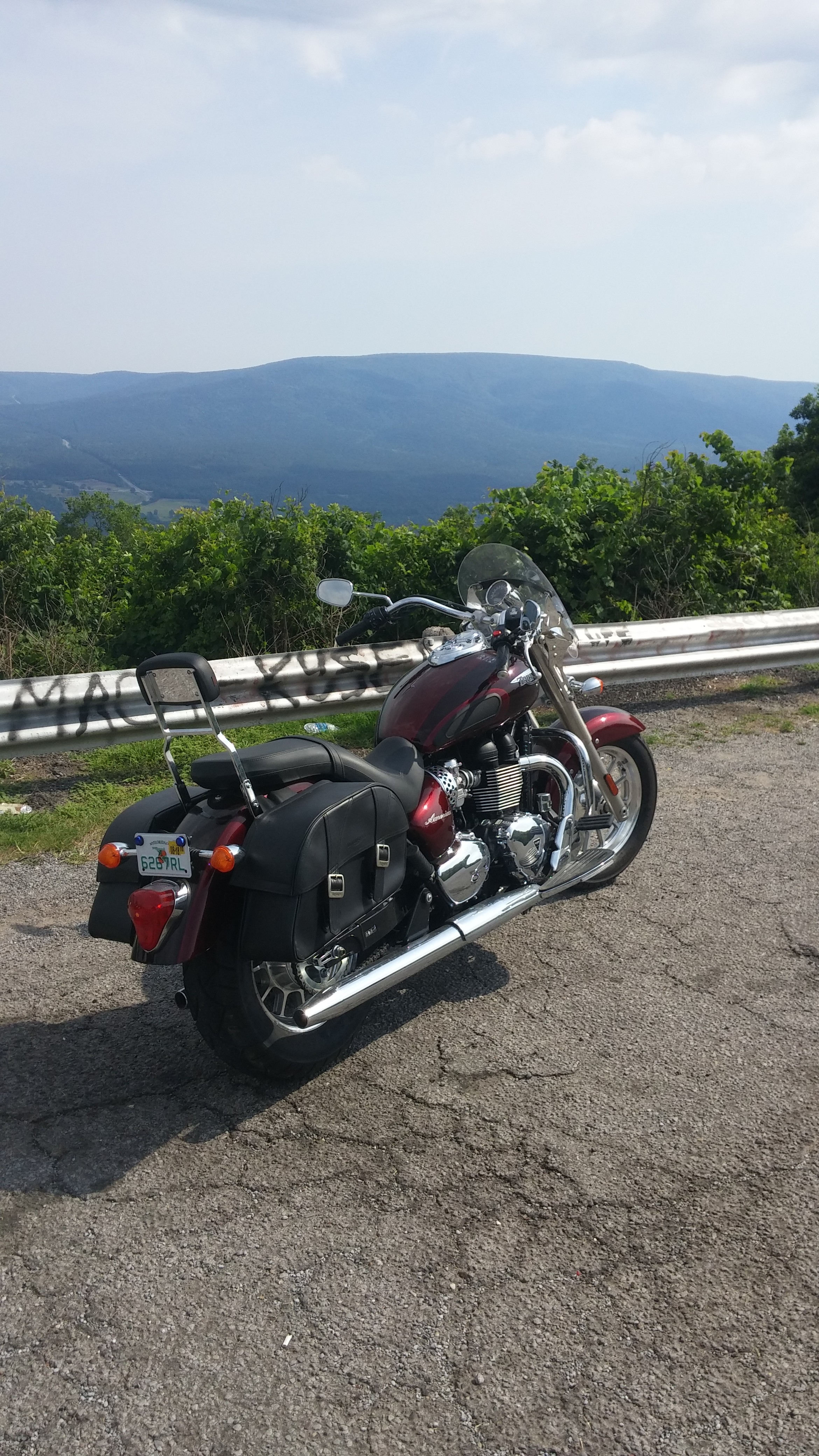
Two more overlooks on the Talimena Byway. Facing north toward the Ouachita National Forest
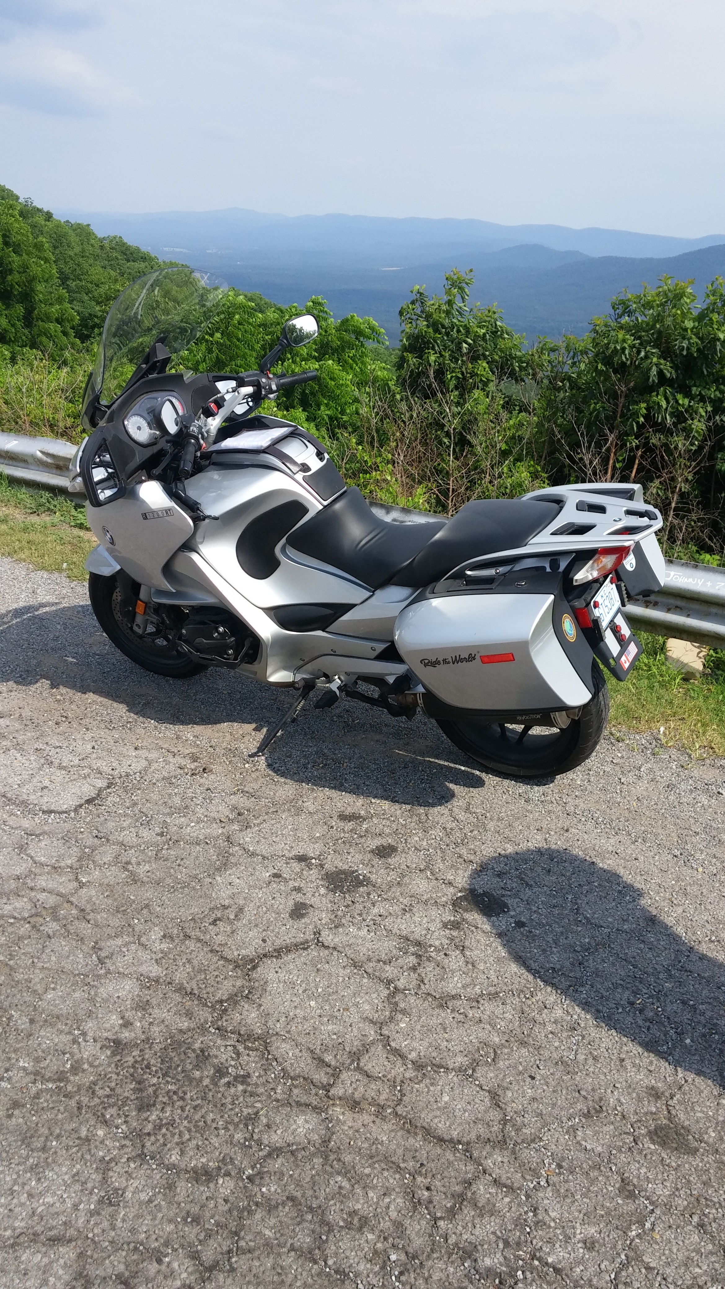
Reunited with Paco once more, we set out on June 4, 2018 in Paco’s truck hauling our two motorcycles in his brand new trailer. We were in pursuit of my quest to ride the lower 48 states. I’ve ridden in 42 states; six are left: Oklahoma, Texas, Nevada, California, Oregon and Washington. This road trip will tackle Oklahoma and Texas. (Summary: total motorcycle mileage=353. Truck mileage=over 2,000; we lost track.)
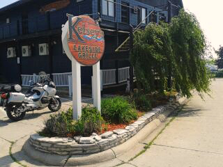
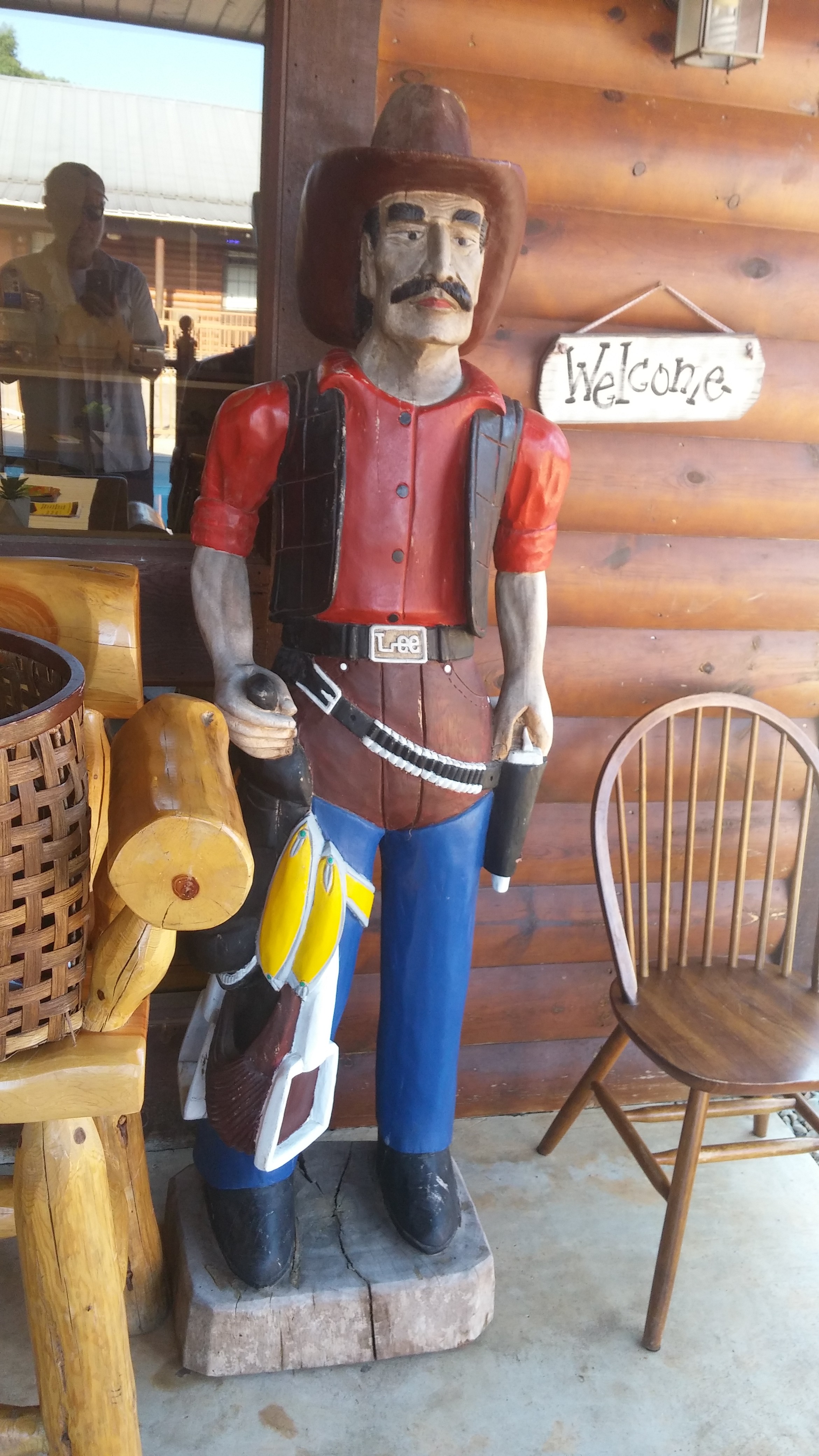
An Oklahoma Cowboy at the Hotchatown County Lodge
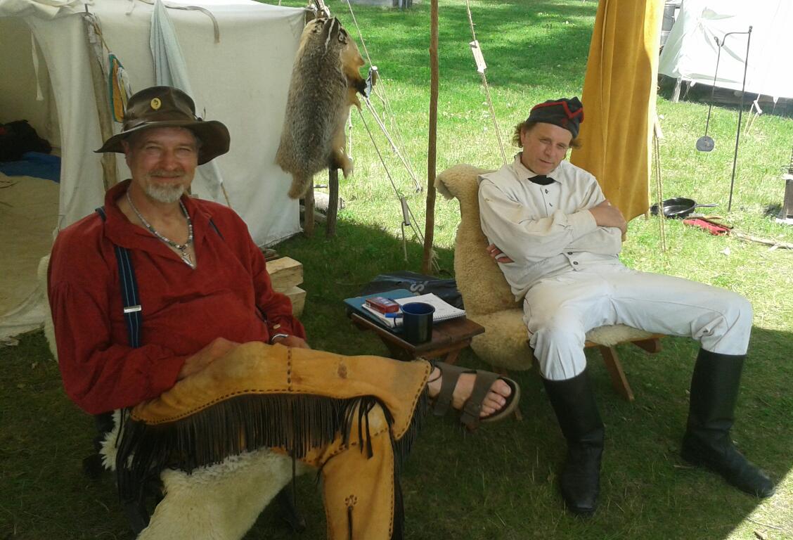
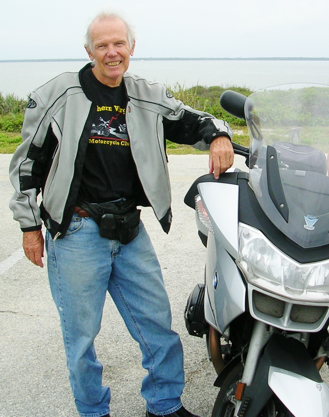
Before I jump into this latest travelogue, I need to say a few things about my moto buddy, Frank “Paco” Bartlett.
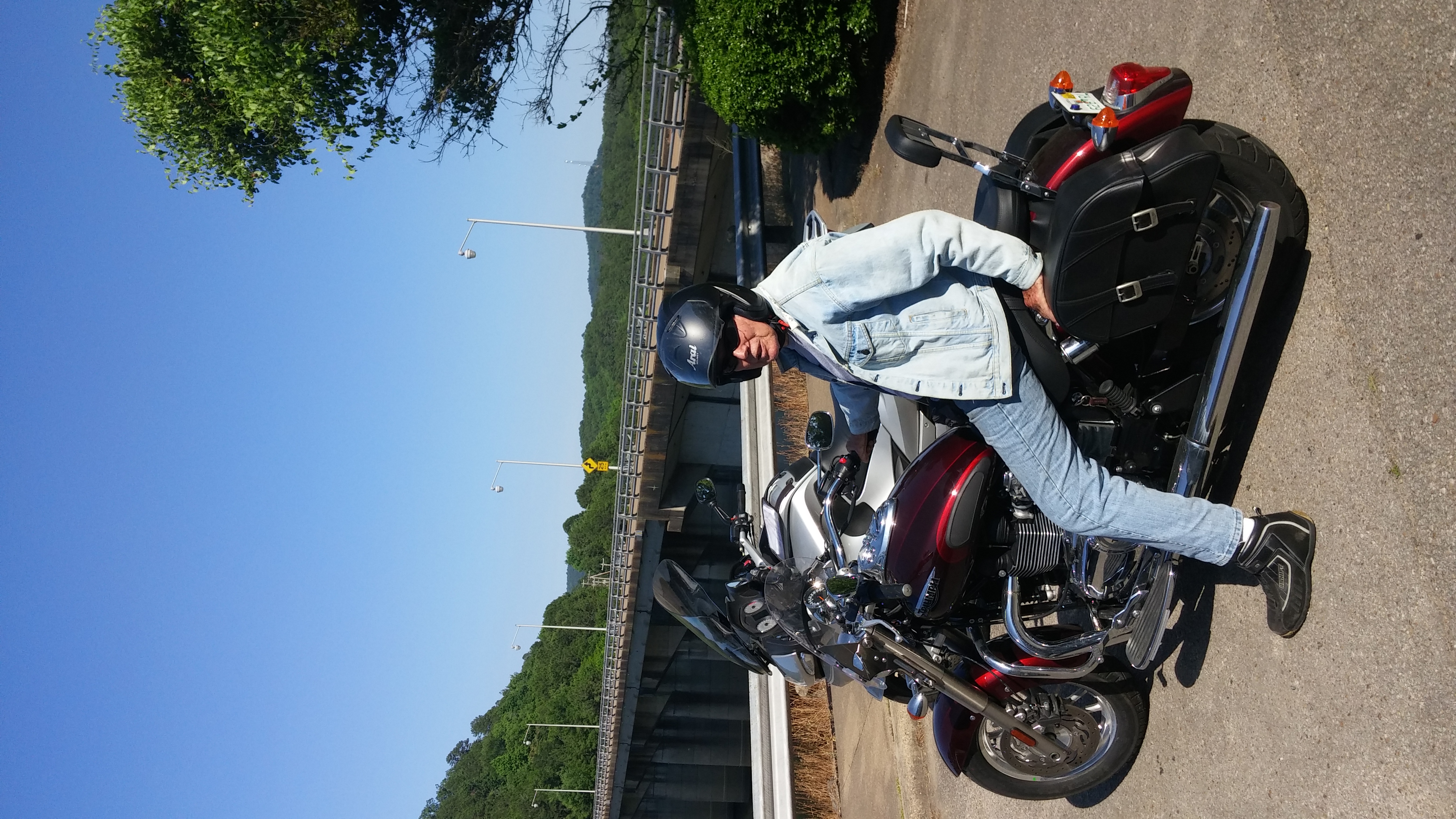
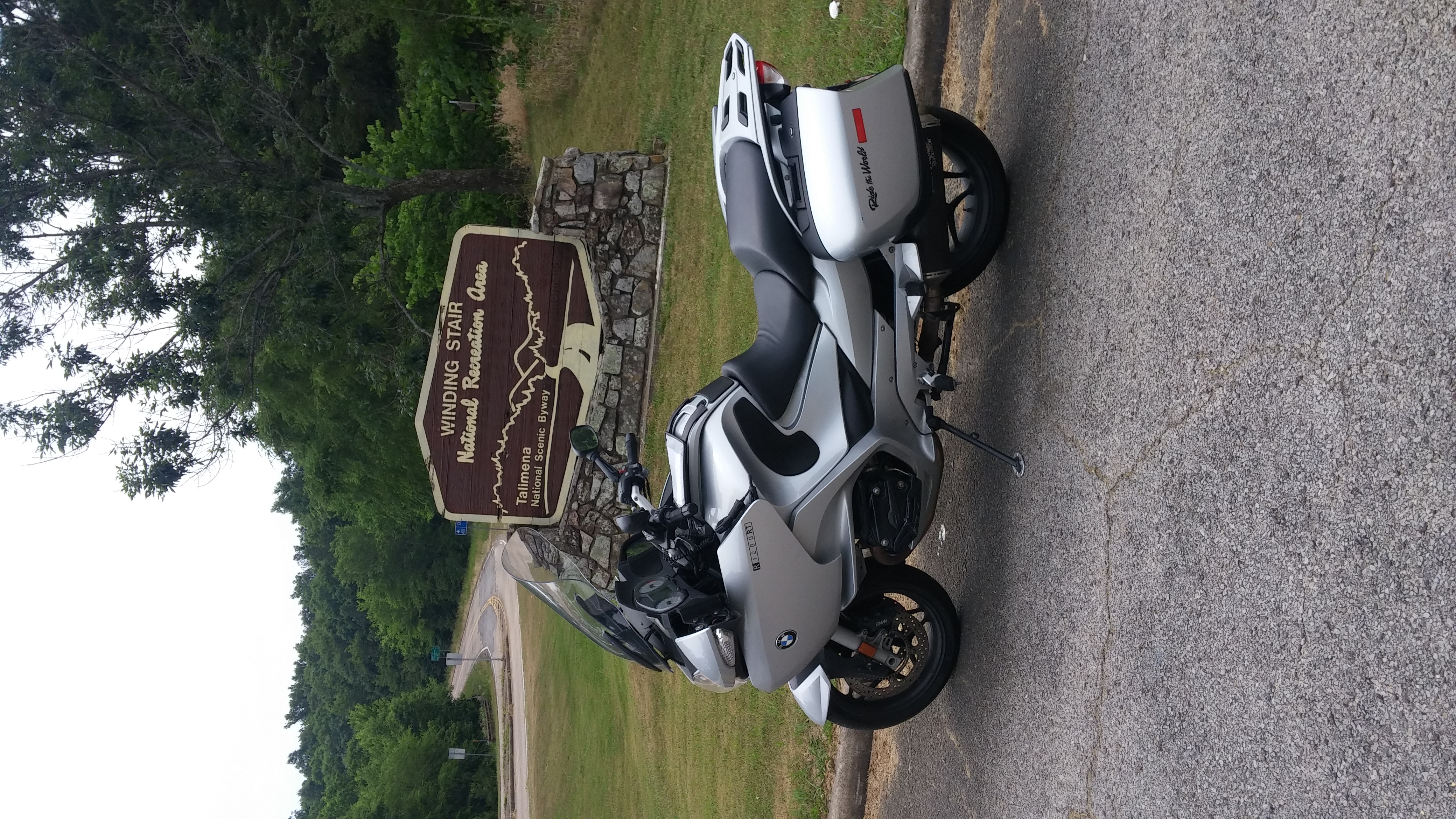
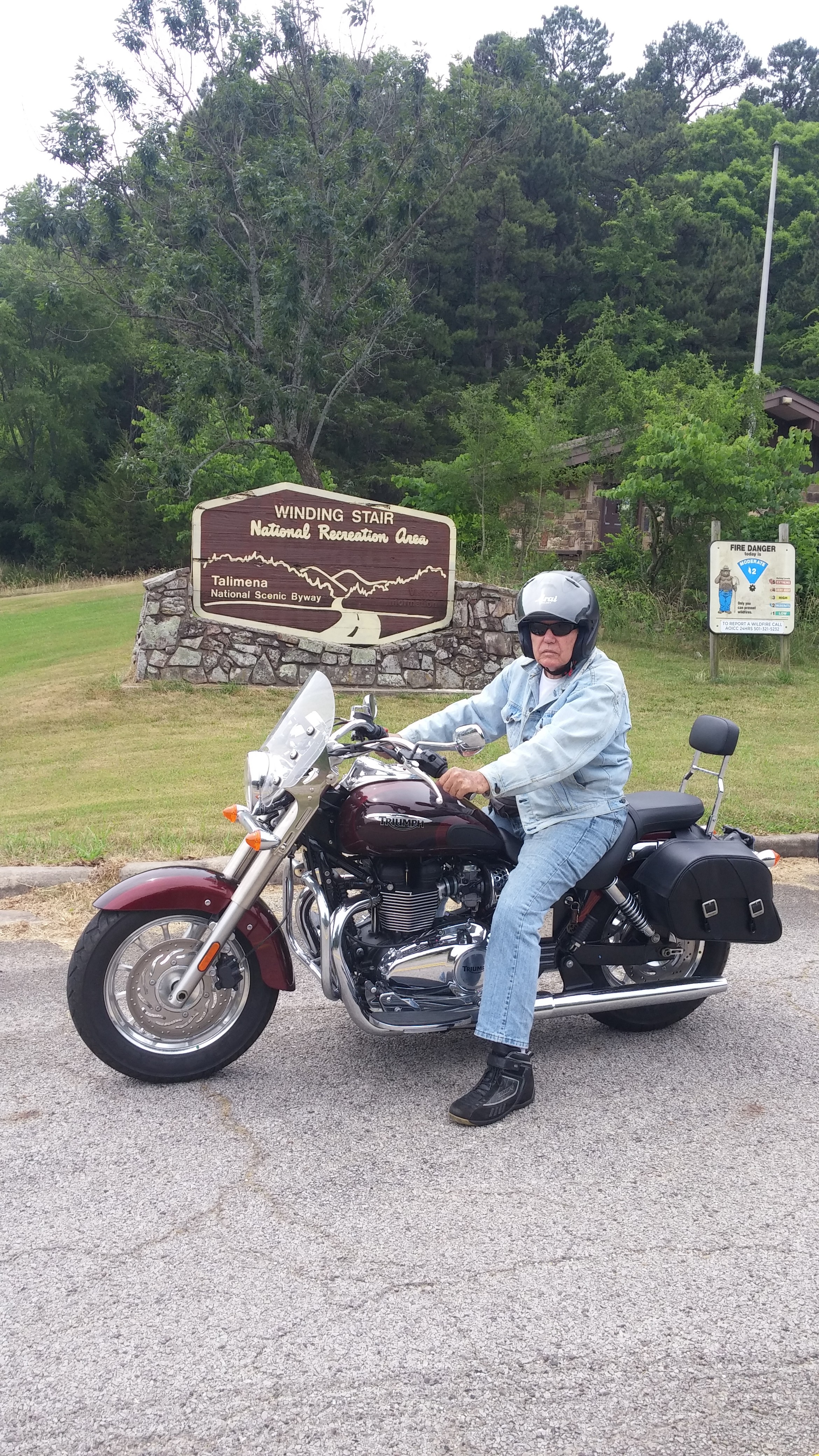
Frank “Paco” Bartlett at the Talimena Byway Entrance
To have a good friend, to paraphrase Cicero, increases your joy and lessens your sorrow. Paco is my amiable, competent traveling companion and I am truly blessed that he is my friend. He is the guy who can expertly back up a 14 ft. trailer without a hiccup. He knows how to tie down motorcycles for transport. He can drive hour upon hour without food, seemingly beyond human endurance, and get us safely to our destination.
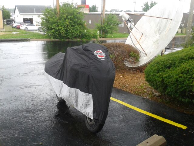
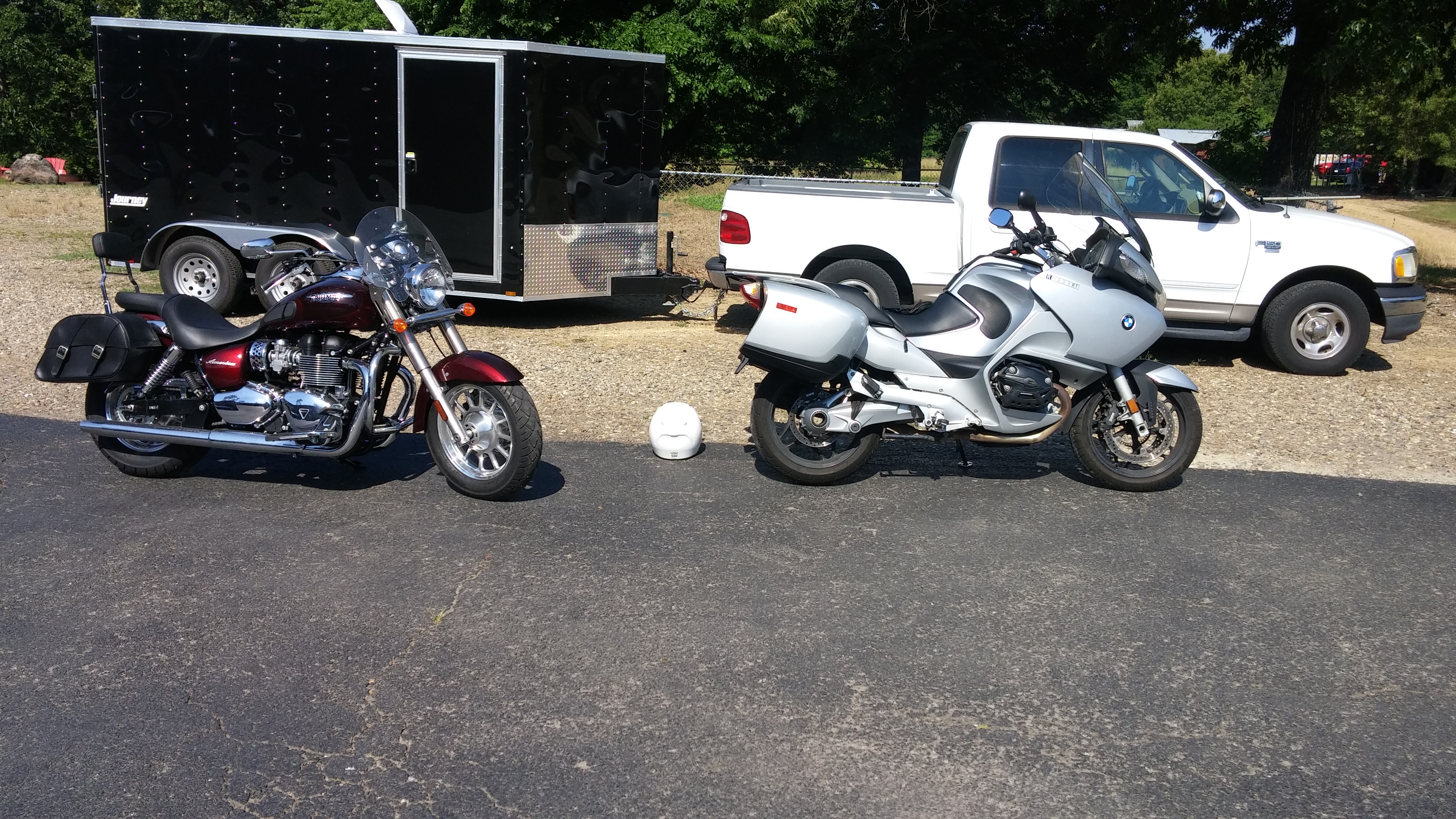
Truck, trailer and bikes at the Hotchatown County Lodge–6/6/18
My admiration and affection for Paco is limitless. Without him, this trip would never have happened. Thank you, Paco.
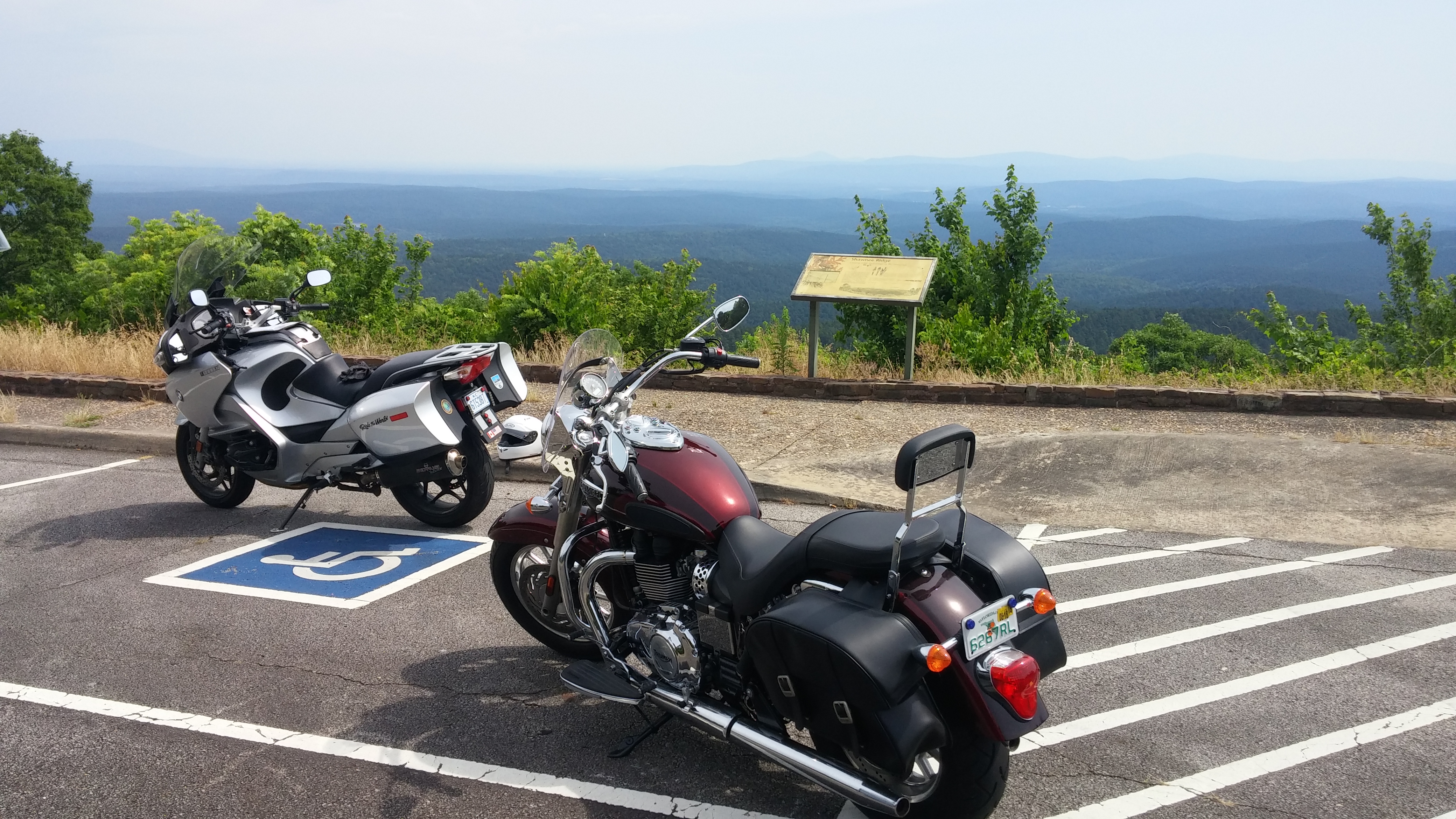
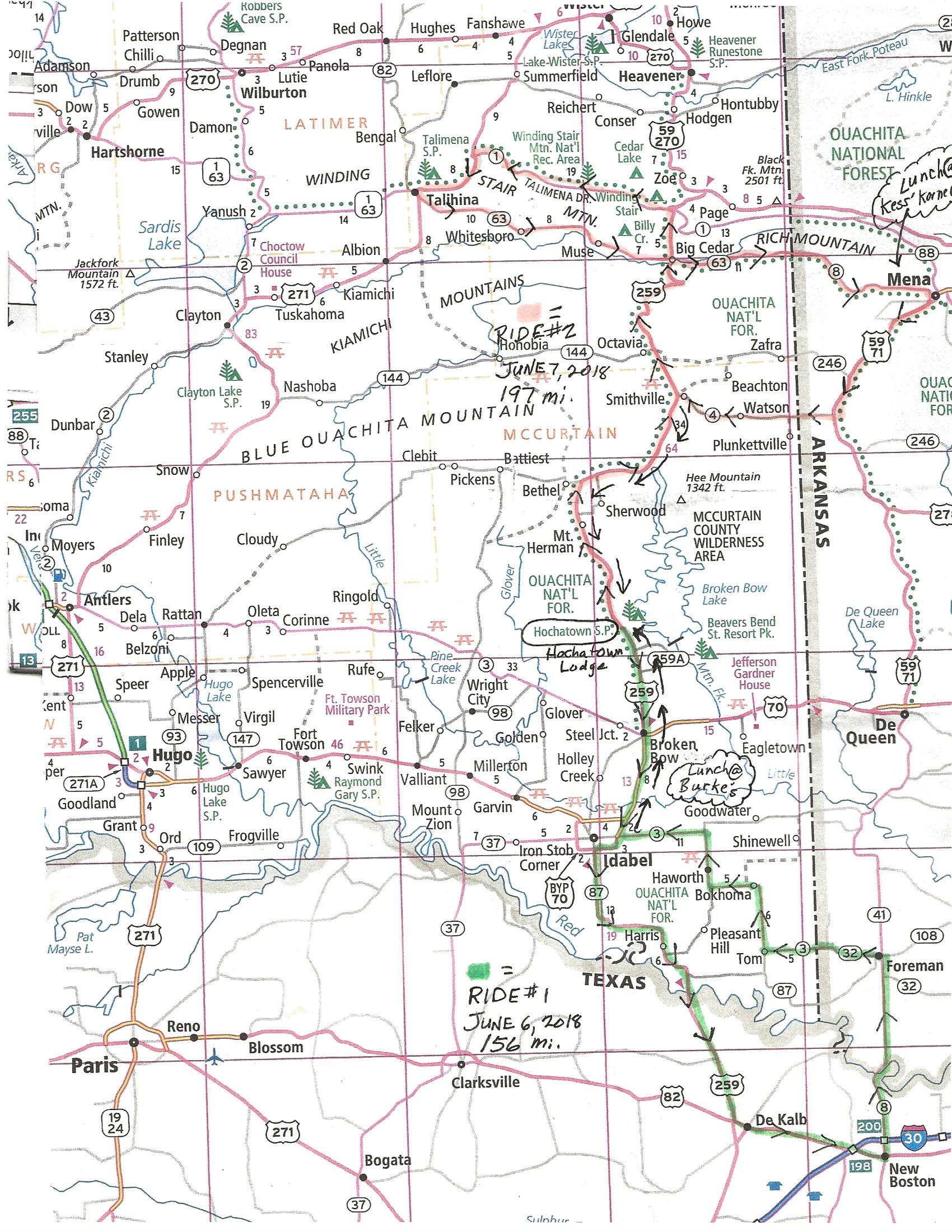
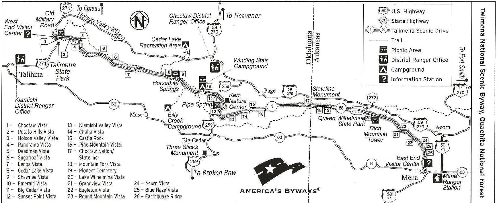
It was Paco’s wise recommendation that we divide the motorcycling in OK and TX into two rides: a south to north and a north to south one, which was the second ride route that took us to the Talimena Byway. (See map. Green route is Ride #1; Orange route is Ride #2).
Map of our two rides: Ride #1 [Green] into Texas and back and Ride #2, [Orange] the Talimena Scenic Byway (Click on map for larger image)
I had envisioned doing one long ride that would include riding the Byway then dipping down into Texas and returning back north. This would have been a disaster. I had badly miscalculated the time and distance involved. Breaking it into two rides was perfect. Big hand to Paco for suggesting this!
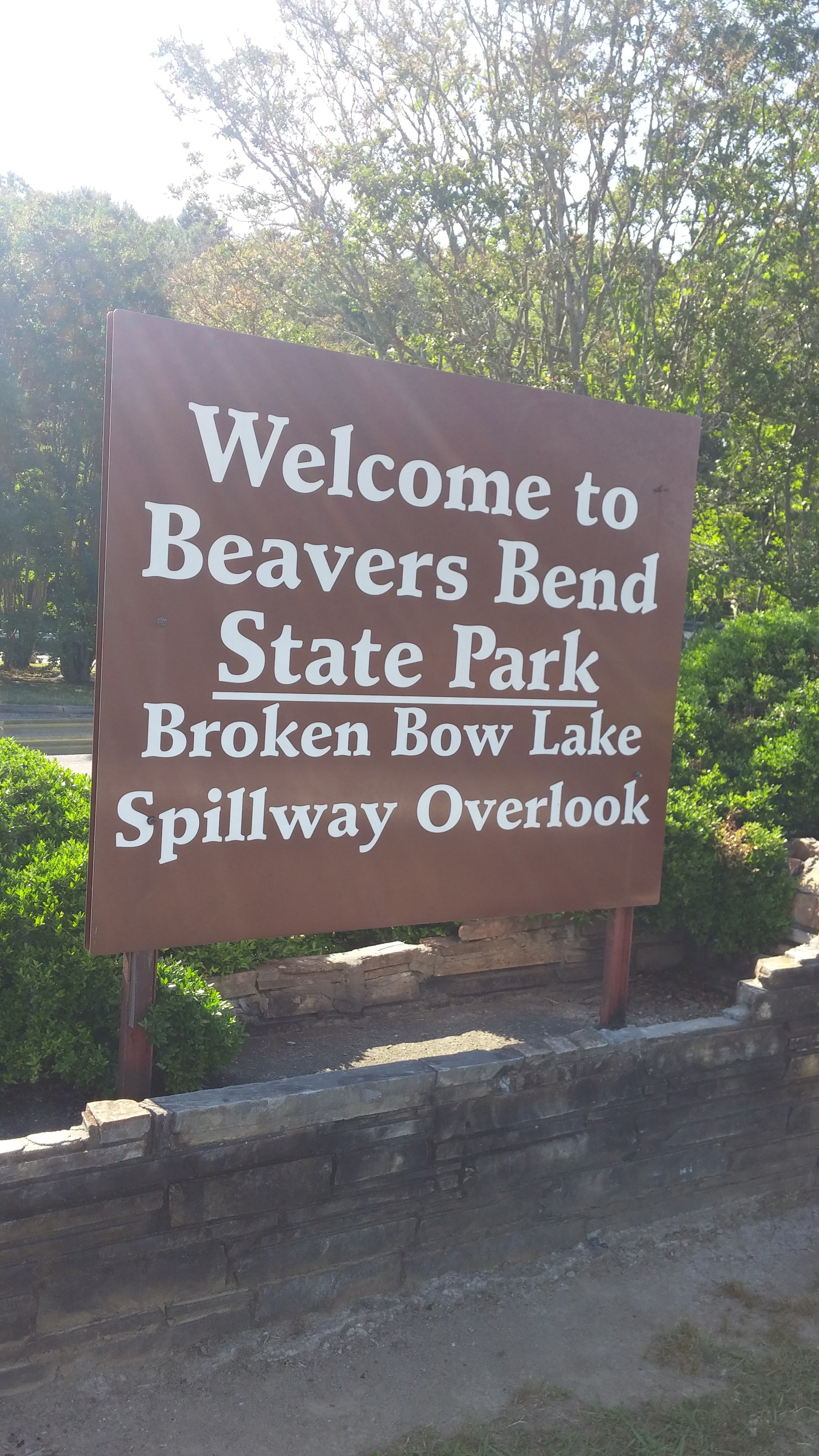
So, we chose a spot near Broken Bow, OK–the Hotchatown County Lodge as our base. (Broken Bow and a good part of McCurtain County are within the boundaries of the Choctow Nation. We saw many native people during our time in the area.)
Front entrance of the lodge
Back of the lodge
On day 1 we rode into Texas, up through Arkansas and back into Oklahoma.
Welcome to the Lone Star State Across the Red River and into Texas
As for Texas, well, there was only the bragging rights of having ridden through a part of the state. Aside from cattle and produce farms there were mostly lonely stretches of highway and a few towns on Ride #1. (See map). We noticed that the rural pastime in both Texas and Oklahoma is shooting up road signs. That and applying graffiti to Jersey barriers set up along dangerous curves in the road. Well, I guess you gotta do something to keep amused out in empty parts of the west.
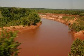
The Red River (image source: internet)
Crossing the Red River was the highlight of the Texas ride. We did that twice (the Red River forms the borders for Texas, Oklahoma and Arkansas). It’s lovely, gently curving river with, as its name implies, red clay banks.
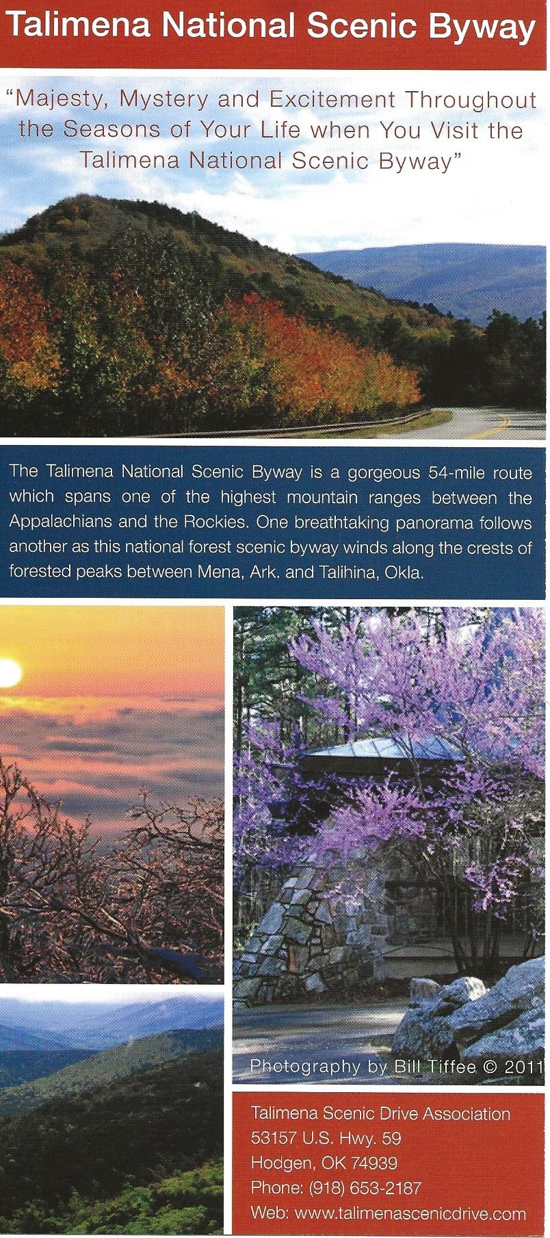
Talimena Scenic Byway Map(Click on map for larger image)
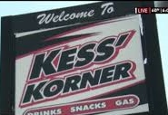
I won’t sugar-coat this trip. It wasn’t as scenic as anticipated. Yes, it had its moments but the real fun was hanging out with Paco and surviving a hellish thunderstorm with the required lightning bolts and swirling winds on our way back from Ride #2. That plus a good time at Kess’ Korner where we stopped for lunch that day. (Scroll down to the very end of this blog entry for details about the Kess’ Korner experience.)
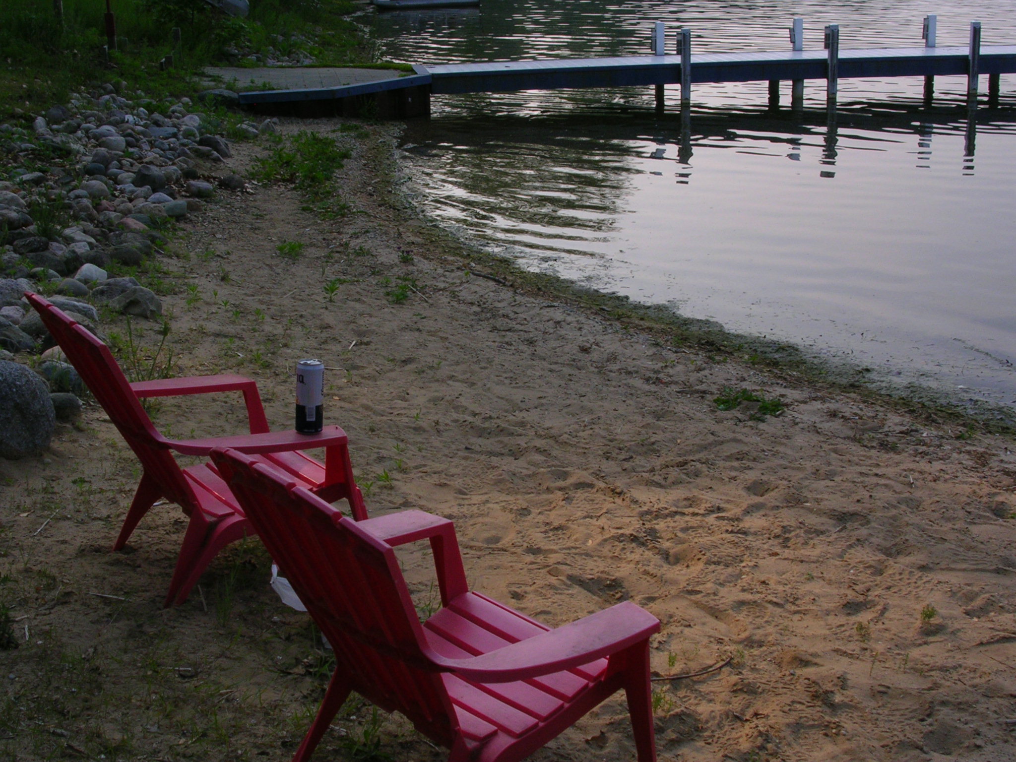
And, to be fair, we also very much liked riding through Beaver’s Bend State Park.
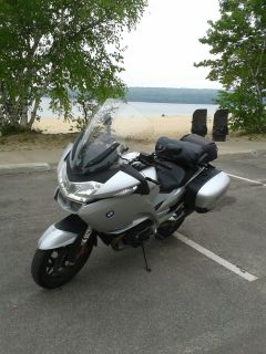
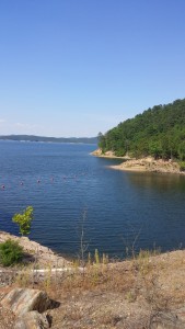
Within the park is the vast and beautiful Broken Bow Lake.
Broken Bow Lake
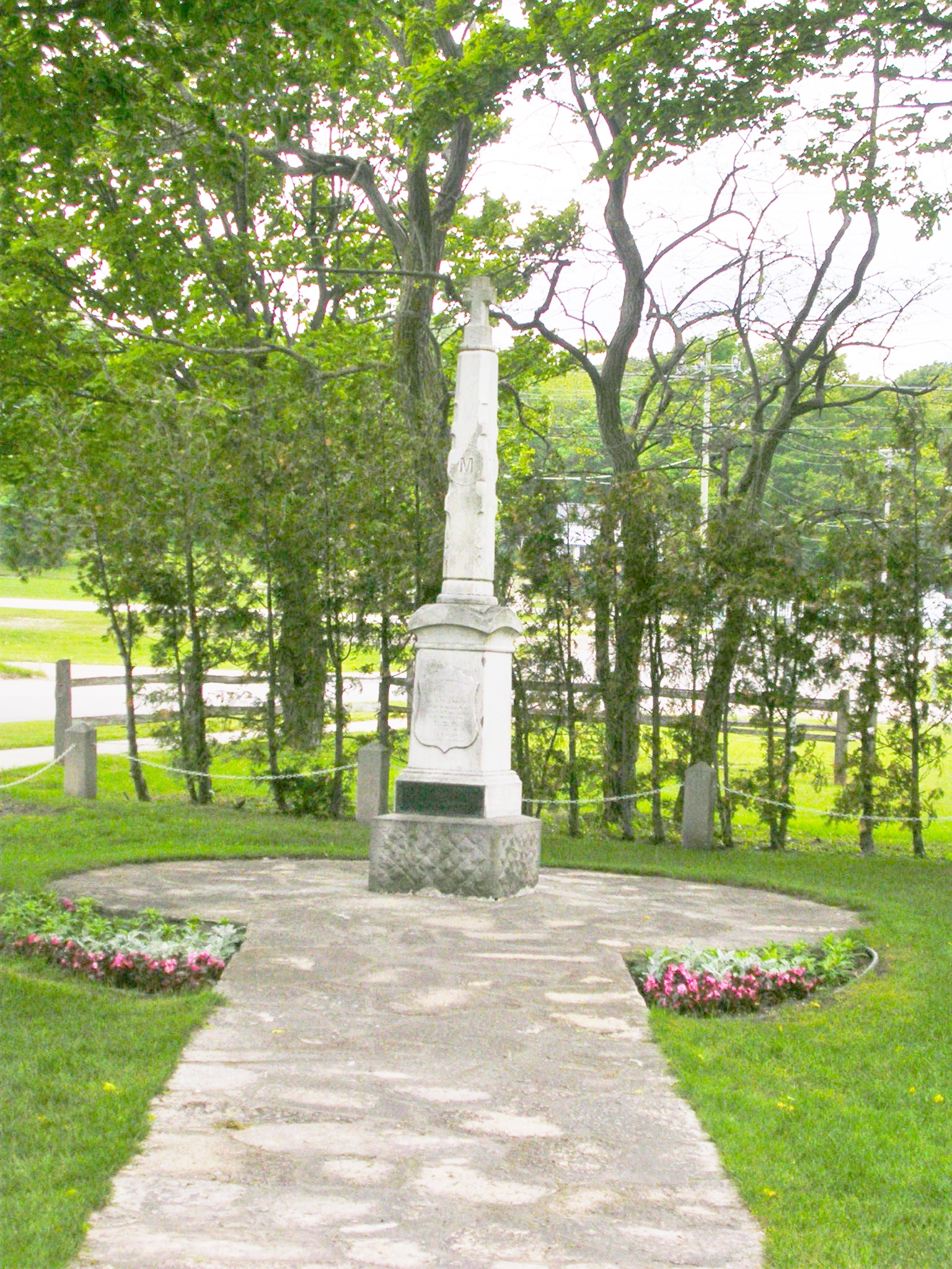
Paco at the Native Peoples Memorial at Beavers Bend State Park
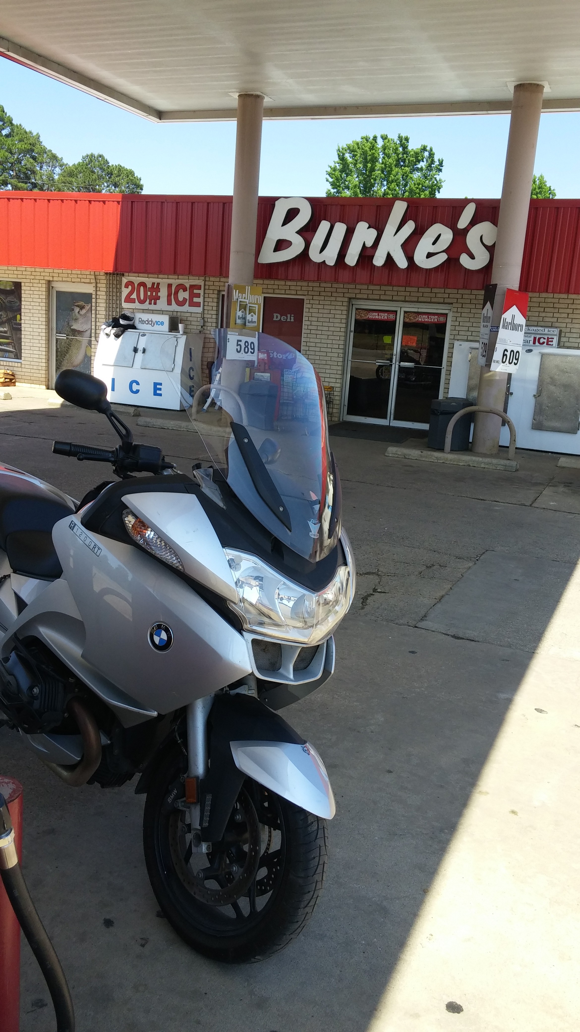
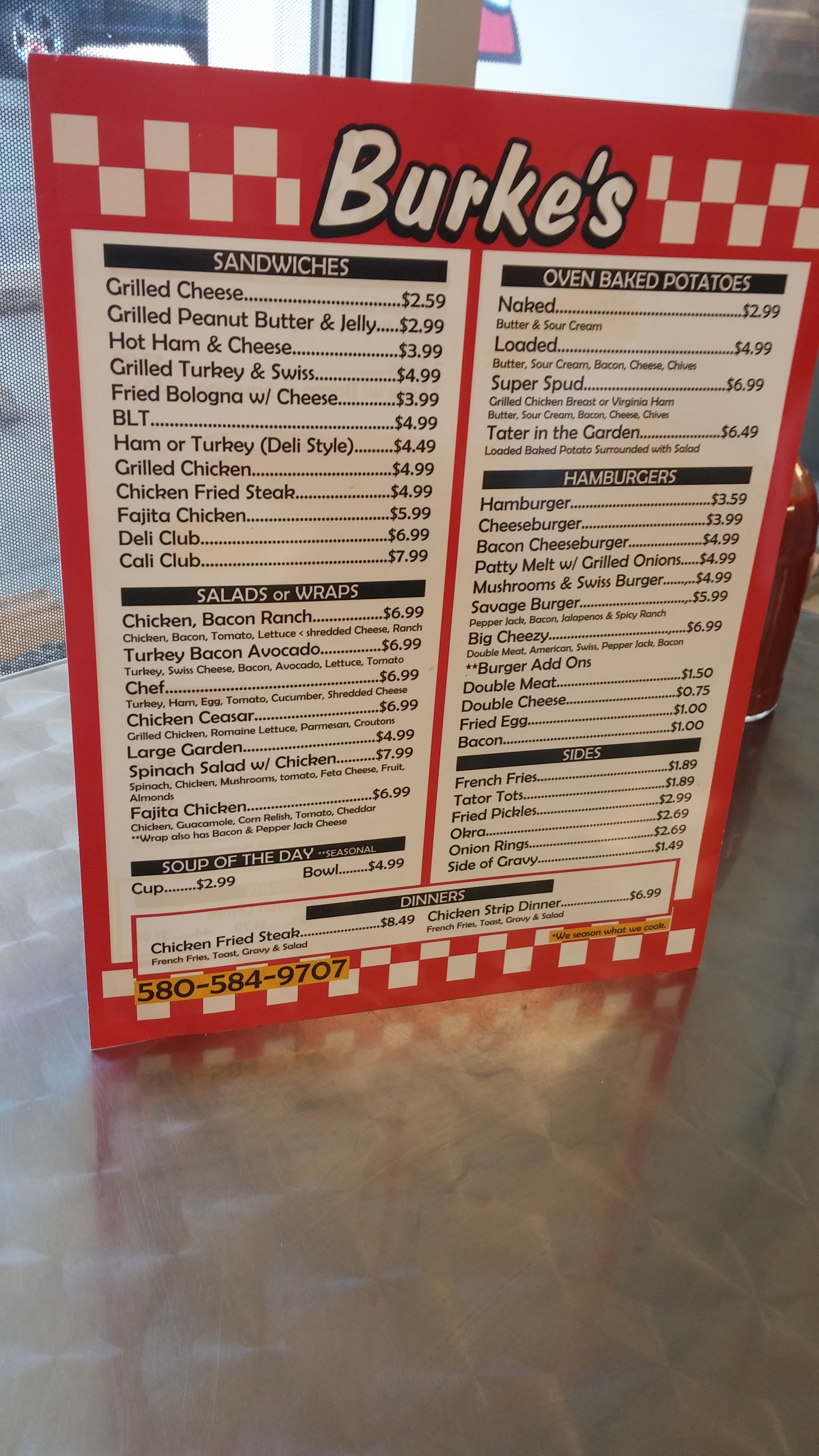
Another plus during the two rides was enjoying two satisfying lunches at local places, Burke’s in Broken Bow and Kess’ Korner in Mena, AR. (See photos below)
Burke’s Menu: Note the grilled PP&J sandwich
Welcome to Kess’ Corner, Mena Arkansas: we never expected to find good food and conversation at a gas station but happily for us, we did….
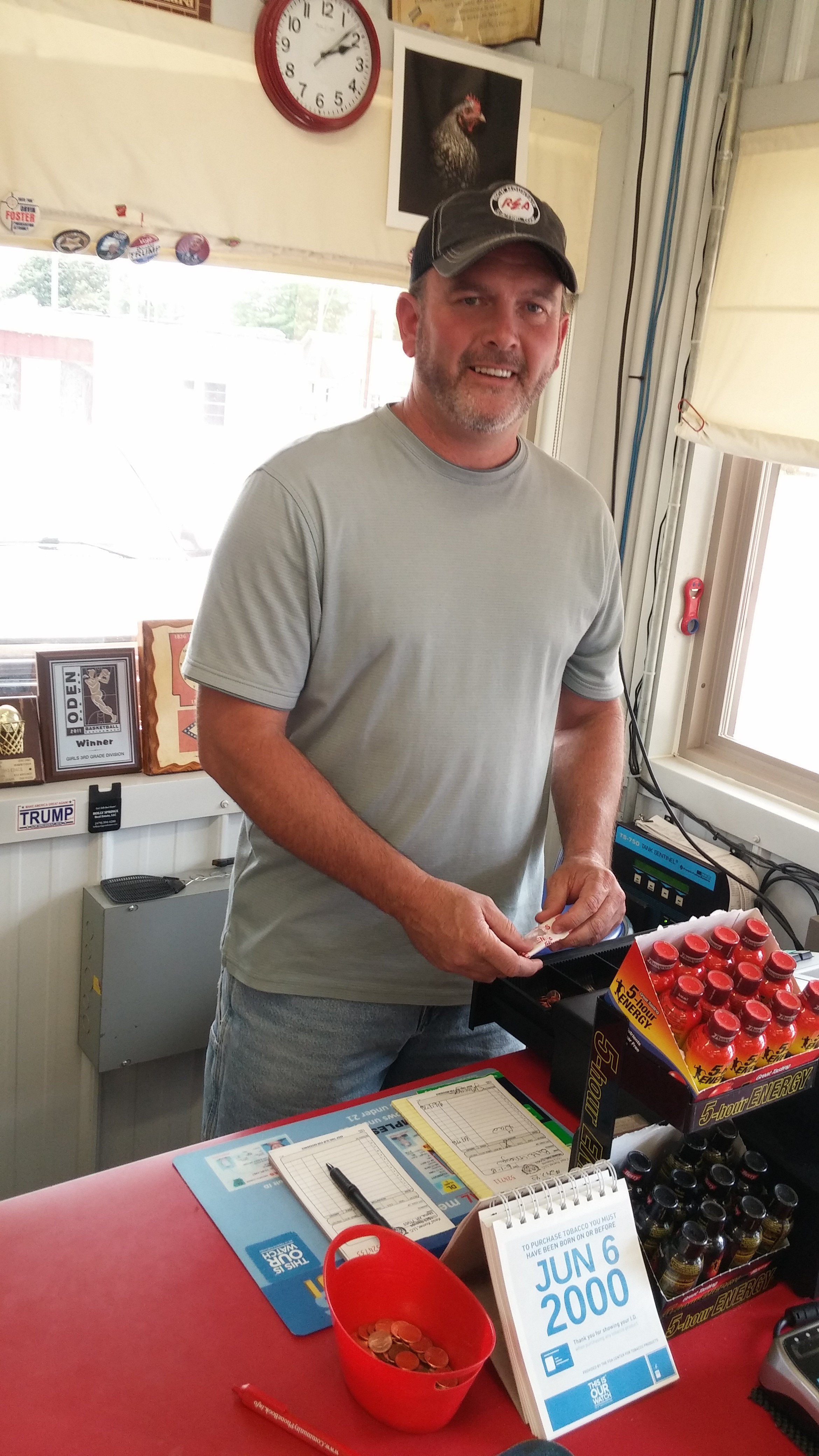
Brian “Kess” Kesterson
We had ridden some 60 hot, punishing miles from Talihina, Oklahoma into Arkansas without seeing a gas station (or anything else) and we badly needed to fill up our tanks and rehydrate our bodies. We were getting desperate and hardly noticed the green heights of Rich Mountain to our left as we plodded along. Arriving at the outskirts of Mena, Kess’ Korner came into sight. Yay! Civilization! We headed for the pumps first.
Kess’ Korner is more than a gas station. It’s convenience/general store, lunch spot, meeting place, and mini-community center. The only thing Kess’ Korner doesn’t have is alcohol. We were in Polk County and it’s a “dry” jurisdiction. Located at the intersection of Routes 8 and 59/71 it’s the only place around unless you ride into Mena.
After taking care of the gas situation, we went inside to pay. There we met the owner, the friendly and genial Brian “Kess” Kesterson. I inquired about possible places for lunch and Kess graciously mentioned a couple of place in Mena, then added, “We serve lunch here.” Sure enough. There was an on-premises kitchen and along one wall were several tables and chairs. I’m pretty certain I heard the chairs tell us to sit down and have lunch. “Why go elsewhere when you’re tired, hungry, parched and food and drink are at hand,” they said. But maybe it was the dehydration talking.
Paco’s chicken wrap and my BLT were thoroughly satisfying and we gave the soda machine a work out.
Between customers, Kess sat down with us curious to know where we had come from and what we were doing in this flat, dusty (and “dry”) corner of the U.S. We got a good laugh when Kess explained that Polk County is the wettest dry county in the State. Thirsty locals in need of adult beverages need only travel about 15 south, then a short distance west and presto, they’re in Oklahoma. Indeed, we took the same route to get back to Hotchatown and right across the border is a neon bedazzled jewel of a liquor store beckoning all those sad Arkansans to find their “beach.”
After paying for our food and drinks, we returned to our bikes and mounted up. We were about to leave the parking lot when Kess ran out to warn us of the impending thunderstorm (the one that caught us about a half hour from our lodge). He had identified the storm on the radar on his cell phone. Terrific guy, that Kess! Thanks for everything.
Backtracking in the Story–Crossing the Mississippi in Minnesota: Before I continue my narrative about this part of the journey, I will backtrack just a bit to recall a moment in Minnesota that caught my attention. My earlier blog post about traveling in Minnesota mentioned a rest stop in Floodwood, MN (alleged Catfish Capital of the U.S.). Just beyond Floodwood, off Rte. 2, is the westward turn off for Rte. 200 which I followed to reach Remer and all its charms. But about 10 miles along Rte. 200 west, I crossed the Mississippi River. The Mississippi River?
The small bridge and marker came and went before it sunk in—I had crossed the Mississippi River. This small stream was The Mississippi? In Minnesota? Yup. Later, after consulting a more detailed map, I realized that Lake Itasca, the headwaters of the Mississippi, was about 40 northwest of where I had planned to stay, but couldn’t get accommodations, in Walker, MN.
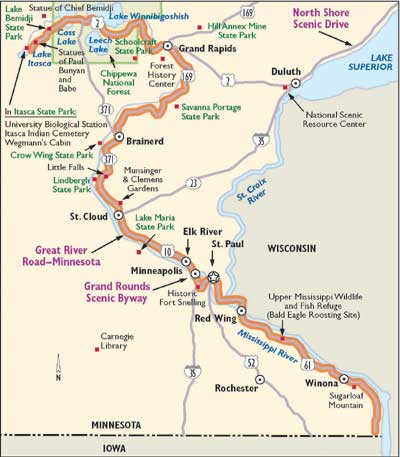
The map below shows the route of the Great River Road in Minnesota:
Great River Road Map (internet image)
This smallish lake (about 2 miles in surface area) is birthplace of the Mighty Mississippi River. Wow. It totally got past me at the time. Duh. What a great photo op missed. I wouldn’t cross the Mississippi again until I reached St. Louis.
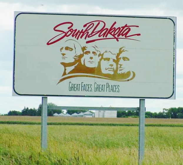
The Staurolite Inn, Brookings, SD (internet image)
But now it was the long grueling interstate trek down I-29 through North Dakota and South Dakota where I spent the night in Brookings, the fourth largest city in South Dakota, with a population of just 23,000. Then I-29 would take me into Iowa and eventually I would cross the Missouri to reach my destination to the west on Sunday—Bellevue, Nebraska to visit my Aunt Anne. I saw nothing of Brookings, home to South Dakota State University, except the exit ramp to get to the next right turn for the Staurolite Inn. The Staurolite is a strange, stony fortress-like accommodation with a restaurant, lounge, and conference center. The rooms were arranged on two levels in an arc surrounding a large indoor pool area.
The inn probably was hip when it opened in 1973 but the dark, cavernous interior hallways were lifeless and a bit scary. There was a noisy wedding reception in progress on the main floor and after the reception ended the drunken guests poured into the “Fireside Lounge” where nearby I huddled in my booth in the tacky restaurant munching on what was purported to be a Caesar salad all the while trying to tune out the hyperactive revelers.
I was eager to leave early the next morning as I stepped over empty beer cans, plastic drink cups and cigarette butts (seems almost everyone in South Dakota smokes) discarded near the front entrance by the young party-goers the night before. But the truly happy part of this experience was that the room cost a mere $44.00, had Wi-Fi, and was comfortable enough for one night. As those famous British philosophers, the Rolling Stones, wisely counseled: “You don’t always get what you want, but sometimes you get what you need.”
I can report that the trip down I-29 through the eastern slice of North and South Dakota taxes the soul. It’s mostly flat with a farm here and there. One small random sighting broke the dull spell: somewhere along the way I passed a large sign plunked in a field near the interstate avowing: “Dakotans reject animal activists!” Next to that sign was another: “Eat Beef!” Huh? OK, if that’s how you feel.
The landscape is not so much featureless as it is plain and repetitive. It was the first time so far that I longed to have my iPod plugged in to provide distraction and entertainment. On the plus side, the speed limit was 80 mph. You can chew up pavement quickly at that speed—true, except there was a brutal headwind pushing me backward. Undeterred, I kept the Silver Streak at 80 and just let the wind beat the hell out me. I was going south as fast as I could; if I ended up a tattered rag at the end, so be it.
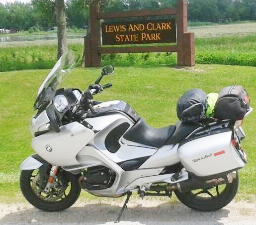
On to Iowa, the Sgt. Floyd Monument, Lewis and Clark State Park and Bellevue, Nebraska:
The big surprise for me was western Iowa. Like eastern Nebraska it’s not at all like the flat farmlands associated with these states. The Missouri River Valley is hilly, forested here and there, and almost lush.
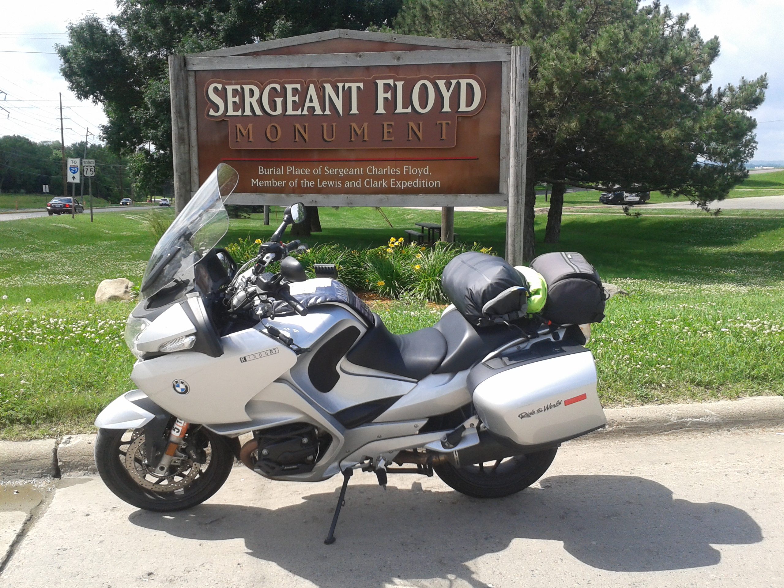
Entrance Sign to the Sgt. Floyd Monument, Sioux City, IA
Sgt. Floyd Monument, Sioux City, IA
At Sioux City, I relentlessly sought out the Sgt. Charles Floyd monument. The directional signs were needlessly confusing but I was determined to find this landmark, having seen it from the interstate last year during the homeward bound portion of the “Westward Ho” trip with Frank “Paco” Bartlett. I eventually located the monument and was richly rewarded for my trouble.
I will be the first to admit that as history nut, I am fascinated by the Lewis and Clark Corps of Discovery expedition. After reading Stephen Ambrose’s popular history of the expedition I was hooked.
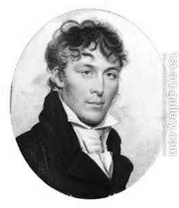
Sgt. Floyd, a Kentuckian and one of the first to volunteer with the Corps, was the only member of the Corps of Discovery to die; presumably from appendicitis. It was remarkable that a journey that took two years and four months up the Missouri River from St. Louis into the wilderness of the plains, the Rockies, to the west coast and back with just the one fatality among the 33 members. And this loss was from a condition readily treated today but at the time even the best doctors couldn’t have helped poor Sgt. Floyd. He was only 22 years-old when he died on August 20, 1804. He was buried on a high bluff above the Missouri River near present day Sioux City.
Sgt. Charles Floyd (internet image)
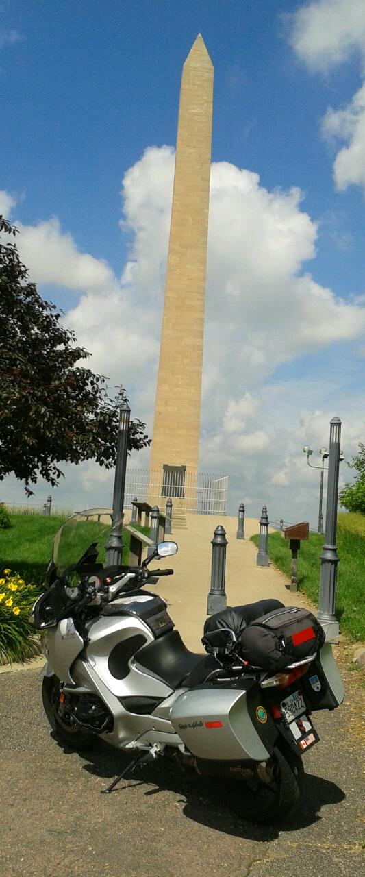
An impressive 100 ft. high white sandstone obelisk constructed in 1901 rises above the bluff and marks his gravesite. It’s a quiet, meditative location with a majestic view of the Missouri River. The river is now in a different location relative to where the bluff was in 1804. In fact, Sgt. Floyd had to be reinterred to the current spot because, as the river shifted it eroded the contours of the bluff and pulled Sgt. Floyd’s remains down to the river bank.
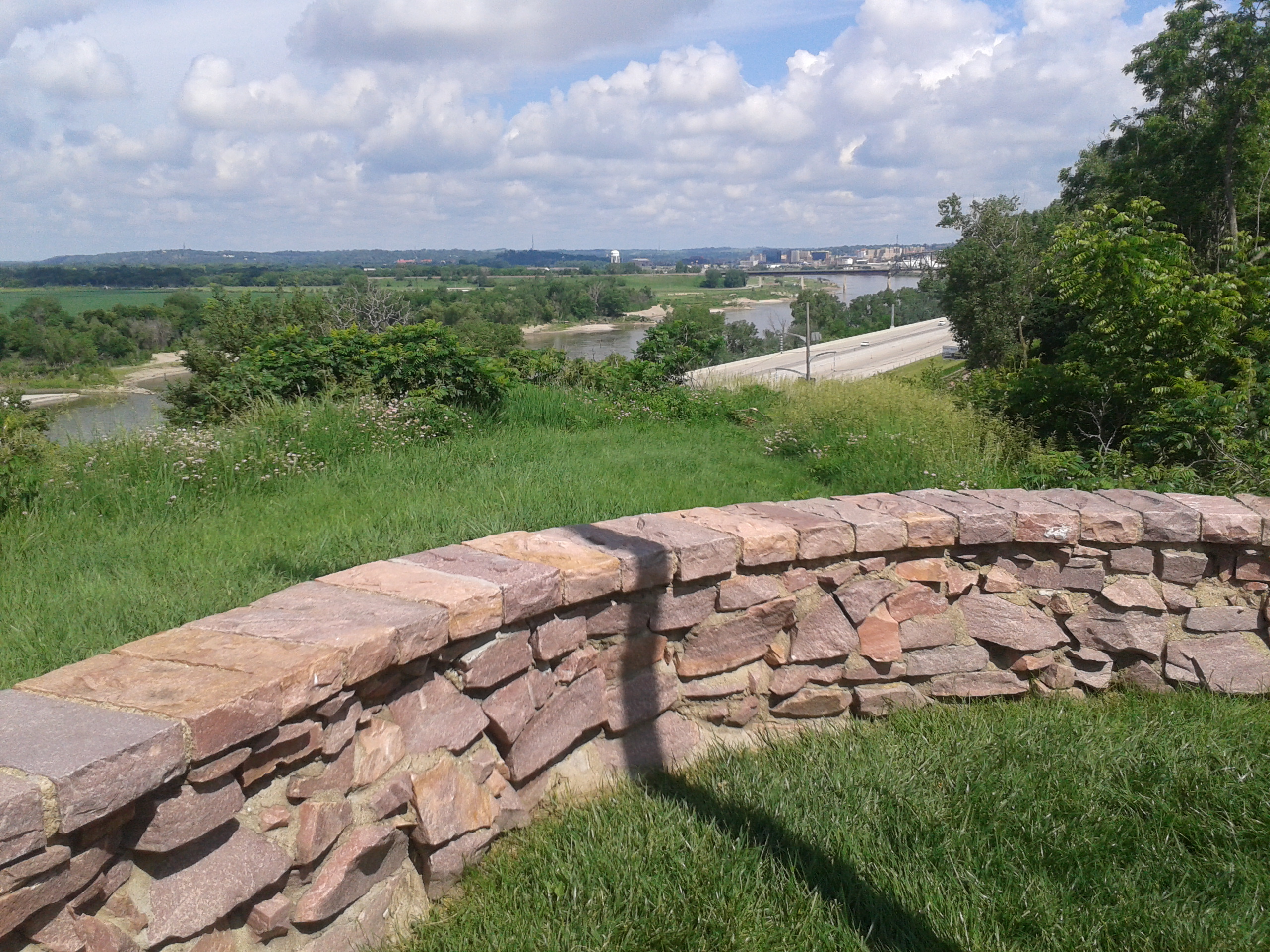
View of the Missouri River from Sergeant Bluffs
I returned to I-29 south and in less than 30 miles, spied a sign for Lewis and Clark State Park at the exit for Onawa, Iowa. I hesitated. Should I check this out or keep riding? I knew rain and thundershowers were predicted for the Omaha area. Hmmm. Well, another Lewis and Clark opportunity. So what if I got a caught in a terrifying storm. I surely wouldn’t melt and I might learn one more fact about the Corps of Discovery.
Entrance sign, Lewis and Clark State Park, Onawa, IA
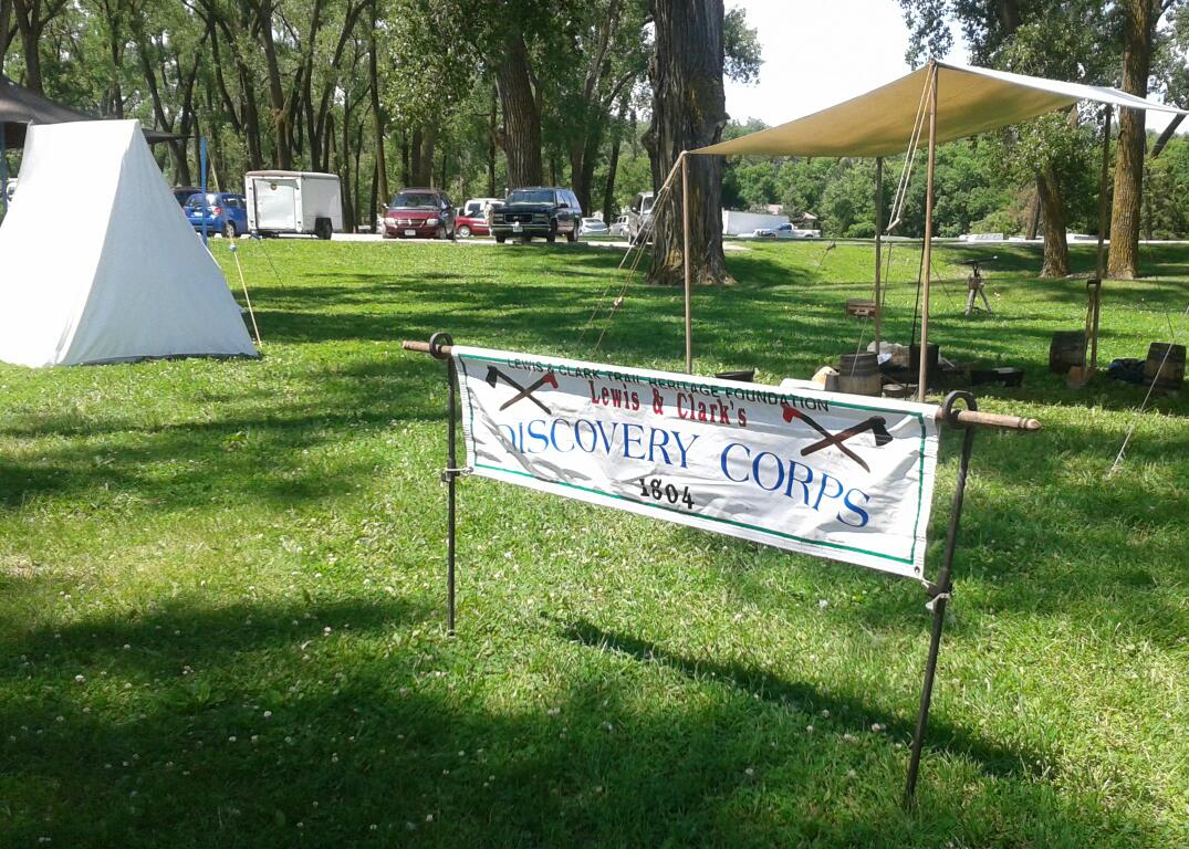
I swung off the interstate and leaned The Silver Streak west. The park sits on horseshoe-shaped Blue Lake and on this Sunday it was filled with campers and day trippers—it was the last day of the Lewis and Clark Festival, with re-enactors, replica expedition encampments, old timey vendors and craftspeople. Jackpot!
Encampment for the Lewis and Clark Festival
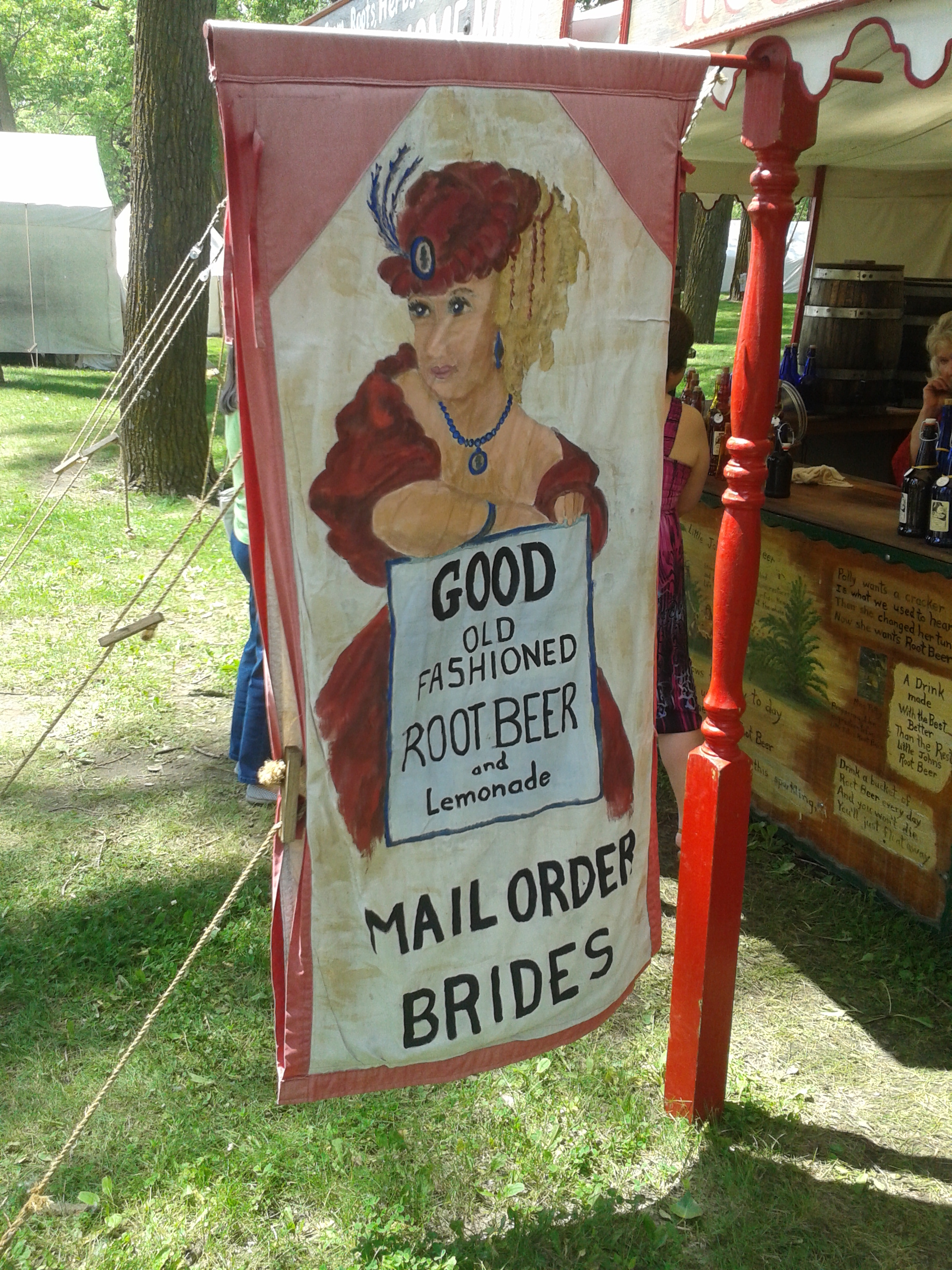
Festival Vendor Sign
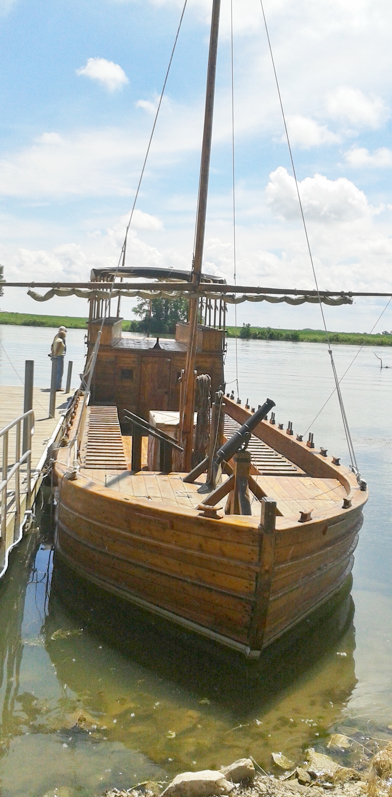
In addition to all this, a replica keel boat was moored on the lake next to the visitor’s center and inside the center—one of the actual keelboats from the expedition, lovingly preserved. I never would have expected to see the real thing here in Iowa. Double jackpot!
Replica of Lewis and Clark Keelboat
The Real Thing: One of the Original L&C Keelboats
While strolling among the encampment I met several knowledgeable and engaging members of the Sgt. Floyd Tri-State Chapter of the Lewis and Clark Trail Heritage Foundation. These folks know their history including arcane details such what kind of lightweight woolen material was used for the explorers’ clothing in those days. For more about the Foundation: http://lewisandclark.org.
Re-enactors at Lewis and Clark State Park
I had another 75 miles to go, so I left the park to get one last photo at the entrance sign. Off to the west across the Missouri were the Winnebago and Omaha tribal lands but I had no time explore them. I jumped on I-29 once again to get to Aunt Anne’s.
Omaha skyline (internet image)
Interstate 29 and I were becoming like family. I’d spent many hours riding south on it but really, it was time for us to part. As I approached Omaha, the predicted rain hit me. I was paying the price for my obsession with Lewis and Clark. I had no choice but to pull over and tug on my rain suit. So, there I was on the shoulder of busy I-29 with semis whizzing past me trying to get jacket and pants on. Finally encased in my protective but toasty Frogg Toggs cocoon (Frogg Toggs are made of Tyvek—the material used to wrap houses in) I edged back into the flow of traffic. Predictably, I rode but a few miles and the showers inexplicably stopped. Sigh. What can you do? Well, ya just keep riding and sweating.
Welcome to Nebraska (internet image)
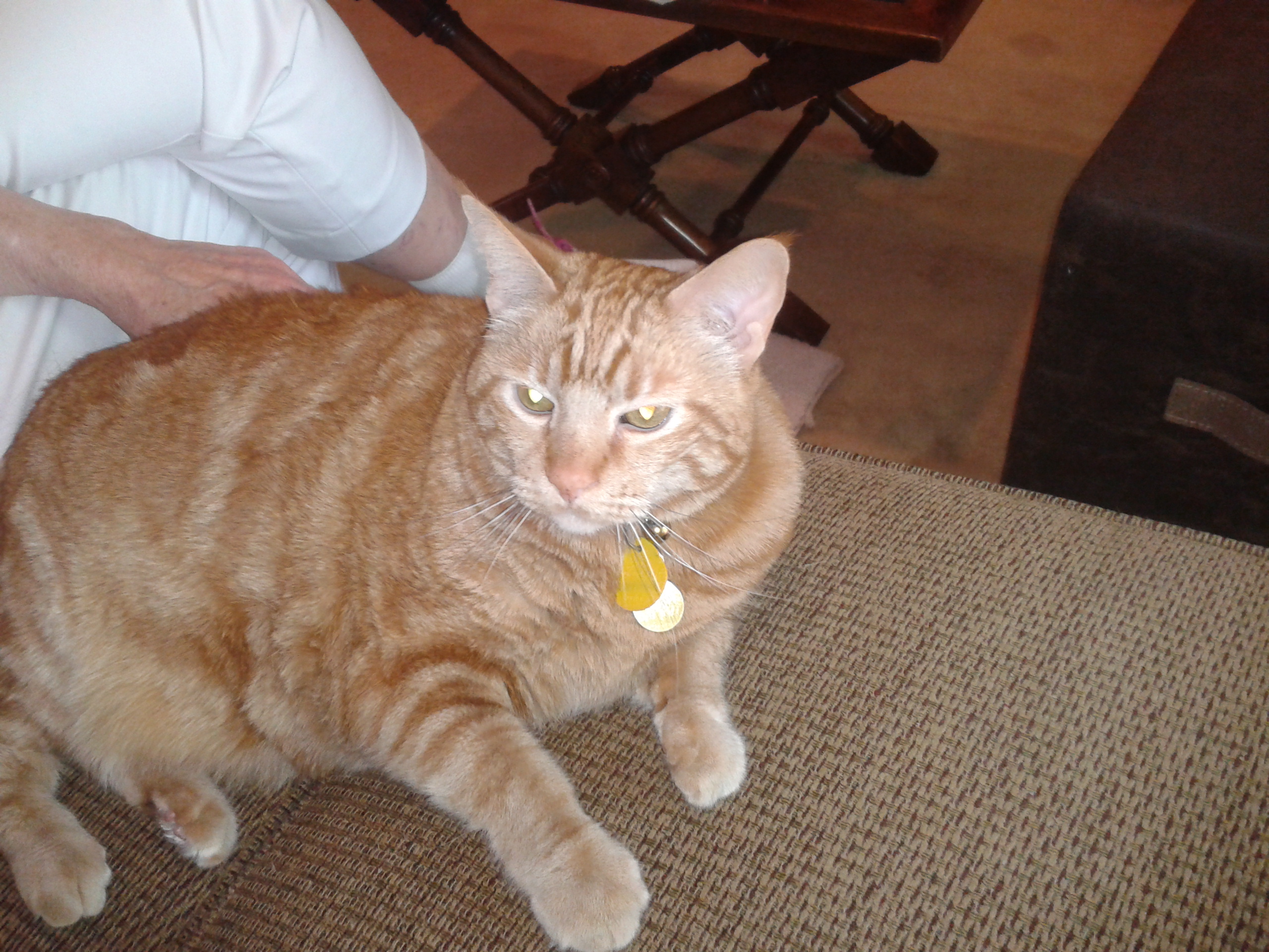
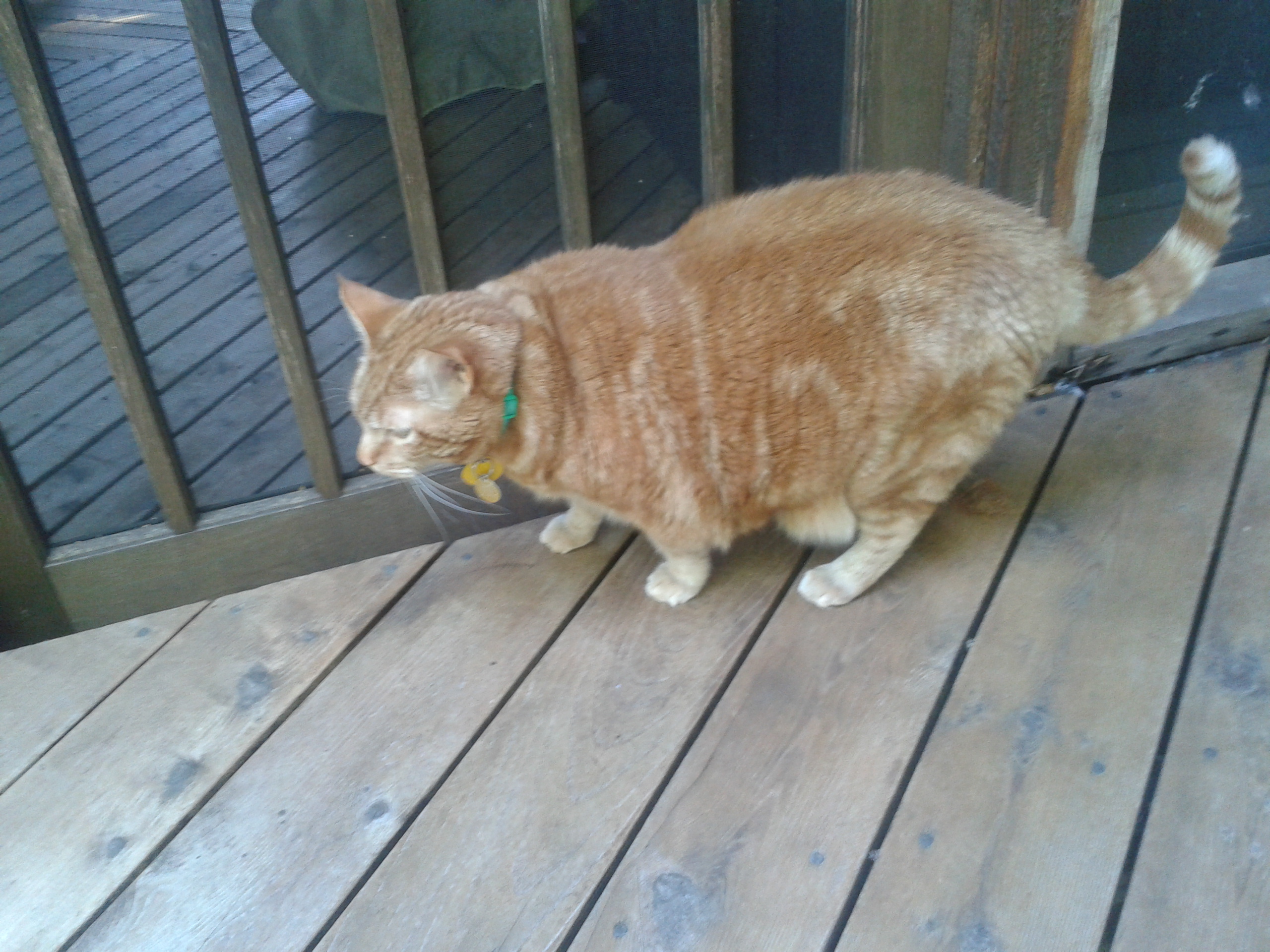
At last I turned west, went over the bridge, crossed the Missouri once again, and was welcomed to Nebraska. I followed Aunt Anne’s perfectly scripted directions and pulled into the driveway of her exquisite home around 2:00 p.m. Aunt Anne greeted me and right away introduced me to her gentleman friend—Tabby, a puppy-like ginger cat, who is quite content to hang out wherever his human companions happen to be. Sometimes he’s quietly underfoot. Have to be careful where your feet end up under a table because Tabby might be there listening in on the conversation. Tabby and I bonded quickly because, as the first one up, I made sure his bowl was filled with fresh food.
Aunt Anne
Mr. Tabby
Tabby exploring the back deck
We ate, had our 5:00 p.m. cocktails, and talked into the night. It was a memorable visit, especially the hilarious moment Monday night when I got locked in the garage. I’d been cleaning the bug splattered windshield of the bike which was safely tucked in the two-car garage and Aunt Anne came to the doorway between the garage and the back of the kitchen to see how I was doing. “I thought you’d finished that some time ago,” she said. I told her I had been putting it off to work on the blog, but was almost done.
Aunt Anne went back inside and I took a few more minutes completing the clean-up.
I went to the door to get into the house—LOCKED. What? Oh right, Aunt Anne was careful about re-locking that passage door from the garage. OK. I thumped the door soundly. Nothing. Uh oh. Had she gone upstairs to bed? And if so, she would never hear me since she would have removed her hearing aids.
I pounded again. Nothing. This might mean a night in the garage in the back seat of her car. I tried one more thing: I opened the garage door and started for the front to ring the doorbell in hopes that she was still downstairs and would hear it. Just then she popped out of the door from the kitchen as I stood in stocking feet at the entrance of the garage—“I thought I heard a noise. That was you knocking wasn’t it? Oh no, I locked you out. Force of habit. Sorry.”
“You’re never going to live this down, you know,” I joked. “It’s going in the blog.” Unfazed by that threat, she laughed and we grabbed our drinks and settled in for a long talk in the cozy family room with Tabby keeping us company.
On to Missouri through Kansas
Day 8, June 16, 2015
(Bellevue, NE to Columbia, MO: 313 miles)
Bellevue Truss Bridge: The toll is 50 cents for motorcycles (internet image)
I kissed Aunt Anne goodbye at the Bellevue post office where I shipped a 10 lb. box of clothing and assorted gear back home. A 10 lb. box! Despite my judicious packing, I still had 10 lb. of stuff I didn’t need. It was a shameful moment for me, “Mr.-I-Travel-Light,” as I paid the clerk and left to gas up.
It was bittersweet departure—my Aunt is a resilient woman who has coped with a number of health limitations that she handles with dignity and grace. She insisted on preparing meals for me, showed me around town, and before I left, she made sure I had water and a container of magnesium powder to stave off leg cramps.
Aunt Anne was about 14-years-old when I was born. I fondly recall her babysitting my sister, Sheila, and me—she was lively and funny and we loved having her take care of us. One Halloween she showed up with an outrageous red devil mask which should have been terribly scary except I knew it was our Aunt Anne and so I couldn’t possibly be afraid. I also was the consummate worry-wart and one day while riding in her car it conked out not far from the family home. I was quite distressed by this. How would we get to Grandma’s house? Aunt Anne reassured me that it would be all right. We would just walk there. She held my hand as we went down the country road and all was well. My trust in her was absolute after that.
A beautiful dark-haired young woman with a pixie haircut, she went on, among other accomplishments, to become an expert skier first in Vermont and then Colorado. I think she may have been one of the first “ski bums” of the late 1950s and her adventurous life enthralled me.
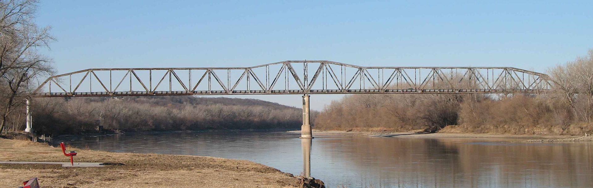
I left Bellevue and crossed the old truss bridge for the bargain price of 50 cents (cars, $1.00) and connected up with I-29. So, there I was slugging out the miles down I-29 once more, though it was slightly more interesting as I approached the outskirts of Kansas City.
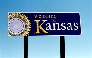
Welcome to Kansas, the Sunflower State (internet image)
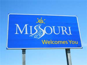
Rolling countryside and some foothills in the distance provided a bit of variety. I decided to peel off slightly westward to officially ride through Kansas and see the skyline of Kansas City, Kansas. Then it was straight ahead on I-70 past Kansas City, Missouri, Independence, and to Columbia, MO, my destination for an overnight. At last I said goodbye to I-29 and was now working my eastward—toward home!
The Show Me State (internet image)
The rain started as I got close to Columbia. I found my cheap motel, got the cover on the bike, and hunkered down for the evening.
Eastbound through St. Louis and on to Indiana
Day 9, June 17, 2015
(Columbia, MO to Dale, IN: 309 miles)
And it rained and it rained…at the motel in Columbia, MO
The next morning the rain intensified. Small rivers were running down the inclined driveway in front of the motel. I packed up, had the Host Budget Inn’s meager version of a continental breakfast, returned to my room and tried to wait out the worst of it while working on the blog. My plan was a bust. By 10 a.m. it was still at it—pick your cliché about a robust and vigorous rainfall and that’s what was going on. Weather radar indicated that the rain was conveniently distributing its soggy bounty east to west right down the I-70 corridor. There was no escape.
I reluctantly checked out and experienced the most intensely terrifying part of the entire trip—heavy rain and almost no visibility. Inexplicably, some motorists did not have their lights on. Did they forget? Were they just stupid? I cursed them roundly for this folly. I slowly followed the wake of a semi, whose lights were just dim pinpoints in the foggy mist.
I rode on with white knuckle intensity, hunched up shoulders (you know what that led to later, right?), and pleas to the Almighty on my lips. I really don’t know how long it took but eventually the visibility improved and I could almost manage the speed limit. It’s about 125 miles to St. Louis from Columbia, a couple of hours at 65mph. Again, I have no recollection of how long it took. I was just relieved that the rain abated when I had to work my way through St. Louis with its assorted construction zones and on/off ramps for different city exits to eventually connect with I-64 east.
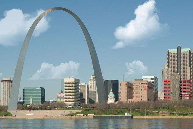
St. Louis Arch on a Sunny Day (internet image courtesy of Microsoft)
I crossed the Missouri and shortly the Gateway Arch appeared ahead of me. I chugged along carefully threading my way through traffic and crossed the Mississippi and I was now in Illinois on I-64. The real eastward leg was underway!
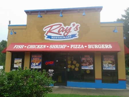
Ray’s in Washington Park, IL, where everything is fried
With the rain just about over, I jumped off 64 to get lunch at Ray’s in Washington Park, Illinois, which is really at the edge of East St. Louis. And if you are thinking that I stumbled into an all-black enclave, you would be right. Housing segregation at its worst.
Everything at Ray’s was fried. Not a healthy choice on the menu but I was there, I was hungry, and I tried to limit the damage with some butterfly shrimp and coleslaw all of which were very good. Everyone in Ray’s was pleasant and one fellow, decked out in a complete rapper outfit including gold capped teeth called me, “Sir.” That was an unexpected honorific in a chicken joint in East St. Louis.
About half-way through southern Illinois, with it sprinkling on and off, I stopped for gas in Mt. Vernon. By the exit ramp stood a tacky Washington Monument replica. Now, I realize the good people of Mt. Vernon, Illinois, were trying to make a connection with George Washington but I think they missed the point. The Washington Monument is in Washington, D.C. and certainly not at Washington’s home at Mt. Vernon in Alexandria, VA. This bit of self-promotion, without a doubt, was a first class “one-off” and a total misfire.
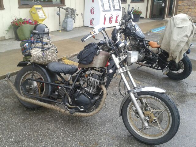
The Real Deal: Authentic “Rat Bikes,” Mt. Vernon, IL
Gassing up at the Shell station, I heard a hearty backfire and looked up to see two guys ride in on authentic “rat bikes.” One bike was a one cylinder thumper cobbled together from assorted parts from different motorcycles—a real “Frankenbike.” The other was a modified Yamaha 750.
The pair had no rain gear other than what looked like a long western-style trail coat that the older of the two had draped over his bike. And, as you can see from the photo above, the seats were really primitive, too. Ouch. They had come from somewhere on the east coast, had ventured to the west coast and were returning east to North Carolina for a rally.
No question, they were the real deal. Must be tough as boots to be riding on those machines in bad weather. Next to them I felt like a real wuss wearing my Frogg Toggs with my bike equipped with ABS brakes, cruise control, hard cases, adjustable suspension, and adjustable windscreen. I got their OK for the pics and then, embarrassed to be in the company of real bad-ass bikers, I hastily motored out in the direction of Indiana.
The Hoosier State Welcomes You! (internet image)
I had hoped to make to Ferdinand, IN and I got close but the rain started up again in earnest and I had enough. I bailed out of I-64 at Dale, a few miles from Ferdinand, and found a Motel 6. Bad choice. Very expensive compared to various accommodations I found so far, most of which didn’t exceed $65. With no coffee maker in the room, this place didn’t even offer the parsimonious fare of the Budget Inn in Columbia—it offered nothing. Well, there was the “free” coffee in the morning. Wow, generous. Oh, and there was no Kleenex either.
Showering the next morning I discovered a long black hair stuck to the wall. Yuck. Nice cleaning job, folks. This was most money I’d spent so far and had gotten the least. I wasn’t pleased. However, to put things in perspective, there was a gas station right next door with a good-sized convenience store, strangely named “Chuckles,” that had a decent selection of food and drink items.
Down the road in Dale, with one traffic light and a population of 1,600 (they must have been hiding somewhere in the corn fields, I hardly saw anyone) was a well-stocked “Package Store.” The owner was a biker and we had a friendly chat about road trips. He was not a weekend cruiser type but had done some serious long distance rides. Our shared experiences took my mind off the penitential conditions at the motel.
I discovered later that Florence Henderson (AKA Carol Brady of the Brady Bunch) is from Dale. It seems odd that Dale didn’t make a point of advertising this fact with a sign or a marker or something. Maybe sell some Brady Bunch junk? At least this was a genuine connection to the town not like the Washington Monument knock-off was to Mt. Vernon, IL.
Of course it rained overnight but the day seemed to be clearing. I was happy to be on the road and away from my “hosts.” If this lodging is anything like other Motel 6s, I’d recommend another brand.
The Big Push: Indiana to West Virginia
Day 10, June 18, 2015
(Dale, IN to Beckley, WV: 375 miles)
Making my way through southern Indiana, the scenery was classic Midwestern: corn fields, soy fields, wheat fields, farms and small towns.
Welcome to the Bluegrass State (internet image)
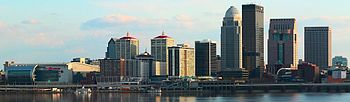
Before long it was “Welcome to Kentucky.” I had forgotten that the skyline of Louisville, KY was such an appealing sight. There are a few commercial structures with interesting architectural touches and then there are the numerous church steeples poking above the tree line.
Louisville, KY Skyline (internet image by Fine Art America)
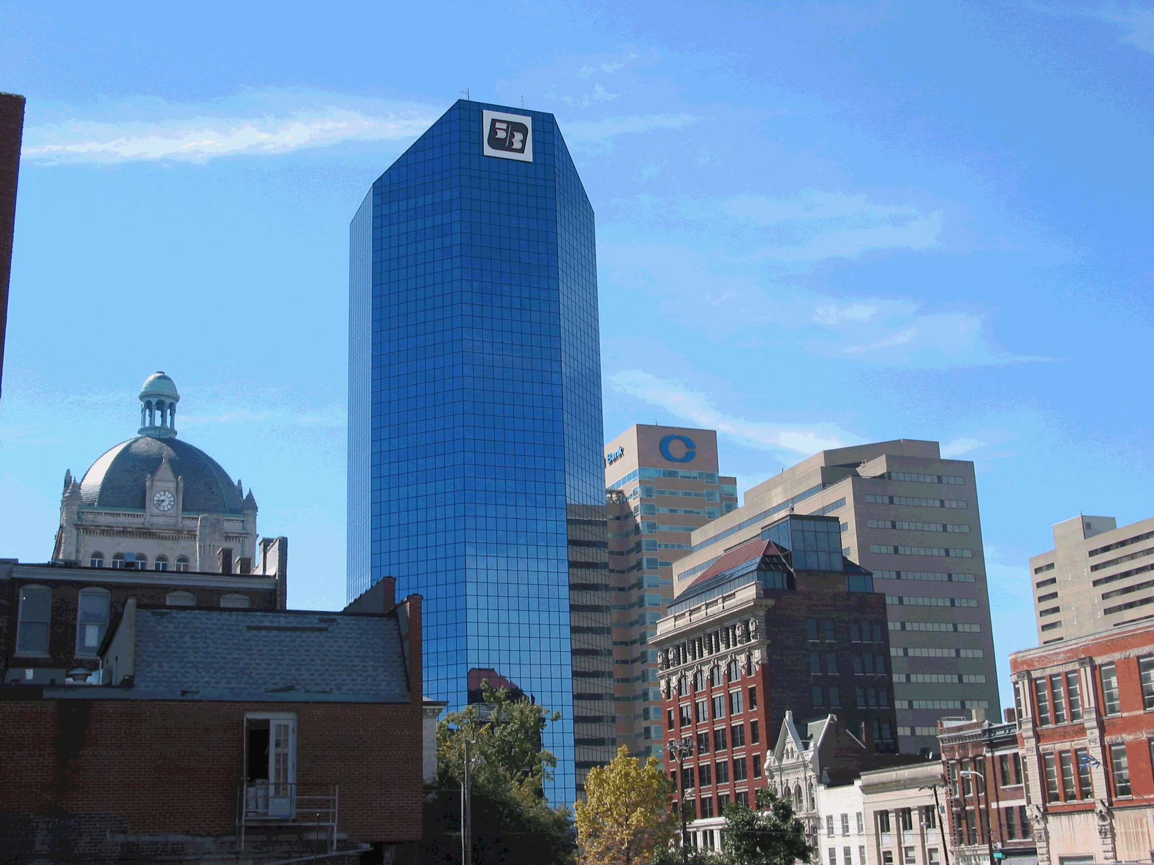
I chalked up the additional 79 miles to Lexington and passed familiar exit signs for the University of Kentucky (Go Wildcats) and local routes from my grad school days there.
Lexington, KY Skyline (internet image by Conjunction Marketing)
Just about halfway between Louisville and Lexington is the state capital, Frankfort, and about 20 miles south of Frankfort is Woodford County—where the upscale Bourbon of the same name is distilled. Another mystery solved: I had wondered why the name Woodford was chosen for that brand. It was all very simple: that’s where it’s made. Of course, a quick Google search would have enlightened me ages ago, but why do it the easy way?
By lunchtime I had reached Mt. Sterling and tried a Cracker Barrel assuming I could get a salad of some kind, which turned out to be true. No complaints: CB is what you expect. No surprises. Bland, all-American fare to keep you fueled so you can continue traveling. The place was busy with families and geezers like me. Next to me, a mother and her young daughter were having lunch with the grandmother, all the while yakking away. Southern accents can sometimes be charming and cute but to my ear that afternoon the twangy sing-song Kentucky accent was annoying and grating. During the two years I lived in Kentucky, I guess I adjusted to the sound. In the four-and-a-half decades since I left the Bluegrass State, it seems I’d lost any tolerance for it. Of course, I was planning on making it to West Virginia that day. No improvement in the accent department there.
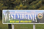
Wild and Wonderful West Virginia (internet image)
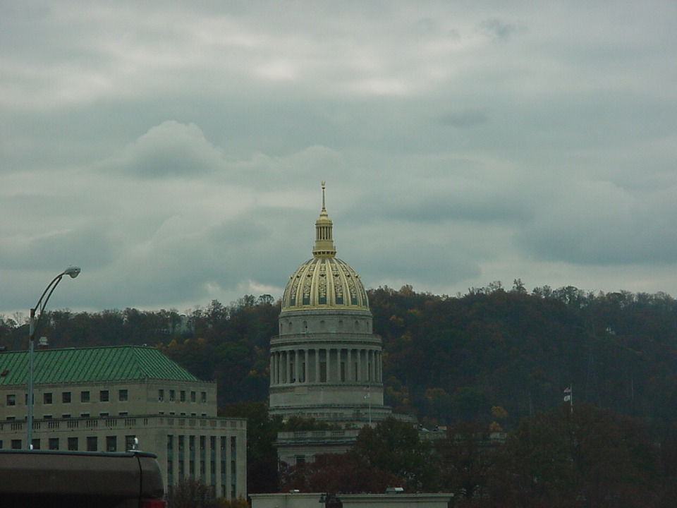
Off and on rain greeted me as I crossed into West Virginia. I sincerely believe that one of the ugliest sections of interstate highway is between the Kentucky border and Charleston, WV. I guess Charleston can be pretty under the best of conditions but today was gloomy and dreary and even the golden dome of the capitol seem lose its glitter.
Capitol Building, Charleston, WV (internet image)
Probably the section of interstate highway/toll road with the most demanding and challenging series of curves is between Charleston and Beckley, WV. But mix in some rain and it’s no bag of chips. A rider is no longer excited about handling the switchbacks but simply trying to get through it alive. With much effort and concentration I got to Beckley as the rain ebbed away.
Beckley has plenty of accommodations and I unwisely picked a Microtel since it seemed the least crowded when I arrived around 6:00 p.m.
Silly me, I was seeking a kind of formal balance to my travels: I started the trip staying in a Microtel in Ohio and since it was OK and affordable, I thought I’d end the trip in one.
Now, let’s do a playback from Indiana: Bad choice. Very expensive. This was the most expensive motel yet, over $90.00. They did offer a cold breakfast but there was no fridge, no microwave, and no coffee maker.
There was a pool and spa but earlier a bus had disgorged a group of kids and they overwhelmed the facilities. I wasn’t about to try to wedge my way in among a pod of squirming porcine brats. I retreated to my room after scrounging up an edible salad at a Burger King, watched some TV and hoped the people in the next room would turn off their set before midnight.
Homeward Bound to Virginia via I-64 to I-81 to I-66
Day 11, June 19, 2015
(Beckley, WV to Reston, VA: 295 miles)
I had just packed the cover to the bike to get the day started and it began to rain again. I muttered a futile curse at the skies and went inside to finish organizing my gear, load up, and get on the road for home. There was no point in complaining. Weather-wise I had been enormously lucky throughout the most interesting parts of the trip. Yes, now, I was being plagued by rain in just about every state as I traveled east.
But the fact was that I hadn’t planned doing any sightseeing in these states anyway, especially Indiana and Kentucky. I pretty much had seen what I wanted to see in those states from previous travels. So, aside from the tension of riding in wet conditions there was nothing to feel bad about. And, really, my new Michelin Pilot tires were performing flawlessly in the rain—that in itself was greatly reassuring.
Welcome to Virginia Sign, I-64 at the W.V. line (internet image)
I took off from the Microtel and perhaps the cursing worked because once underway, the rain stopped. Though the day was overcast and threatening, the road was dry for all 176 miles from Beckley to Harrisonburg, VA. That was 60 percent of the trip home completed. My luck was holding up. In fact, it was holding up nicely because the rain, though steady, was not blinding and The Streak sailed along effortlessly. The worst part of the ride was the effect that the dopes that refuse to pass and get to the right on I-81 have on traffic flow. I was sitting behind a semi going faster than the car to my left because someone several miles ahead in the passing lane wasn’t passing but squatting there holding up a parade of other vehicles. The zenith of thoughtlessness.
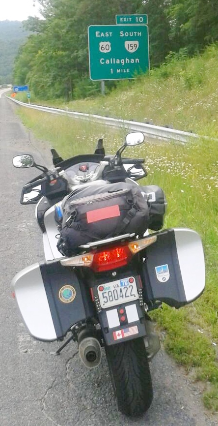
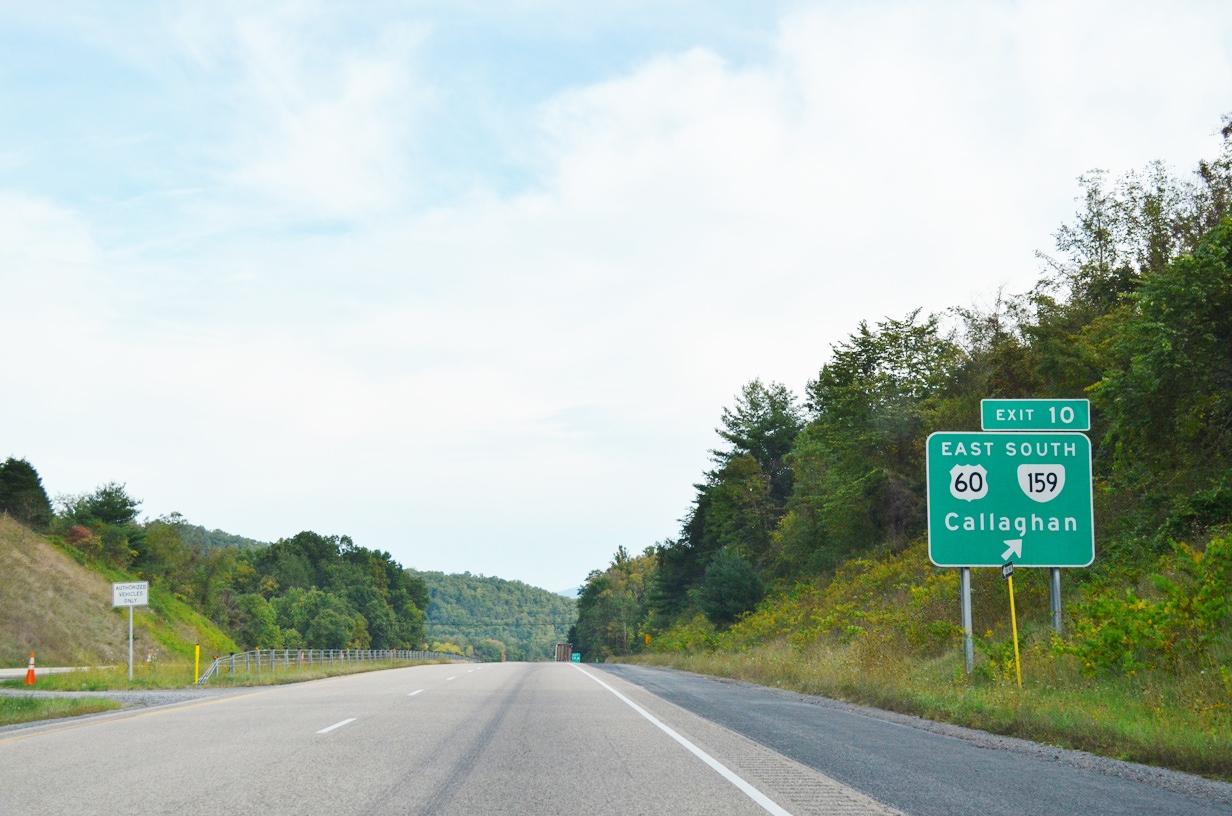
Exit 10 for Callaghan, Virginia
Next Exit: Callaghan
Without any rain to interrupt me on I-64, I was even able to get my signature photo of my motorcycle next to the exit sign for Callaghan, VA. The last time I had a chance to take a shot like this was when I owned Big Blue and visited the area in 2008, staying the night in Hot Springs, VA.
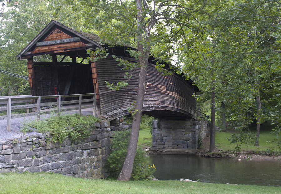
One of the fascinating attractions in the tiny town of Callaghan is the Humpbacked Covered Bridge, a wooden structure spanning Dunlop Creek. It’s one of the last of its kind in the U.S. (See photo below)
Special thanks to Brendan Reals of Falls Church for granting permission to use this photo. He’s a first rate photographer and has a stunning collection of prints of Washington, DC and scenes of Virginia at: http://fineartamerica.com/profiles/brendan-reals.html
Humpbacked Covered Bridge, Callaghan, VA (2009 photo courtesy of photographer, Brendan Reals http://fineartamerica.com/profiles/brendan-reals.html)
The trip up I-81 has become so routine for me that I don’t fear the trucks or the 70+ mph speeds anymore. There was a time that the idea of riding the I-81 corridor through the valley filled me with dread. Now, I’m no longer a puddle fearfulness. I guess there’s no substitute for the direct experience of motorcycling and doing it over and over until you get to know your limits, hone your skills, and learning by doing.
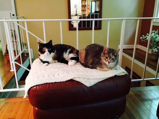
And so, by 12:40 p.m. I was coasting down our driveway. I checked the mileage: in 10 days of riding I chalked up 3,326 miles for the round trip and got home safely. And our two cats were waiting for me. Ah, so good to be home!
Blog note: I didn’t get my narratives up-to-date the other day and publish fresh posts as I had hoped (and stated in the brief update below). Instead, I spent a good part of the evening having a deep conversation with my Aunt Anne that lasted past midnight. This was time better spent for me personally than working into the night to post the blog. I’m sure the reader will understand how important it is to invest in connecting with family especially someone as dear to me as Anne, whose resilience, sense of humor and compassion are inspiring.
Days 4-6, June 12-14, 015
Michigan, Wisconsin, Minnesota, North Dakota
June 12
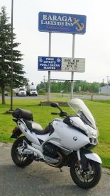
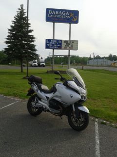
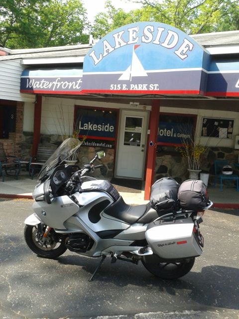
Lakeside Inn, Baraga, MI
The fog on Lake Superior blotted out every feature of the shore and the landmarks across the bay. I waited it out with a superior sized breakfast at the Lakeside Inn in Baraga, Michigan, my first real breakfast since leaving home on Monday.
At the counter in the hotel I sat between two local guys and managed a conversation about fishing and the pros and cons of the Ojibway Casino on the hill above town. These fellows reminded me so much of Mainers…a bit taciturn with a touch of sly humor. They aren’t going to let you in on too much about what they’re thinking. A subtle quip or two gets rolled out but for the most part you struggle to get anything out of them.
During the sparkling breakfast conversation I demolished a big breakfast, for less than $10, and with the fog lifting, I made a quick stop at the post office and at last got on the road—after 10 a.m., very late for me.
Today’s ride, while it had many positives like the charming country roads I sailed along as the day warmed up, it was countered with road closures, detours, lane shut downs, spots where pilot trucks had to escort lines of traffic in alternating directions, loose gravel and snail-like speed limits. Arrgh. I took me way too long to tick off the 308 miles that I eventually rolled up.
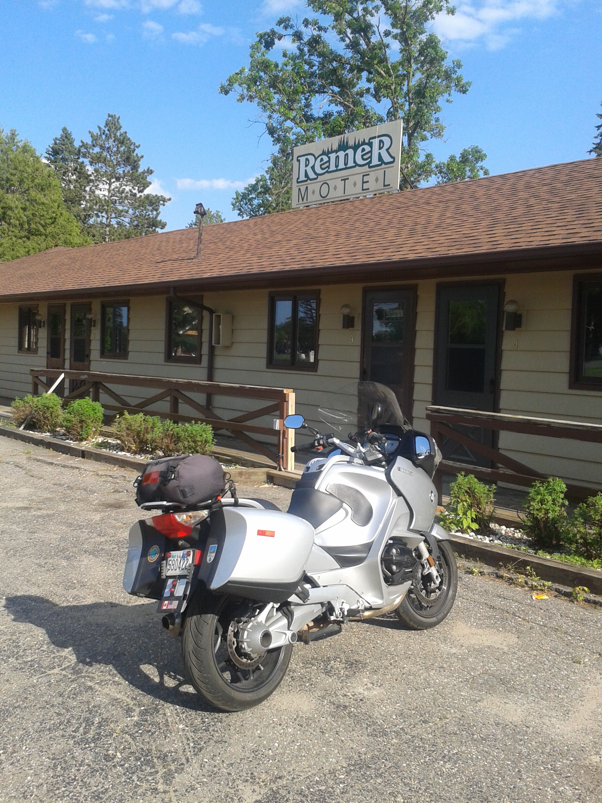
By the time I stumbled upon the Remer Motel I was at the end of my tether. I saw the dinky, down-at-the-heels motel and gave up trying to go any farther west to Walker, my planned destination. (Good thing I didn’t persist in reaching Walker; I found out there was a fishing tournament there on Leech Lake and all the accommodations in Walker were booked up.)
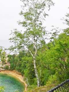
The elegant birch, my favorite tree
A series of impressions kept recurring as this ride has unfolded, mainly certain scents that have become evocative of the U.P. and its neighboring states: the smell of balsam that perfumes the air along some of the highways, then there is the odor of campfires–the sweet smokiness reminding me of the many backpacking trips Rosa and I have taken over the years, but there’s also the sight of stately birches lining the edge of the forests along the roads. For some reason, I never tire of seeing those elegant trees. Taken together these sights and smells create calm and joyful feelings that’s hard to describe.
The Remer Motel
I was traveling west on Route 200 in Minnesota when I came through Remer, population 366; this was another happy accident. Remer, according to Wikipedia, had a Big Foot sighting a few years ago and claims to be the Big Foot Capital of the U.S. Notwithstanding the Wiki citation, and likely out of embarrassment of such a silly sobriquet, no local ever mentioned this nor did I see any promotion of the Big Foot craze whatsoever.
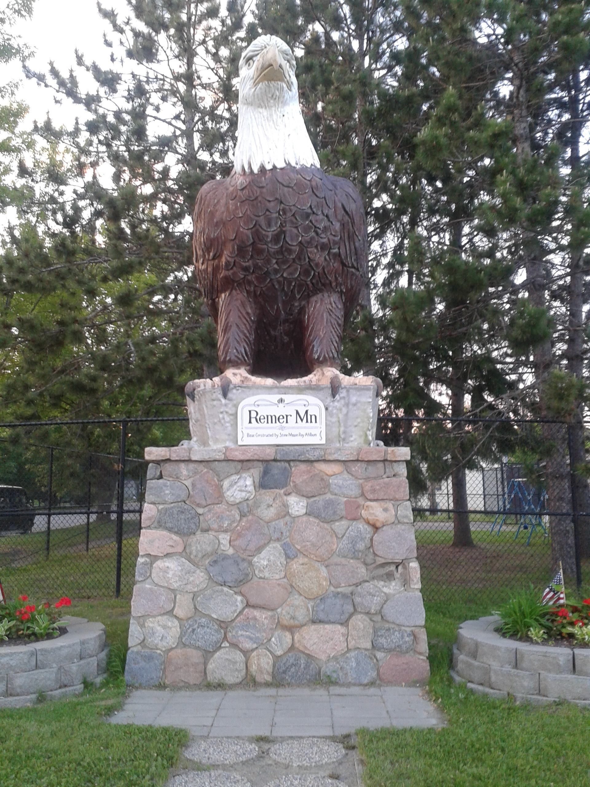
Fishing is the main interest, pastime, obsession, and activity around Remer. On the other hand, it is true that Al Capone stayed at the Thunderbird Lodge near Remer on his visits to Minnesota. I guess then things got too hot in Chicago, Remer was the place to be. Remer is supposed to have the largest eagle statue in the world. (See photo below.) Somehow, I can’t quite buy that.
The Remer Eagle
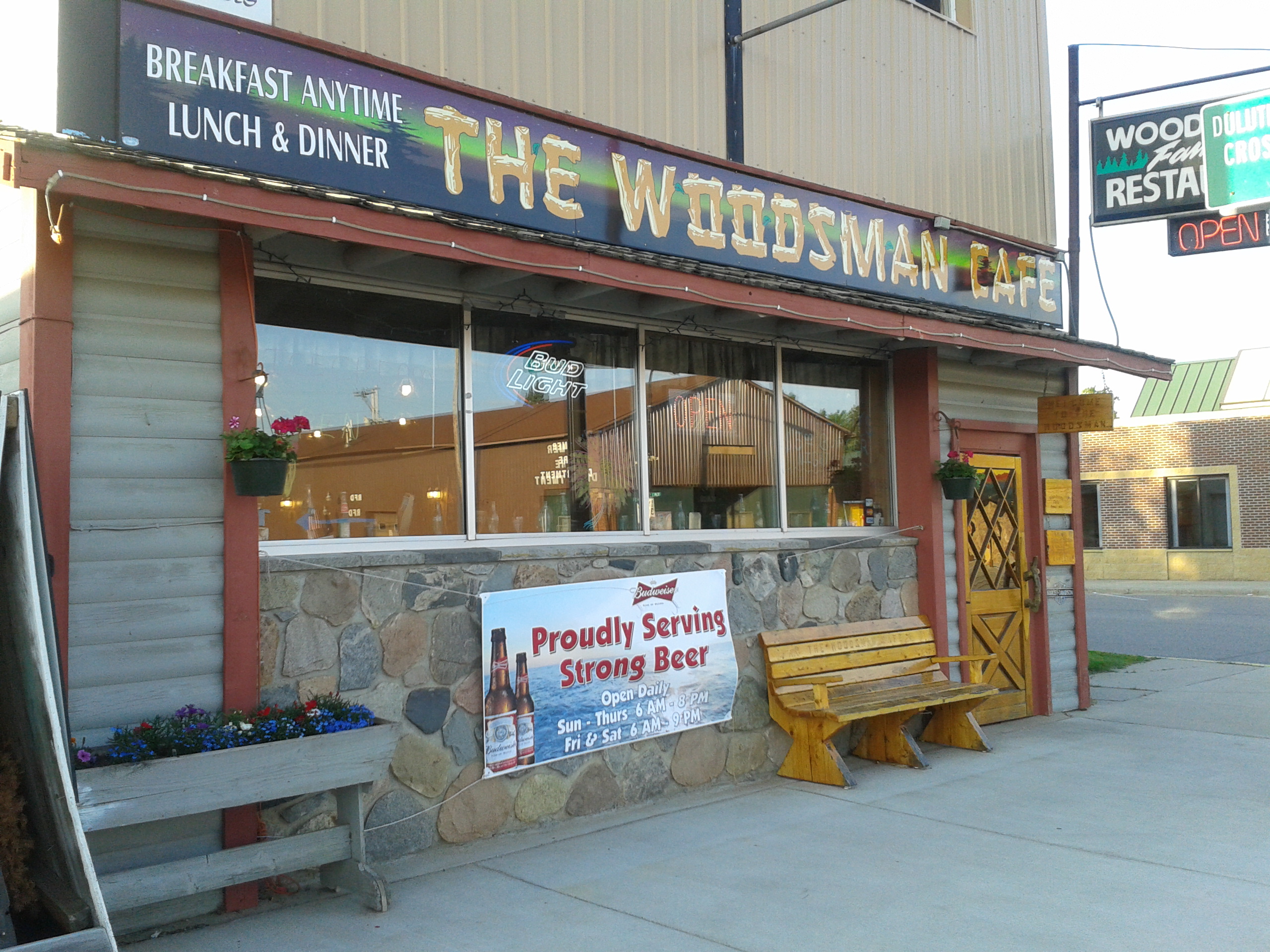
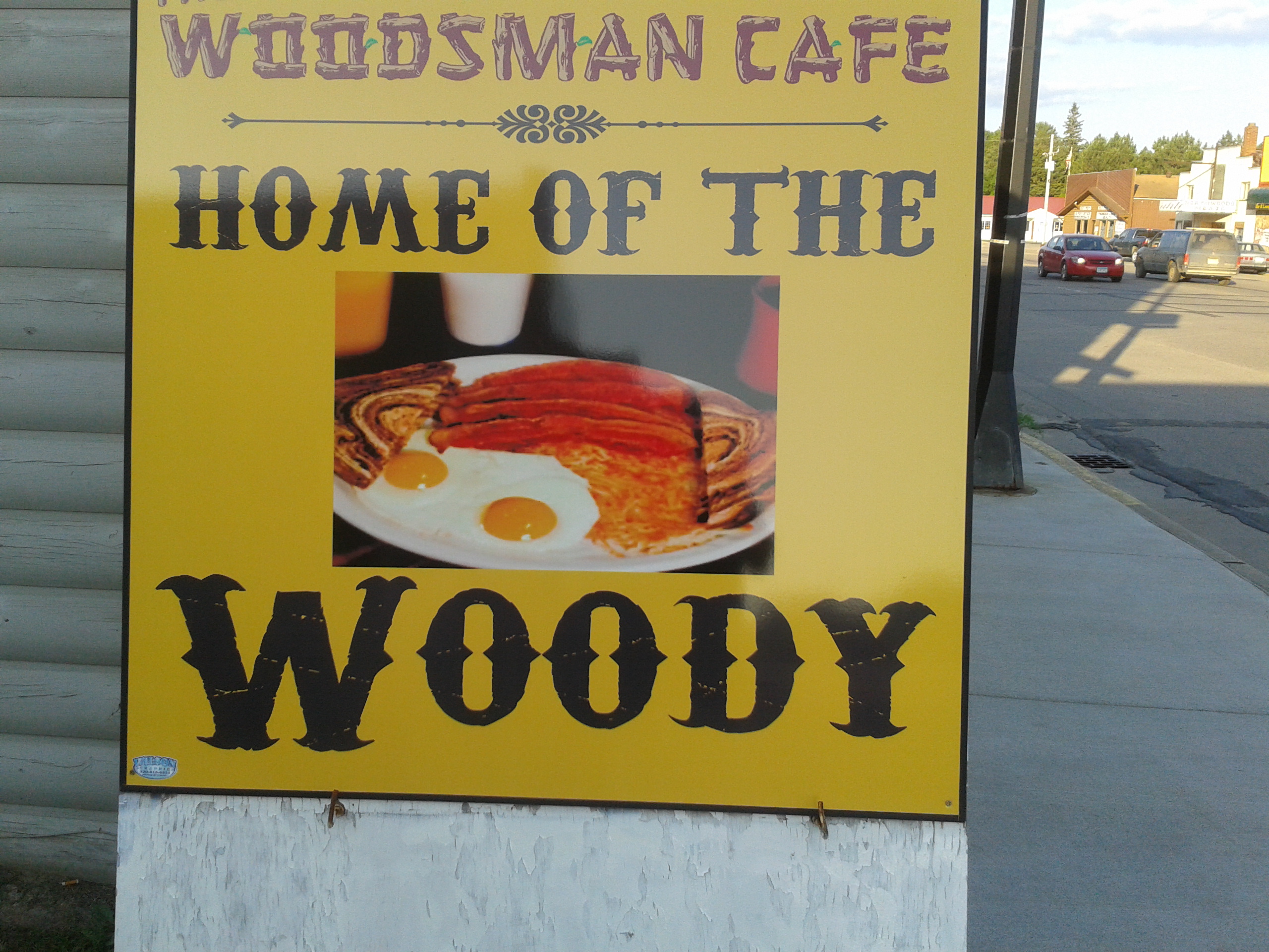
The Woodsman Restaurant is the only place in town so that’s where I ate dinner (a Walleye fish sandwich) and then breakfast: the famous “Woody” special—two eggs, hash browns, toast and coffee. Again, a meal under $10.
The Woodsman Café, Remer, MN
The Home of the Woody
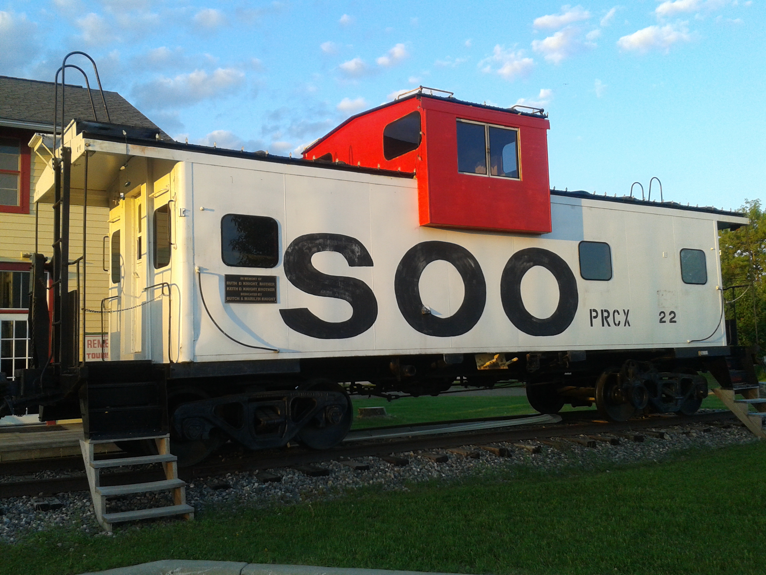
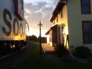
Remer has five churches so that works out to about 73 people per church. It also has an old depot still standing on a branch of the defunct “Soo” line. For more about the Soo, see the Wikipedia entry: https://en.wikipedia.org/wiki/Soo_Line_Railroad.
Soo Line Caboose
Who would have guessed that this tiny town had so many interesting facets?
But I’m digressing about where I ended up and need to get back to how I got there. First, Wisconsin. Let me say one word about northern Wisconsin—meh! Let me say two words about northern Wisconsin, especially Superior (which is most certainly is not): Under Whelming.
Crossing from Michigan, there isn’t even a sign or welcome center to greet one’s arrival into the state. I kind of figured it was Wisconsin after passing a tired dairy farm. That was the only hint. Poor old Route 2 here was crisscrossed for miles with ribbons of tar snakes—one of motorcyclists’ most hated road conditions, along with rain, headwinds, and gravel.
Gone were the pristine roadside rest stops I came to appreciate throughout Michigan’s Upper Peninsula. Gone were the safe shoulders were an emergency pull off could be managed without fear of instant death. Instead there was some kind of sloped edge covered in what appeared to be cinders.
OK, enough of slamming pitiful northern Wisconsin, but I couldn’t help feel that the official attitude was: “There’s nothing to see here, visitor. Keep moving and don’t bother us.”
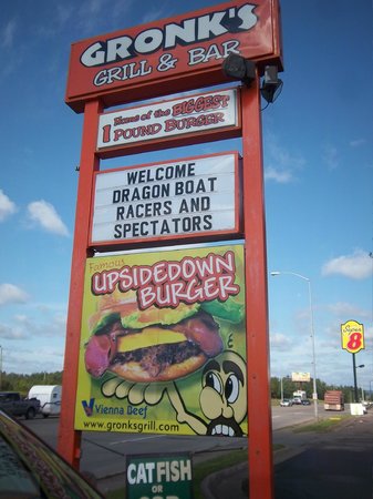
I stopped long enough in Superior to get a photo of a hard drinking bar and eatery called Gronk’s—their logo, a caveman, gives you an idea of the attitude and atmosphere. I poked my head into the dark confines of Gronk’s and then withdrew quickly back into the daylight.
In fairness, the Trip Advisor reviews about the food and ambiance have been positive, so I don’t want to slander what is possibly an otherwise terrific eatery that just appears less so.
Gronk’s in Superior, Wisconsin (internet image)
So, Superior Wisconsin is the ugly stepchild of Duluth and Duluth, though it indeed has a skyline of shorts is just a slicker version of a port city like Superior. Just the same, it does look much nicer.
And in the category of Happy Accident once more: I got lost after crossing the border from Superior to Duluth and ended up north of the city instead of aiming west along Route 2. I had to turn around to get back to the right exit and in doing so came down a long hill overlooking the city.
Here I was treated to a stunning view of the harbor and Lake Superior that I would have never seen if I had made the “correct” directional decision. There’s some kind of wondrous cosmic karma hovering over me during this trip. I’m getting goose bumps thinking it.
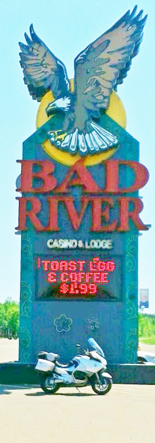
Before leaving Wisconsin, I was able to get a nice clear shot of Lake Superior—the day was cloudless and brilliant–and another photo of the Bad River Indian casino sign where I stopped for a break to pop Advil and mail some more items from the Odanah post office which is officially on the Bad River Band of Lake Superior Chippewa Indian reservation.
Lake Superior on a Clear Day
Bad River Indian Casino, Odanah, MN
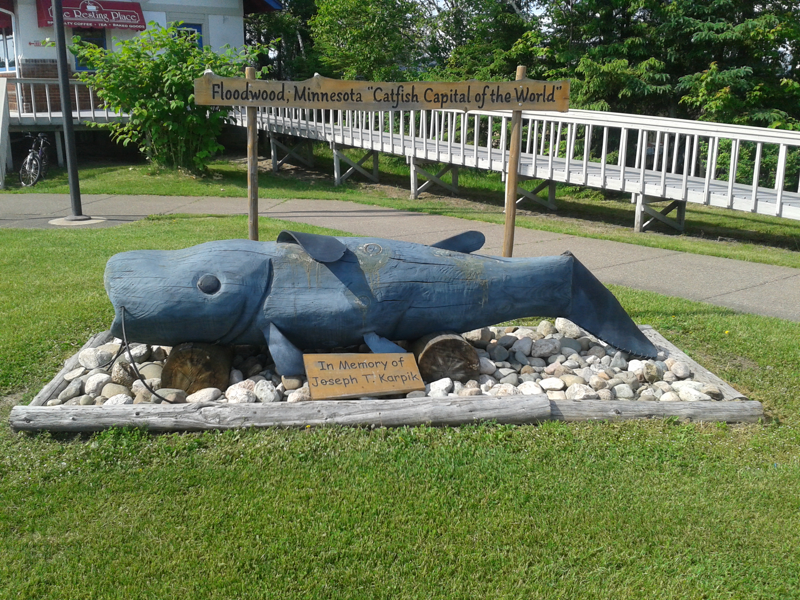
I took another rest stop in Floodwood, MN, “Catfish Capital of the U.S”. and captured the picture below of the catfish sculpture. However, in the interest of brutal honesty: there are at least seven other states with towns boasting they’re the Catfish Capital, along with one other town in Minnesota.
The Catfish of Floodwood, MN
Day 6, June 13, 2015
In Brookings, SD
One of the dangers of blogging is getting too detailed about routes, scenes, observations and the like which seem interesting to the royal blogger but are, well, “Ho hum, yawn” to everyone else.
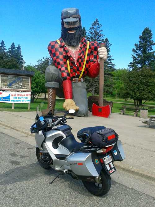
So, OK, here’s a summary of the day: a big breakfast at the Woodsman Family Restaurant in Remer to hold me until suppertime. Followed Route 200 to Walker (there were scores of pickups and RV lined up next to Lake Leech for the fishing contest) and scoped out the motel that had no room for me. Humph! Not any better accommodations than my little nest in Remer. Glad they had no room for me. Remer was a tiny little burg but interesting in its own way. I’m grateful I found it. Along the way I just had to get a shot of the Giant Paul Bunyan in Akeley, MN. I’m a sucker for those tacky roadside attractions.
Giant Paul Bunyan, Akeley, MN
After several pleasant hours on Rte. 200, I connected with Route 10 and boogied into Moreland and then Fargo along a four-lane highway.
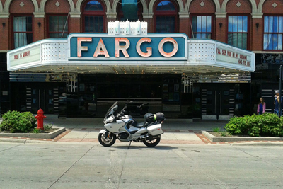
The Fargo Theater in downtown Fargo on N. Broadway
Fargo is an active place on a Saturday. The downtown area is crowded with cars and seems to be a lively scene for music and the arts on weekends. In my very brief drive-by, it appears there’s a mixture of old, new, and re-purposed buildings and the general sense is that the authenticity and soul of the architecture has been preserved. If I’m right, I applaud the city for their resistance to the developers and MBA marketeers who homogenize everything they touch so one place looks the same as another anymore.
I briefly cruised a few areas on North Broadway and some side streets to get some photos (again, just happened to find the right spots for interesting pics) and returned to Route 10 West to pick up I-29 south.
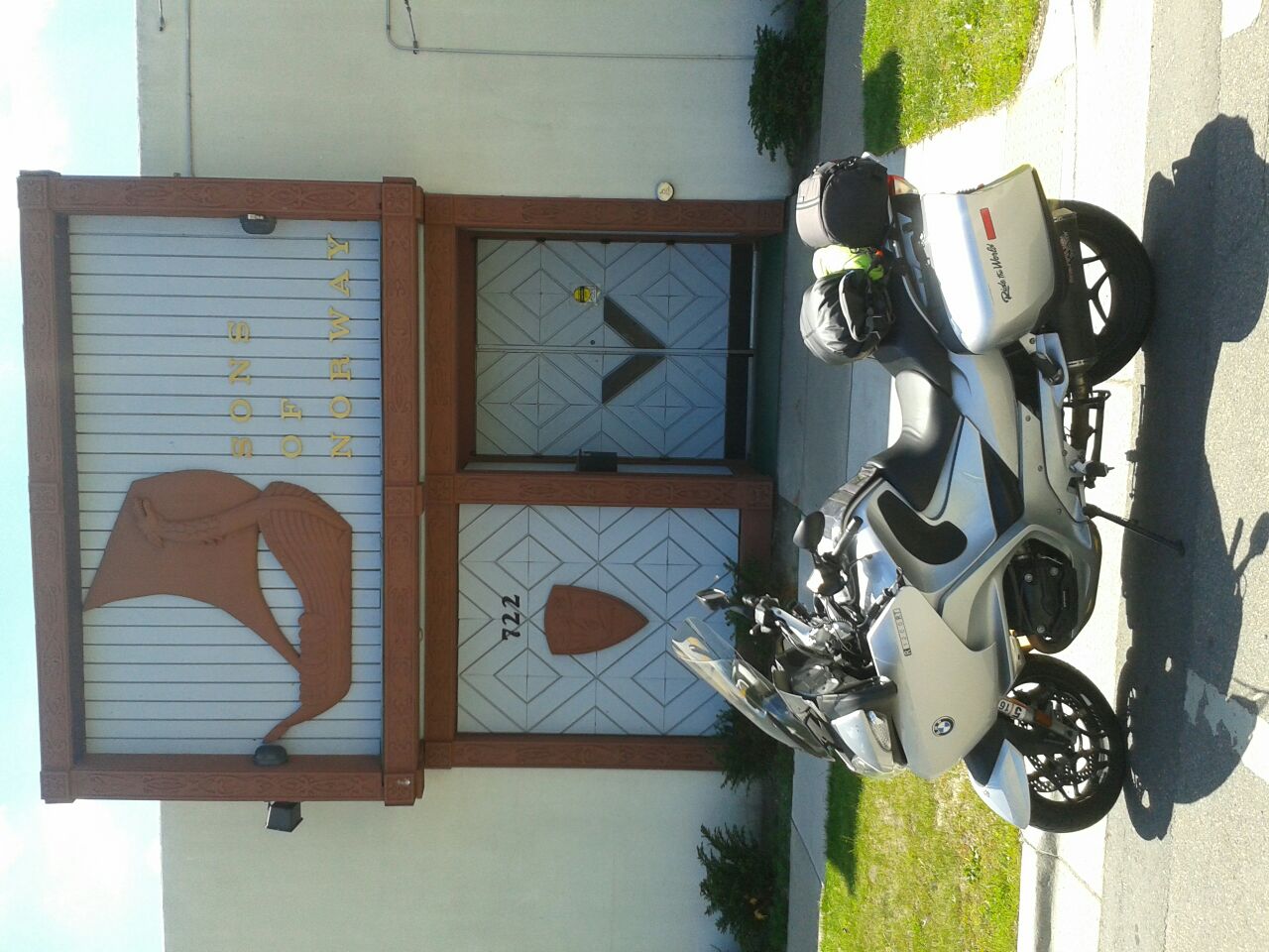
Sons of Norway in downtown Fargo
Route 10 leading out of town is a gritty strip of blue collar businesses, biker bars, tattoo parlors, payday loan operations, and a motorcycle dealers. And as a foreshadowing of what I was about to experience, as I made the turn on to the strip I was greeted by a doughy, chubby 20-something who was clutching a hand-lettered cardboard sign imploring passersby with the message: “Please help me…any amount helps.”
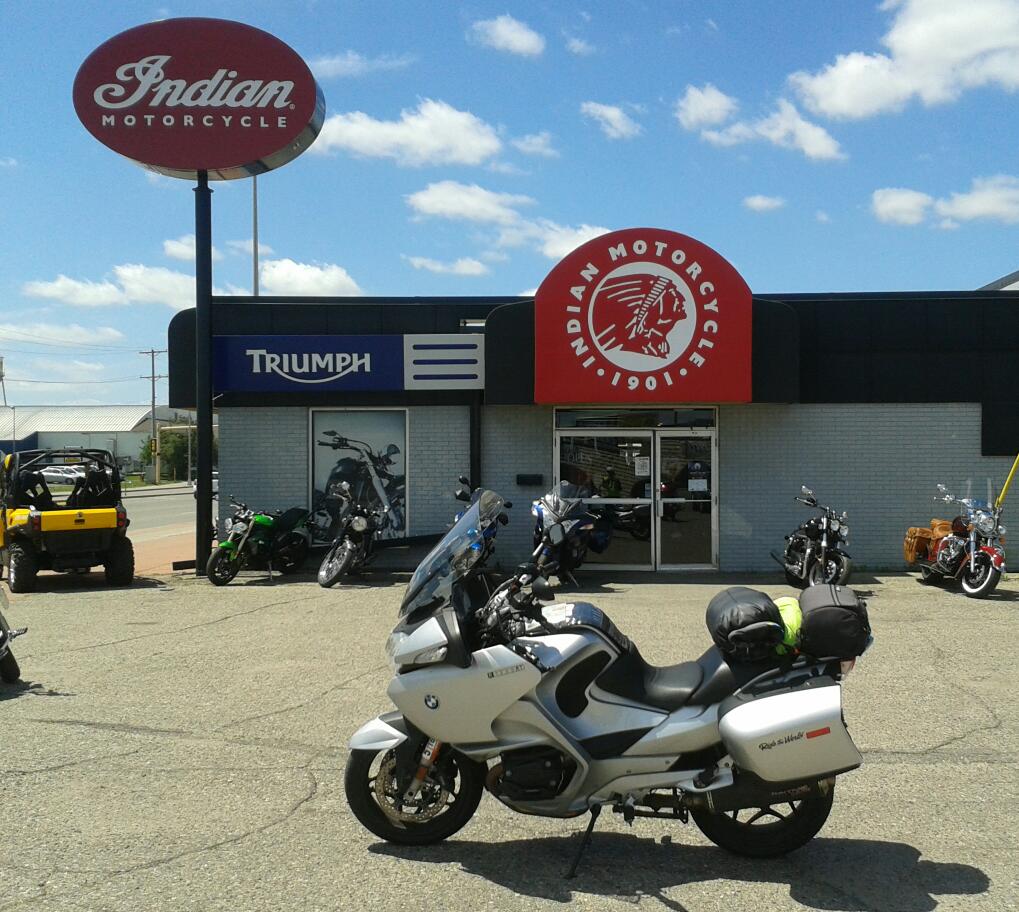
Not far along Route 10, I stopped at an Indian Motorcycle dealership for a photo and the next thing I knew, a posse of bikers swept into the driveway between the dealership and a biker bar and took a shortcut to get to around to the front of another biker bar, Specks, (Beer On/Off Premises).
Indian Motorcycle Dealership, west Fargo
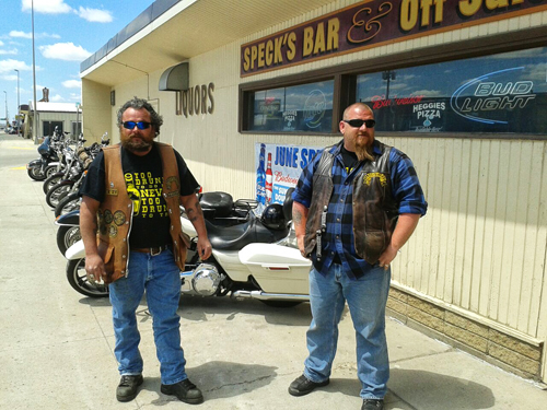
Well, seeing this colorful wild bunch demanded that I meet them. So, I parked the Beemer in back of the bar (I wouldn’t dare try to park out front with all the choppers and Harleys). I walked to the front and found Travis and Rev standing there waiting for the rest of their club members to appear for a meeting.
For some reason, I become fearless when I’m on an adventure and just assume that God watches over fools and drunks. During the day, I’m pretty much the former and plunge right in as the affable innocent in these encounters. Keep in mind I’m dressed like the complete Beemer Nerd: white helmet, safety vest, mesh jacket, the usual “AGATT”—ALL GEAR ALL THE TIME—look. Pretty macho, eh?
I ask if it’s OK to take a photo; they agree without resistance. I tell them about the blog, give Travis my Honey Badger biz card with the website on it. I added that we have a club, too, but aren’t hard core like them. Travis replies: “Well, we really just try to look the part.” That kind of refreshing honesty is in great demand and in short supply. Thanks, Travis, for a bright moment while I was cruising out of Fargo.
Travis and Rev at Speck’s Bar, Fargo, ND
Next it was the long grueling interstate trek down I-29 through North Dakota, South Dakota (where I spent the night in Brookings) and then through Iowa to reach my destination on Monday—Bellevue, Nebraska to visit my Aunt Anne.
I know about four days have come and gone without a post. Sorry. I’ve been without internet connections and my phone’s hotspot is, well, spotty and painfully slow when I try to upload photos.
However, I have working on the narratives for the previous ride segments and hope to post some fresh material with pictures later today.
I’m taking a break and resting up at my Aunt’s house near Omaha where she is graciously feeding me and providing accommodations. She also has a wonderful cat named Tabby and we have become friends…especially since I’ve fed him a couple of times.
My phone’s hotspot seems to be working OK here, though still slow. I’ll see what I can get posted to bring things up-to-date or close to it by this evening. I had some interesting adventures in Minnesota and Fargo, ND, along with a visit to an historical site in Iowa associated with the Lewis and Clark Expedition near Sioux City, and a stop at Lewis and Clark State Park in western Iowa where I met members of the Lewis and Clark Society.
Old Depot in Remer, MN on the Soo Railroad Line (now a snowmobile and mountain bike trail)
Those were the message on signs dotting Route 2 as I traveled west and then north from St. Ignace to reach Pictured Rocks National Lakeshore. The tacky roadside Yooper Tourist Traps have a goofy charm that can only make you smile. The pasties are the classic turnovers eaten by miners in Cornwall, England and imported to the U.S. by miners working the copper mines to the north of here (hence the town of Copper Harbor). It’s clear it’s a favorite fast food in the U.P.
About 10 miles out of town, the first set of sand dunes rose up to my left and then long gaps in the dunes offered sweeping vistas of Lake Michigan. Though the day began with bright sunshine, overcast conditions set in and as I rode north toward Pictured Rocks in Munising it became chilly. Unfortunately, not chilly enough to deter the swarms of baby black flies that formed clouds around anyone who stood still for a moment…this made gassing up a frantic activity to get fuel and get going, pronto. Later, at Munising Falls near the park, the Michigan Air Force, AKA, giant U.P. mosquitos, did their best to suck blood from me through my mesh jacket as I dodged and weaved to avoid them while get a few snapshots. From afar I no doubt looked like I was doing the Hokey Pokey.
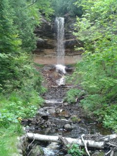
Munising Falls
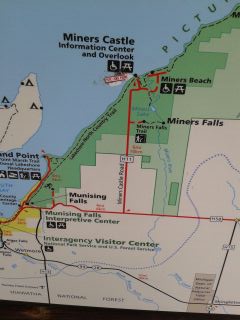
Park Map
Pictured Rocks are best seen from a boat, but without enough time to do that, I made two of the obligatory stops at the Falls, Sand Point and Miners Castle Rock as well as my first glimpses of Lake Superior. The overcast skies made photography a sketchy enterprise and I don’t carry (well, I don’t have) any sophisticated equipment to help out. I still need to load a photo editing app on my little HP laptop, too, make adjustment. So, with these excuses provided I absolve myself from any criticism about the illustrations.
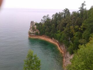
Miners Castle Rock from the distance
Miners Castle Rock–close up
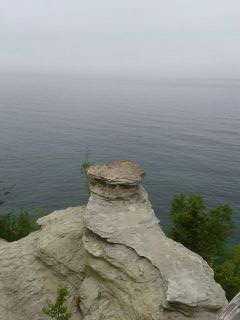
At Sand Point, Lake Superior. Note park trash cans giving shot an extra quality.
I left Munising after 2pm without a specific destination and without lunch.
On my westward trek, Lake Superior appeared to my right and visibility very limited for any photo ops, nonetheless it was a delightful company until it got cold…it was 50 degrees and breezy when I reached Marquette. Shivering, I stopped at the Welcome Center to warm up and get advice about accommodations somewhere. There’s not much along the way, I was told and my best choice was to swing about 17 mi. north from my planned route and make it to Baraga (named after a 19th century missionary bishop).
Baraga, population about 2,000, had two offerings: the Ojibway Indian Casino, Hotel and Restaurant or the Lakeside Inn (ah, another Lakeside lodging…I sense a theme here). I checked out the Casino just to get an idea of what it was and wasn’t surprised to see a full parking lot in front of a decidedly unglamorous casino (a warehouse comes to mind) and a three-story pedestrian hotel with a restaurant somewhere on the site.
Lakeside Inn here I come. It was good choice–relatively new place that was formerly a Best Western. Got a large, very clean room with expansive views of Lake Superior for a remarkably reasonable rate. With a restaurant inside, also with nice views, I was all set. I finally got settled in, wolfed down a good meal of fish ‘n’ chips accompanied by a forbidden Corona and planned my route for Friday. After three days exploring Michigan, it was time to move on to Wisconsin and Minnesota!
Update: Friday morning, June 12-FOG, FOG, FOG. Lake completely obscured. Won’t be able to travel safely until burns off.
St. Ignace, MI at the Quality Inn near the Mackinac Bridge
Across the Mackinac Bridge
Although I only rode anemic 184 miles today, it was full of good surprises and wonderful views of Lake Michigan. I left my hideaway at the Lakeside Motel in Harrison and buzzed up Rte. 127 which offered scenery not unlike Maine.
There were bogs and ponds, tall conifers, and lovely white birches—a rarity on the east coast. The road runs arrow straight with a 70 mph speed limit that everyone but me enthusiastically exceeded. It was a relaxing ride; very few cars and wilderness with a lake here and there.
One poor soul had a really bad day…ran off the road and flipped his car just a short time before I came by. Police on the scene, then not long after the EMTs were speeding from the next town to get to the accident.
About 25 miles past the point where 127 meets I-75 I rode west from Gaylord toward the eastern shore of Lake Michigan. My destination was Charlevoix on the coast. At one point while cruising along Rte. 127, I passed a sign that told me I was at Latitude 45, halfway between the North and South Poles.
As I made my way toward The Big Waters, I had serious misgivings about the whole idea. The wind was howling from the west and angry dark clouds drifted over head. But all I encountered was some wet pavement in a few areas. The real treat was a series of 10 or so twisties that the map couldn’t capture. It was an exciting departure from the many interstates and freeways I endured to get to this part of Michigan.
Kelsey’s on Lake Michigan
Ready for lunch at Kelsey’s Lakeside Grille
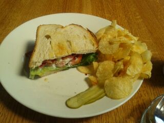
I arrived in Charlevoix ready for lunch and, thanks to a local at the gas station I stopped at on the edge of town, found Kelsey’s. In fact, when I asked the man gassing up his pickup about a good lunch place, he had me follow him to it! Nice guy. Here I got my first view of Lake Michigan. The weather had cleared perfectly and I had a satisfying lunch while soaking in the majesty of the lake. For some reason I was in the mood for a BLT and the menu offered it. The sandwich was a monster, but I managed to finish it.
Half of the Giant BLT
Lacie, my server at Kelsey’s
I got talking to a couple seated next to me and they told there are two kinds of people who visit Charlevoix: “Trunk Slammers” and “Fuggies.”The former are people to live elsewhere, usually downstate, and have a weekend/vacation place in the area. The latter are day trippers to come to Charlevoix to sightsee and visit the fudge shops in town.
After walking around near the lakefront after lunch, I rode into the main part of town and sure enough, it was a handsome but definitely touristy place with…yup, fudge shops, ice creams parlors, and candy emporiums. I didn’t stop and continued north and was treated to more views of Lake Michigan.
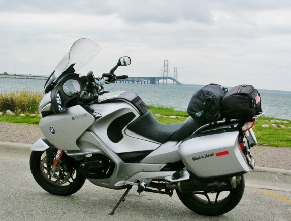
The grand moment came when I rejoined I-75 and approach the Mighty Mackinac Bridge. Before the 5-mile span opened in 1957, commerce and travel went by ferry across the straights between Lake Huron, to the east and Lake Michigan to the west. At times ice blocked the docking area and travelers went by foot from the ferry to the shore across about 100 yards of the frozen lake.
But I had my own exciting adventure getting across; the unsettling westerly winds I ran into earlier had picked up speed and trucks and RV had to creep across the bridge at 20 mph. I managed about 40 mph myself trying to stay upright and not freak out when I had use the lane with the metal grating. The wobbling effect of the grating combined with the steady buffeting of the wind gave me more than a few anxious moments.
With great relief I got to the other side, found a delightful park that hosted a seagull colony…hundreds of white dots along the shore line. There I got my obligatory photos and it was on to St. Ignace where I staying.
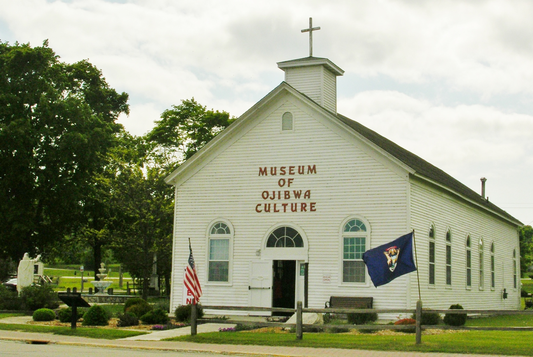
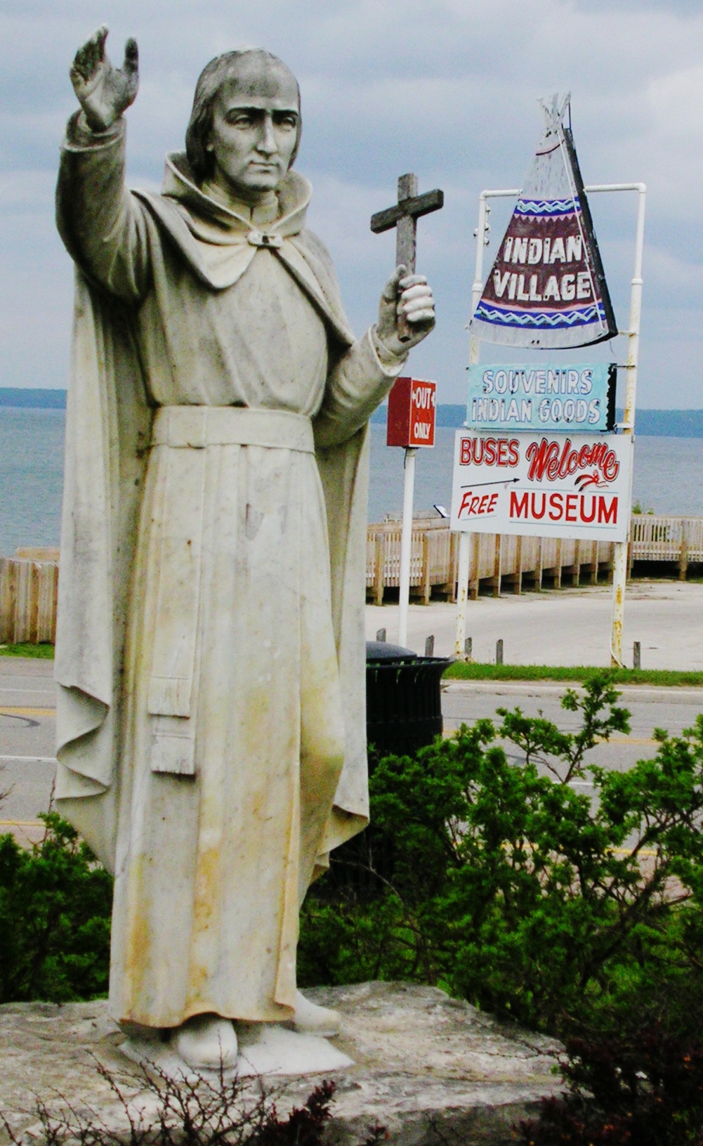
By a happy mistake, I thought I’d booked a Quality Inn in town, not out on the highway as was actually the case, and puttered along the main street that follows the curve of the Lake Huron shore line. I passed a church re-purposed as the Museum of Ojibwa Culture. I made a quick u-turn to check it out and found a building full of Native crafts (the real stuff—there’s still a thriving native population in the area), displays and historic artifacts.
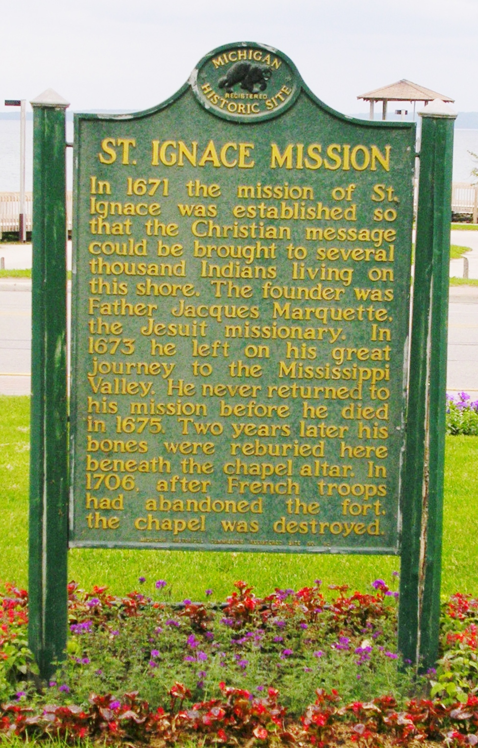
On the grounds is the grave of Fr. Marquette, the famous explorer and Jesuit missionary. Over 300 years ago, this was the site of the “Huron Mission” established by Fr. Marquette and was the subject of the 1991 movie Black Robe—a film I had just viewed last week with John and Ray. I was stunned that I was standing on the very spot that the Black Robe protagonist endured so many hardships to reach.
Fr. Marquette’s Grave, St. Ignace, MI
There’ something wrong about those signs right behind Fr. Marquette, isn’t there?
Happy mistakes—that’s the enchanting thing about travel. They happen and when it all works out, all you can do it step back and appreciate the wonder of it.
Next stop on Thursday: Munising and perhaps a quick glimpse of the storied Pictured Rocks National Lakeshore and Lake Superior.
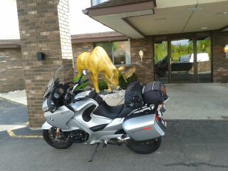
The Golden Moose Mascot at the Quality Inn by the Mackinac Bridge, St. Ignace, MI
[Note to blog readers: the problem you are having posting comments seems to be associated with the Word Press update to their system. I checked their forum and many users have posted queries and requests for help about this issue. Some remedies were offered and I will follow-up to see if the suggestions help. In the meantime, if you want to send an email to my personal address, I can then post your comments on the next blog entry. I know that’s really awkward, but I’m stuck for a better solution just yet. Thanks.]
Ah, Michigan. How I love thee! Another long day, about 340 mi., but now that I’m here in Harrison on tranquil Lake Budd, it was worth the effort. Once again, this was a random selection that worked out so nicely that it was hard to believe.
Outside the sliding glass door of my room is a picnic shelter and beyond it the lake with a dock and a small private beach. Right now I can see a gang of chipmunks running back and forth playing tag near the back patio and earlier I spotted a loon drifting along near the lake shore.
The Lakeside Motel, Harrison, MI on Lake Budd
Starting out the day, I chugged along the Ohio Turnpike through a misty, dreary morning but as I began my turn north along route 23 the skies cleared and warm temps prevailed. Although it was more of same along a monotonous highway, once I began riding west from Bay City, the “True North” of Michigan began at Route 127 at Clare…rolling hills, pine trees, black squirrels and crisp, cool air.
Michigan has interesting German roots—I rode past the town of Frankenmuth, which bills itself as a slice of Bavaria in the state. There’s also Zilwaukee—must be a story there. My observation of some of men from these parts, limited as it may be, it seems to indicate that they are from a stocky stock of beer and sausage loving people.
Then there are the unusual names, of Native American derivation no doubt, such as Owosso and the Tittabawassee River.
Along the way, I passed through the Isabella Indian Reservation which abuts Route 10 west of Bay City. This reminded me of one of Hemingway’s grim short stories, derived from his younger days in Michigan, about the suicide of an Indian family’s father. (Sorry, don’t remember the name of it. You’ll have to Google it for me.)
The Lakeside Motel likes bikers…that’s what Julie told me when I checked in. What a great welcoming message. Up the road was a well-stocked supermarket where I picked up some food for dinner and later I ate my meal lakeside as I watched fishermen trying their luck and at the same time admired the lakeside homes—some grand and some modest.
Evening at Lake Budd
The Lakeside Motel’s motto is “Making Memories for 50 Years” and I think they’re doing good job of it—I certainly will leave with pleasant memories of a relaxing stay. For photos and info check out: www.lakesidemotel.com. I had a spacious and very clean lake view room with a Queen bed, free WiFi, a fridge, coffee maker and up-to-date TV for the bargain price of $66.91 including tax!
View from my room
Lake Budd in the evening
As an aside to those readers who are motorcyclists, as you know, the usual protocol among riders is to signal a fellow rider going in the opposite direction. I went past at least a dozen riders, only one of whom signaled back at me. This is very different from my experience in Northern Virginia and the south in general where the hand wave is common. Wonder what’s different here? Maybe there are just too many motorcyclists to warrant signaling—certainly there are a lot of riders in this part of the U.S. Quite commonplace. Of course, maybe being on a BMW made me a leper to them. Who knows?
Tomorrow the Upper Peninsula awaits. Crossing the Mackinaw Bridge should be a special moment. Otherwise, no specific plans; I expect to wander and wonder at whatever comes my way.
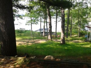
 Broken Bow Lake